Добрый день, Коллеги. Важное сообщение, просьба принять участие. Музей Ферсмана ищет помощь для реставрационных работ в помещении. Подробности по ссылке
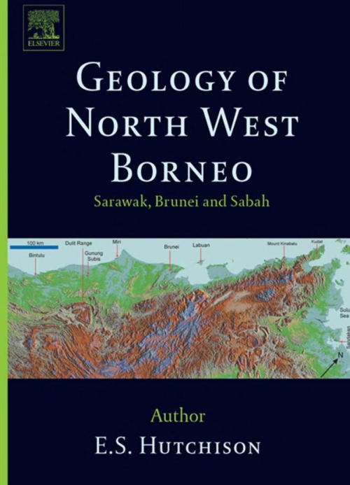
The earlier, mostly non-geological, exploration reports of Borneo have been listed by Worth (1940). The first reliable geological observations on Sabah were by Hatton (1885), a young mineral explorer employed by the Chartered Company of North Borneo. He met a tragic death while hunting along the Segama River. The most significant publication was that of Posewitz (1892), who summarized the earlier writings of geologists who had journeyed through Borneo. Although, he never set foot in Sarawak or Sabah, but had journeyed through Kalimantan. He collected the literature and compiled a geological map of the known parts of Bomeo. The work was unsystematic and is now obsolete. Rutter (1922) described the journeys of some mineral prospectors in his account of Sabah, but he did not mention the real geological explorers. <...>
For several decades a team of specialists from the field of paleontology has been acting in the Geological Institute. The team has gathered rich material of fossil fauna and flora from drillings and outcrops in several parts of the country (Polish Lowlands, Silesian-Cracow Upland, the Gory Swietokrzyskie Mts and the Carpathians).
Analythical results of studies of the above team of the Geological Institute, especially those obtained in the course of paleontological and biostratigraphic expertises, have as far as possible been published, contributing to the Polish and world biostratigraphic literature. This made it necessary for the Geological Institute, the oldest and biggest centre of geological sciences in the country, to undertake works aimed at gathering museum collections and synthetize most important biostratigraphic information dispersed in various sources.
Works on monograph Atlas skamienialosci przewodnich i chardktery sty cznych, the third volume of Budowa Geologiczna Polski and the first position of that type compiled in our country, were initiated in 1971. The team of researchers of the Geological Institute and the invited specialists from other research centres in the country which took part in that project has been led by Doc. Dr. Lidia Ma-linowska (Head of Laboratory of Paleozoology of Department of Stratigraphy, Tectonics and Paleogeography, Geological Institute) as the General Editor. Thanks to the deep concern of the General Editor, section editors, authors and editorial teams of the Department of Publications, Maps and Text (Geological Institute) and the Publishing House Wydawnictwa Geologiczne, it became possible to publish first of Mesozoic parts of Polish version of the monograph as early as 1979.
Presenting Mesozoic part of the monograph to the foreign Reader, the Geological Institute dedicates this publication unique in Polish geological literature to our paleontologists such as J. B. Pusch-Korenski, J. Siemiradzki, L. Zej-szner, M. Raciborski and others who laid foundations for major achievements of Polish biostratigraphy
The map area, covering 2,250 km", lies in the central part of Spitsbergen, south of Isfjorden. Geological investigations were started by Swedish expeditions in the last half of the 19th century, and the work was continued in the present century mainly by Norwegian expeditions. The region is mountainous, moderately glaciated, but shows a juvenile glacial morphology. The climate is polar. The rock sequence exposed in the area is c. 3,400 m thick and consists of two Permian, six Mesozoic, and six Tertiary formations. The Permian deposits are mainly eherts , cherty limestones, limestones, and sandstones deposited under marine conditions. The Mesozoic-Tertiary sequence is composed generally of shales, siltstones, and sandstones deposited mainly in marine environments, and to a lesser extent under terrestrial conditions. Surficial deposits of Quaternary age are largely of glacial, colluvial, alluvial, and marine origin <...>
This volume, "The Geology of the Arab ian Peninsula," is a logical consequence of the geographic and geologic mapping project of the Arab ian Peninsula, a cooperative venture between the Kingdom of Saudi Arabia and the Government of the United States. The Arabian-American Oil Co. and the U.S. Geological Survey did the fieldwork within the Kingdom of Saudi Arabia, and, with the approval of the governments of neighboring countries, a number of other oil companies contributed additional mapping to complete the coverage of the whole of the Arabian Peninsula. So far as we are aware, this is a unique experiment in geological cooperation among several governments, petroleum companies, and individuals. <...>
The Arizaro and Lindero prospects are possibly the youngest recognised examples of the hydrothermal iron oxide-copper-gold class of deposits in the world. These two prospects, and numerous other iron-oxide manifestations, form a newly discovered district within northwest Argentina. The Arizaro and Lindero prospects are hosted within mid-Miocene, calc-alkaline, dominantly andesitic, volcanic complexes that formed within a convergent plate margin tectonic setting. This descriptive paper presents observations from surface geology and petrographic studies.
The Bingham deposit is centred on a small 40 Ma stock of older, generally equigranular, monzonite that is cut by quartz monzonite porphyry, latite, and quartz latite porphyry dykes. The surrounding country rocks are quartzite and minor but important limestone. A body of fractured rock formed over the top of the monzonite as it cooled leaving a weakly fractured core below a dome of strong fracturing. Early fluids entered this fractured mass at about the time of the intrusion of the first porphyry resulting in an undetermined amount of alteration and mineralisation. This fracturing is a major control on the location of the ore shell and the concentric zoning pattern of alteration and mineralisation. Five porphyry intrusives have been described and each is followed by a cycle of veining, alteration and mineralisation. The porphyries all trend north-easterly across the northern half of the deposit, forming the porphyry trend. At least three overlapping centres of fracturing, alteration and mineralisation seem to be present within the stock, one centred in the fracture dome and two or more in the porphyry trend.
The McCoy Au-Ag skarn and Cove Au-Ag deposits are located in the northern Fish Creek Mountains, Lander County, Nevada. Through the end of mining in 2001, large-scale open-pit and associated underground production at the two deposits yielded 3.3 million ounces (Moz) of Au and 108 Moz of Ag. Most production was from Cove, making it the fourth-largest Ag producer in the history of Nevada.
Cove is hosted by the middle to early Late Triassic Augusta Mountain Formation, which consists of limestone with lesser dolostone and clastic units. Ore also is present locally in Eocene porphyritic granodiorite dikes and sills. The deposit comprises two distinct ore types: a central core of polymetallic vein-type ore and an outer aureole of relatively Ag rich Carlin-style ore. Polymetallic veins consist of pyrite-sphalerite-galena–dominated Au- and Ag-bearing veins, veinlets, stockworks, crustifications, and disseminations in clastic and carbonate strata and locally in the intrusions. Carlin-style ore comprises disseminated Fe ± As sulfides with arsenian, argentiferous, and auriferous components ± native Au-electrum in silty to sandy carbonate strata. Polymetallic vein-type ore has Ag/Au ratios of >50/1, and Carlin-style ore has Ag/Au ratios that decrease from ~50/1 near the feeder faults to ~1/1 in one of the more distal ore zones. Both types of ore are associated with decarbona-tized, silicified, and illitized rocks. New structural and age data for fresh and altered intrusive rocks indicate that mineralization at Cove occurred during active extension and magmatism at ~39 Ma (40Ar-39Ar). Fluid inclusion and δD and δ18O data for polymetallic vein-type ore indicate that the mineralizing fluids had temperatures of 250° to 370°C and were magmatic in origin.
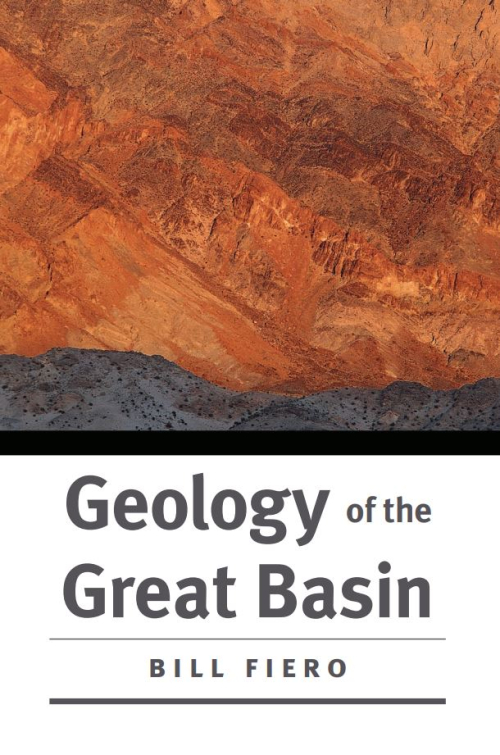
The dry sand stretches away as far as I can see to the east and the west. The July sun burns a hole in the sky and sears the desert basin. Shimmering heat waves ripple the sand at the horizon and make the refl ections of the mountains fl icker upside down on the pseudoliquid surface. The sandy mud has shrunk and cracked since the last summer rain and has formed polygonal fractures in the barren brown surface. These are the only marks on the sand.
This book presents a short description of major geological structures in the region and is based on current geological-geochemical and geophysical data and interpretations. New versions of the Geological Map of the Kola Peninsula and some of its structures are given. The book was written for a wide audience of Russian and foreign geologists and can be used as a geological guide.
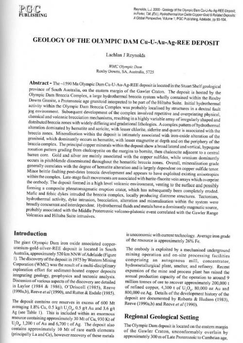
The -1590 Ma Olympic Dam Cu-U-Au-Ag-REE deposit is located in the Stuart Shelf geological province of South Australia, on the eastern margin of the Gawler Craton. The deposit is hosted by the Olympic Dam Breccia Complex, a large hydrothermal breccia system wholly contained within the Roxby Downs Granite, a Proterozoic age granitoid inteipreted to be part of the Hiltaba Suite. Initial hydrothermal activity within the Olympic Dam Breccia Complex was probably localised by structures in a dextral fault jog environment. Subsequent development of the complex involved repetitive and overprinting physical, chemical and volcanic brecciation mechanisms, resulting in a highly variable array of irregularly shaped and distributed breccia zones with widely differing and gradational lithologies. A complex pattern of hydrothermal alteration dominated by hematite and sericite, with lesser chlorite, siderite and quartz is associated with the breccia zones. Mineralisation within the deposit is intimately associated with iron-oxide alteration of the granitoid, which dominantly occurs as hematite, with lesser magnetite at depth and on the periphery of the breccia complex. The principal copper minerals within the deposit show a broad lateral and vertical, hypogene zonation pattern grading from chalcopyrite on the margins to bornite, then chalcocite adjacent to a central barren core. Gold and silver are mainly associated with the copper sulfides, while uranium dominantly occurs in pitchblende disseminated throughout the hematitic breccia zones. Overall, mineralisation grade generally correlates with the degree of hematite alteration and is largely dependent on copper sulfide tenor. Minor brittle faulting post-dates breccia development and appears to have exploited existing anisotropies within the complex. Late-stage fault movements are associated with barite-fluorite vein arrays which overprint the orebody. The deposit formed in a high level volcanic environment, venting to the surface and possibly forming a composite phreatomagmatic eruption crater, which has subsequently been completely eroded. Mafic and felsic dykes intruded the breccia complex, locally producing diatreme structures. Tectonism, hydrothermal activity, dyke intrusion, brecciation, alteration and mineralisation within the system were broadly concurrent and interdependent. Hydrothermal fluids and metals have a dominantly magmatic source, probably associated with the Middle Proterozoic volcano-plutonic event correlated with the Gawler Range Volcanics and Hiltaba Suite intrusives.