Добрый день, Коллеги. Важное сообщение, просьба принять участие. Музей Ферсмана ищет помощь для реставрационных работ в помещении. Подробности по ссылке
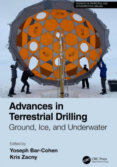
Drilling is a process of penetrating solid objects by creating holes using various tools or approaches. When applying rotation to create a hole, the bit has a circular cross section and the produced bore-hole has a round shape. Alternatively, percussive or hammering drills can create non-round bore-holes. Mechanisms of penetrating objects and formations, i.e., drills, are widely used for many applications including making holes, sampling, exploration, and excavation (Bar-Cohen and Zacny, 2009; Clark, 1987; Hossain and Al-Majed, 2015; Rollins, 2010; Zacny et al., 2008). While the field is quite well established, there are still many challenges including operation at extreme conditions as well as drilling extremely hard materials. Drilling on other extraterrestrial bodies also poses significant challenges resulting from the limited resources that are available and the difficult conditions involved. The earliest successful planetary drilling was performed on the moon in 1970 by the Soviets’ robotic Luna 16 lander (Bar Cohen and Zacny, 2009). In recent years, missions have been increasingly launched to drill on Mars and penetrate the surfaces of other extraterrestrial bodies. <...>
This volume organise presentations given by leading international researchers at a NATO Advanced Research Workshop on the state-of-the-art of geological storage of CO 2. The book is divided into 5 parts. Part 1 provides background by describing how human activities are modifying the atmosphere in industrially-active areas in Siberia. Part 2 outlines the innovative idea of using deep permafrost layers as either impermeable boundaries below which CO2 can be injected or as a cooling source for the formation CO2 clathrates. Part 3 describes recent studies conducted on naturally occurring CO2 reservoirs, sites which have the potential to help us understand the possible long-term evolution of CO2 storage sites. Part 4 outlines various industrial-scale applications of CO2 geological storage and shows it to be technically practical, economically feasible and, to date, very safe. Finally Part 5 gives us a view of the future, showing how energy uses are predicted to change over the next 50 years and how the public must be involved in any future decisions regarding climate change abatement.
This volume contains the lectures presented at the NATO ADVANCED STUDY INSTITUTE that took place at Newark, Delaware, U.S.A., July 14-23, 1985. The objective of this meeting was to present and discuss selected topics associated with transport phenomena in porous media. By their very nature, porous media and phenomena of transport of extensive quantities that take place in them, are very complex. The solid matrix may be rigid, or deformable (elastically, or following some other constitutive relation), the void space may be occupied by one or more fluid phases. Each fluid phase may be composed of more than one component, with the various components capable of interacting among themselves and/or with the solid matrix. The transport process may be isothermal or non-isothermal, with or without phase changes. <...>
Volcanoes are an astonishing manifestation of the activity of planets and their satellites, as observed in active and/or fossil examples on Earth, Mars, Venus, Mercury, the Moon and the Jovian satellite Io. On Earth, volcanoes are one of the most impressive evidence of the same imbalance in energy that is also driving plate tectonics. Active volcanoes have terrified and at the same time fascinated populations and civilizations for thousands of years.
Part I Landslide Interactions with the Built Environment Session Introduction—Landslide Interaction with the Built Environment M.G. Winter, T.A. Dijkstra, and J. Wasowski Landslide Risk Assessment for the Built Environment in Sub-Saharan Africa
Peter Redshaw, Tom Dijkstra, Matthew Free, Colm Jordan, Anna Morley, and Stuart Fraser Rainfall-Induced Debris Flow Risk Reduction: A Strategic Approach Mike G. Winter RUPOK: An Online Landslide Risk Tool for Road Networks Michal Bíl, Richard Andrášik, Jan Kubeček, Zuzana Křivánková, and Rostislav Vodák The Impact (Blight) on House Value Caused by Urban Landslides in England and Wales William Disberry, Andy Gibson, Rob Inkpen, Malcolm Whitworth, Claire Dashwood, and Mike Winter Landslide Monitoring and Counteraction Technologies in Polish Lignite Opencast Mines
The digital era has caused an outstanding change in the acquisition of information concerning our planet. We are accustomed to an uninterrupted monitoring by means of satellite imagery, measurements of ground deformation in the context of geodynamical studies, seismic and geochemical data acquisition, etc. Continuous data acquisition in Earth sciences, in general, and geophysics, in particular, leads to the accumulation of a huge amount of information. Terabytes and Terabytes of data pile up in digital archives over short times. Often, we are left without a key to these archives, which turn them into “data graves,” containing precious information difficult to unearth. In addition, many geological processes are slow phenomena, the study of which comes along with the need to cover time spans as long as possible. Therefore, the necessity to “unearth” old archives becomes of paramount importance <...>
The geologic story of North America is a fascinating one. It’s also more than 4 billion years long—much more than we could ever hope to cover here. However, if you’re curious about the world around you, enjoy the big-picture perspective, and are interested in some of the processes that are constantly reshaping our planet, here’s a crash course on the basics. It’s a good place to start on your aerial tour of the continent’s most breathtaking landforms.
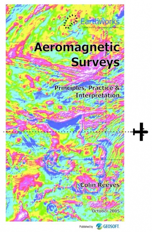
From the point of view of geomagnetism, the earth may be considered as made up of three parts: core, mantle and crust (Figure 1.1). Convection processes in the liquid part of the iron core give rise to a dipolar geomagnetic field that resembles that of a large bar-magnet aligned approximately along the earth's axis of rotation (Figure 1.2). The mantle plays little part in the earth's magnetism, while interaction of the (past and present) geomagnetic field with the rocks of the Earth's crust produces the magnetic anomalies recorded in detailed (e.g. aeromagnetic) surveys carried out close to the earth's surface.
African Mineral and Energy Resources Classification and Management System (AMREC) is a continental system for management of Africa’s mineral and energy resources.
The AMREC is based on United Nations Framework Classification for Resources (UNFC) Principles, Generic Specifications and Guidelines and is aligned to Africa Mining Vision (AMV) and the Sustainable Development Goals (SDGs). Adapting to national or local needs, the AMREC provides the specifications and guidelines required for sustainable development of Africa’s mineral and energy resources.