Добрый день, Коллеги. Важное сообщение, просьба принять участие. Музей Ферсмана ищет помощь для реставрационных работ в помещении. Подробности по ссылке

Поиск по книгам
Автор(ы):Winkler A.
Издание:Goldschneck-Verlag, 1986 г., 50 стр.
Язык(и)Немецкий
Jura-fossilien erkennen und bestimmen. 1. Belemniten, brachiopoden, foraminiferen, rohrenwurmer / Диагностика и идентификация юрских окаменелостей. 1. Белемниты, брахиоподы, фораминиферы, трубчатые черви

Mit diesem Sonderheft soll den Wünschen vieler Sammlerfreunde entsprochen werden, die meine Ausarbeitungen zur Bestimmung von Jura-Fossilien in zusammenhängender Form besitzen und gebrauchen möchten. Gleichzeitig wurde die Bitte berücksichtigt, jene in den MINERA-LIEN-MAGAZIN-Heften 9/1979 und 2/1980 beschriebenen Foraminiferen nochmals zu veröffentlichen. Für alle Anregungen und Unterstützung möchte ich an dieser Stelle dem Verlag, seinen wissenschaftlichen Mitarbeitern sowie meinen zahlreichen Sammlerfreunden danken.

Автор(ы):Arkell W.J.
Издание:Oliver and Boyd LTD, 1956 г., 806 стр.
Язык(и)Английский
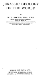
Jurassic geology of the wolrd / Геология юрских отложений мира

The comprehensive Treatise of Geology has had its day. No man can hope any longer to assimilate and summarize the whole known geological history of the world. It has become almost a whole-time occupation to keep track of the literature of a single geological system.
This book represents the first attempt at a synthesis of one system on the basis of marine faunas in all parts of the world. Its object is twofold: first, to present a unified description as a reference work, and second, to enquire what can be deduced as to faunal realms, climate, palaeogeography, volcanic and plutonic activity and earth-movements, and especially the distribution of these in space and time, during one reasonably circumscribed period of geological history. The prerequisite of all such investigations is faunal correlation over the whole world, and no small part
of the object of this attempt has been to test the principles and performance of palaeontological correlation on the world scale, to establish its capabilities and limitations. <...>

Выпуск 69
Издание:Economic geology, 1974 г., 11 стр.
Язык(и)Английский
K-Ar Age Relations of Granodiorite Emplacement and Tungsten and Gold Mineralization near the Getchell Mine, Humboldt County, Nevada

A granodiorite stock intrudes complexly folded and thrust-faulted Paleozoic sedimentary rocks in the Osgood Mountains of eastern Humboldt County, Nevada. Within the metamorphic aureole surrounding the pluton, the sedimentary rocks are converted to cordierite hornfels and marble; tungsten-bearing tactites developed along the contacts of the granodiorite. Cutting the granodiorite and sedimentary rocks is the Getchell fault, along which the disseminated gold ore bodies of the Getchell mine are localized. K-Ar ages of the granodiorite, andesite porphyry, tungsten-bearing tactites, and altered granodiorite from the Getchell mine indicate that emplacement, alteration, and mineralization are all part of a magmatic-thermal episode which took place approximately 90 m.y. ago.

Издание:НПП «КРИВБАССАКАДЕМИНВЕСТ», Кривой Рог, 37 стр.
Язык(и)Русский
K-MINE - программный комплекс для маркшейдеров, геологов и горных инженеров

K-MINE – это специализированная геоинформационная система для решения задач геодезии, картографии, геологии, проектирования.

Существуют специализированные решения K-MINE для предприятий горногопроизводства, сельского хозяйства, транспорта и др. Основой для работы системы служат цифровыетрехмерные модели объектов различной сложности (карты местности, модели месторождений, генеральныхпланов, полей сельскохозяйственного назначения, карьеров, шахт и др.). Наличие специализированногоматематического аппарата позволяет объединять геоданные с таблично-графической информацией, чтоприводит к возможности создания многосвязных аналитических отчетов, проектной документации, построениякомплексных проектных решений для производства и хозяйственной деятельности.

Разработчиком системы является компания «КРИВБАССАКАДЕМИНВЕСТ» (г. Кривой Рог, Украина). Первая версия системы вышла в свет в 1998 г. недропользование <...>


Автор(ы):Sachanbinski M.
Издание:Wroclaw, 1980 г., 260 стр., ISBN: 83-04-00394-6
Язык(и)Чешский
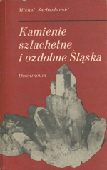
Kamienie szlachetne i ozdobne Śląska / Драгоценные и декоративные камни Силезии

Terminem kamienie szlachetne i ozdobné obejmu-je sig duž§ grupg mineralów i skal maj§cych zastoso-wanie w jubilerstwie, služ§cych do wyrobu ozdób, galanterii artystycznej lub tež užywanych w architek-turze wngtrz. Nazwg kamienie szlachetne czy tež ju-bilerskie stosuje sig do szczególnie pigknych i rzad-ko spotykanych, czystych, jednorodnych i przežro-czystych odmian niektórych mineralów d skal. Odzna-ezaj§, sig one silným polyskiem, efektownym zabar-wieniem (s§ tež bezbarwne), duž§ trwalošci§ i twar-došci§. Maj§. zastosowanie w jubilerstwie, oprawia sig je w zloto, srebro i inne metale szlachetne. Terminem kamienie ozdobné okreála sig natomiast mniej cenne, o mniejszej twardošci i trwalošci lub o mniej efektownym wygl§dzie, minerály i skaly, z których wyrabia sig róžnego rodzaju galanterig artystyczn§, i wyroby pamiftkarskie. <...>

Автор(ы):Sweeting M.M.
Издание:Macmillan publishing company, 1972 г., 392 стр.
Язык(и)Английский
Karst landforms / Карстовые формы рельефа

The study of karst land forms is a branch of geomorphology, the study of the landscape features of the earth’s surface and the processes by which these landforms are formed. The essential characteristic of areas of karst landforms is the presence of vertical and underground drainage. All karst regions are areas of massive limestones.

Редактор(ы):Kresic N., Kururic N, Stevanovic Z.
Издание:Taylor & Francis Group, 2016 г., 375 стр., ISBN: 978-1-138-02968-2
Язык(и)Английский
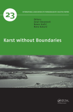
Karst without boundaries / Карст без границ

Karst covers more than 13% of the continental ice-free surface of our planet, with major coverage in the Middle East and Central Asia where it occupies approximately 23% of the land surface. According to some estimates more than 20% of the world’s population is consuming groundwater originated from karst aquifers. At the same time, the management of karst aquifers and their water resources is more problematic compared to any other aquifer type due to uncertainties in defining their boundaries, often irregular drainage regime, and vulnerability to pollution. All these problems are closely related to high heterogeneity of karst aquifers and their locally very high permeability <...>

Автор(ы):Craig D.
Издание:Kazakhmys, 2010 г., 50 стр.
Язык(и)Английский
Kazakhmys exploration standard operating procedures (SOPs) / Стандартные операционные процедуры разведки Казахмыса (SOP)

Once the decision to drill a hole has been made it is the geologist's responsibility to insure the site is properly located in the field. The collar should then be clearly marked with 1.5 - 2.0 m high wooden marker that is spray painted, labelled and marked with flagging tape.

Выпуск 8
Автор(ы):Чуканов Н.В.
Редактор(ы):Пеков И.В.
Издание:Mineralogical almanac association ecost, Москва, 2005 г., 112 стр., ISBN: 5-900395-08-1
Язык(и)Русский
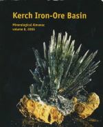
Kerch iron-ore basin. Mineralogy almanac / Керченский железорудный бассейн. Минералогический альманах

The issue contains the most comprehensive description of the Kerch iron- ore basin, including historical and geological sketches. Besides ore deposits some other geological phenomena of the region are described. Mineralogical decription of 160 mineral species is the main part of the volume, the most interesting minerals being characterized in details.

The author has been studing the Kerch mineralogy for more then 20 years and at present is one of the most knowledgeable experts of the region.

Автор(ы):Bierman P.R., Montgomery D.R.
Издание:W.H. Freeman and Company Publishers, 2014 г., 531 стр., ISBN: 978-1-4291-3860-1
Язык(и)Английский
Key concepts in geomorphology / Ключевые понятия в геоморфологии

Key Concepts in Geomorphology is a book about our planet’s dynamic surface, a place where Earth and atmosphere meet and life thrives. By its very nature, geomorphology, the study of Earth surface processes and history, is an integrative discipline. As geomorphologists, we strive to make sense of the complicated web of interactions shaping mountains and valleys, moving sediment and water downslope, and changing the shape of continents and ocean basins over millennia. A deep understanding of geomorphology requires not only expertise in solid-Earth geology but also the ability to use principles of physics, chemistry, biology, and mathematics to understand Earth surface processes and the evolution of topography over short and long timescales. <...>

840.08