Добрый день, Коллеги. Важное сообщение, просьба принять участие. Музей Ферсмана ищет помощь для реставрационных работ в помещении. Подробности по ссылке

Поиск по книгам
Издание:2008 г., 22 стр.
Язык(и)Английский
Linking mineral deposit models to quantitative risk analysis and decision-making in exploration / Увязка моделей залежей полезных ископаемых с количественным анализом рисков и принятием решений при проведении геологоразведочных работ

This paper describes a methodology of translating mineral deposit models into flexible probabilistic structures based on (1) extraction of ore components (fluids, metals, and ligands) from crustal or mantle sources or both, (2) fluid- or melt-assisted transport of ore components from source to trap zones, (3) formation of trap zones (i.e., effective melt or fluid channels) that can focus melt or fluid migration and accommodate large amounts of metal, and (4) operation of the physicochemical processes that promote and sustain the deposition of metal from fluids or melts passing through a particular trap site.

Редактор(ы):Dilek Y., Furnes H., Muehlenbachs K.
Издание:Springer, 2008 г., 358 стр., ISBN: 978-1-4020-8305-1
Язык(и)Английский
Links between geological processes, microbial activities & evolution of life / Связи между геологическими процессами, деятельностью микроорганизмов и эволюцией жизни

Geobiology is a rapidly growing and truly interdisciplinary field at the interface between earth and life sciences, and mainstream research in geobiology involves microbes and microbial activities at all scales in different geological environments through time in Earth’s history. This research and its findings have strong implications for the evolution of life on the Earth and potentially in other planets.

Издание:83 стр.
Язык(и)Английский
List of ASTM standards (American Society for Testing and Materials) / Список ASTM стандартов (Американское общество испытаний и материалов)

1. D 2113 – 99. Standard Practice for Rock Core Drilling and Sampling of Rock for Site Investigation

2. D 2216 – 98. Standard Test Method for Laboratory Determination of Water (Moisture) Content of Soil and Rock by Mass

3. D 2664 – 95a. Standard Test Method for Triaxial Compressive Strength of Undrained Rock Core Specimens Without Pore Pressure Measurements

4. D 2845 – 00. Standard Test Method for Laboratory Determination of Pulse Velocities and Ultrasonic Elastic Constants of Rock

5. D 2936 – 95 (Reapproved 2001)e1. Standard Test Method for Direct Tensile Strength of Intact Rock Core Specimens

Выпуск 22
Автор(ы):Hofstra A.H., Yigit O.
Издание:Journal Ore geology reviews, 2003 г., 24 стр.
Язык(и)Английский
Lithogeochemistry of Carlin-type gold mineralization in the Gold Bar district, Battle Mountain-Eureka trend, Nevada

The Gold Bar district contains five Carlin-type gold deposits and four resources for a combined gold endowment of 1.6 M oz [50 t]. The gold deposits are hosted in Devonian carbonate rocks below parautochthonous and allochthonous Paleozoic siliciclastic rocks emplaced during the Early Mississippian Antler orogeny. The district is in the Battle Mountain-Eureka trend, a long-lived structural feature that localized intrusions and ore deposits of different types and ages.

Издание:E.Schweizerbrat'sche Verlagsbuchhandlung, Stuttgart, 2004 г., 73 стр., ISBN: 3-510-61370-8
Язык(и)Английский
Lithological-paleogeographic maps of Paratethys. 10 maps late eocene to pliocene

The encompassing aim of the European Science Foundation Programm "Environments and Ecosystem Dynamics of the Eurasian Neogene (EEDEN), is the detailed analysis of the response of terrestrial ecosystems to environmental change through the integration of multidisciplinary studies focussing on some selected, already fairly well-known "high-resolution" time intervals in the Neogene of the Eurasian realm. These intervals are known to (a) include major changes in the composition of terrestrial communities, (b) portray large-scale palaeogeographical reorganizations and changes in overall environmental conditions in the terrestrial realm and (c) allow the establishment of high-resolution stratigraphic correlations with data and interpretations pertaining to regional and global aspects of the coeval development of marine environments. They cover (1) the latest Miocene to Early Pliocene (HRI 1:7-4 Ma ago), (2) the latest Middle Miocene to early Late Miocene (HRI 2: 12 - 8.5 Ma ago) and (3) the late Early to early Middle Miocene (HRI3: 17-14 Ma ago).

The research strategy of the EEDEN - programm was realized through three corresponding, internally comprehensive, but mutually complementary and overlapping programme components. These are the terrestrial database component, the time-stratigraphic / palaeogeographic component, and the palaeobiological component.

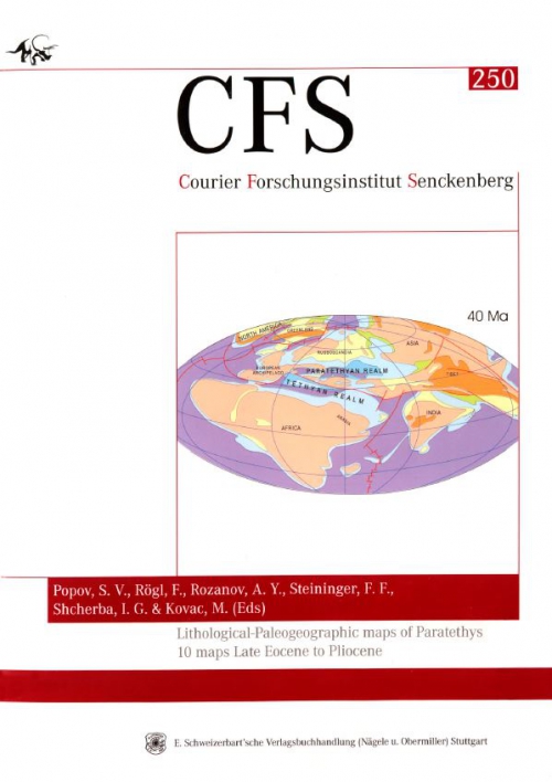
One of the fundamental components, the time-stratigraphic / palaeogeographic component, needs to incorporate the latest dates available to reconstruct the paleogeographic / palinstastic evolution of the Tethys / Mediterranean and the Paratethys realms and to incorporate all these results in a continous sequence paleogeographic maps. Such paleogeographic / palinstastic maps as they are published here are the base for the goals of the EEDEN programm to reconstruct the Environments and Ecosystem Dynamics of the Eurasian Neogene. This new paleogeographic atlas is the continuation of earlier works within the last decade presented by Dercourt et al. 1985, 1993, 2000; Hamor (Ed.) 1988; Kovac2002; Rogl 1998; Rogl & Steininger 1983,1984; Senes 1960; Steininger & Rogl 1982,1984; Steininger et al. 1985; Ziegler 1990.

We are grateful to the European Science Foundation and the Senckenbergische Naturforschende Gesellschaft, which have sponsored the publication of these paleogeographic maps within the EEDEN Programm.

Fritz F. Steininger

Редактор(ы):Bendaoud A., Bodinier J.-L., Hamoudi M., Ouzegane K., Perfettini H.
Издание:Springer, 2025 г., 215 стр., ISBN: 978-3-319-70249-0
Язык(и)Английский
Lithospheric architecture and precambrian  geology of the Hoggar and adjacent areas. A reference case for mapping and modeling  in geosciences / Архитектура литосферы и геология докембрия Хоггара и прилегающих районов. Справочный материал для картографиро

The Hoggar, which forms the Algerian part of the Tuareg shield, is an ideal site for geoscientific studies. As the site of successive orogenies, it offers a single example of the problems that arise on a continental scale, whether in terms of magmatism, metamorphism, structure, metallogeny or geophysics.

Выпуск 280
Издание:Journal Tectonophysics, 1997 г., 15 стр.
Язык(и)Английский
Lithospheric shear zones and mantle-crust connections

A crustal-scale ductile shear zone network in the Precambrian granulite-facies crust of Madagascar is examined to determine the nature of the connections between the mantle arid lower crust. Based on three independent data sets - field and satellite mapping, C- and O-isotope geochemistry and gravimetry - this crust is divided into three zones: (1) outside of shear zones; (2) minor shear zones that are <140 km long and 7 km wide; and (3) major shear zones mat are >350 km long (up to 1000 km) and 20-35 km wide. The mantle is uplifted by about 10 km beneath the major shear zones. The major shear zones are rooted in and are inferred to be controlled by the mantle; they directly tapped mantle-derived C02. The small-scale minor shear zones were controlled by crustal processes and focused crustally derived H20-rich±C02 fluids. The regular distribution of the shear zones on a crustal scale is in agreement with models of buckling of the continental lithosphere in a compressional context. The propagation of these mechanical instabilities promoted and channelled fluid flow. These major Pan-African shear zones thinned the crust and were reactivated during the subsequent drifting of Madagascar and opening of the Indian Ocean during Jurassic to Cretaceous times. They also controlled many of the brittle fault zones in the overlying sedimentary basins. Mantle-rooted large-scale shear zones are inferred to be a general feature of cratonic areas reactivated by shear zone systems.

Редактор(ы):Dallmann W.K.
Издание:Norsk Polarinstitutt, 1999 г., 321 стр., ISBN: 82-7666-166-1
Язык(и)Английский
Lithostratigraphic lexicon of Svalbard. Review and recommendations for nomenclature use / Литостратиграфический словарь Шпицбергена. Обзор и рекомендации по использованию номенклатуры

For the last 15 years or so, Norwegian geologists have been working on the registration and regulation of stratigraphic nomenclature for geological units in Norway. The need for registration and proper definition of stratigraphic names in a central database had long been obvious.

Издание:Elsevier, 2005 г., 13 стр.
Язык(и)Английский
Lithostratigraphic position and petrographic characteristics of R.A.T. (‘‘Roches Argilo-Talqueuses’’) Subgroup, Neoproterozoic Katangan Belt (Congo) / Литостратиграфическое положение и петрографические характеристики подгруппы R.A.T. Катанганский пояс

The Neoproterozoic Katangan R.A.T. (‘‘Roches Argilo-Talqueuses’’) Subgroup is a sedimentary sequence composed of red massive to irregularly bedded terrigenous-dolomitic rocks occurring at the base of the Katangan succession in Congo. Red R.A.T. is rarely exposed in a continuous section because it was affected by a major layer-parallel de´collement during the Lufilian thrusting. However, in a number of thrust sheets, Red R.A.T. is in conformable sedimentary contact with Grey R.A.T which forms the base of the Mines Subgroup. Apart from the colour difference reflecting distinct depositional redox conditions, lithological, petrographical and geochemical features of Red and Grey R.A.T. are similar.

792.17