Добрый день, Коллеги. Важное сообщение, просьба принять участие. Музей Ферсмана ищет помощь для реставрационных работ в помещении. Подробности по ссылке

Поиск по книгам
Автор(ы):Weijermars R.
Издание:Alboran Science Publishing, 2011 г., 396 стр., ISBN: 90-5674-001-6
Язык(и)Английский
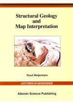
Structural geology and map interpretation / Структурная геология и интерпретация карт

A geological map is a medium of communication that uses graphic symbols to represent spatial relationships among geographical and geological feautures. Lines, points, symbols, and texture markings are used to separate various classes of information. But the interpretation of geological maps goes beyond identifying the individual items displayed on the map. A connection must be made between what is perceived on the map and other knowledge. The interpretation of geological maps is basically an attempt to visualize and understand the complex shapes of rock units in the subsurface. A thorough understanding of the variety of geological structures is particularly important, because it helps to determine the nature of subsurface structures from geological maps. Structural geology, therefore, is a major cornerstone of the art of geological map interpretation. <...>

Автор(ы):Declan G De Paor
Издание:Elsevier, 1996 г., 545 стр., ISBN: 0-08-042430-9
Язык(и)Английский
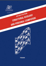
Structural geology and personal computers / Структурная геология и персональный компьютер

Some thirty years ago, structural geology underwent a revolution that fundamentally changed how we think about the deformation of rocks. Regional field observations and laboratory data were given profound new meaning in terms of the global model of lithospheric behavior called "Plate Tectonics". Today structural geologists are witnessing a second revolution and although it is of a very different, less fundamental, type it will clearly have a profound and lasting effect on our field. This new revolution has been fuelled by the widespread use of the personal computer which has become the principal tool of scientists worldwide for data storage or retrieval, teaching, communication with colleagues, number crunching, modeling, and preparation of publications.

Редактор(ы):Kumar S., Simpson M.
Издание:Imperial College Press, 2016 г., 551 стр., ISBN: 978-1783269570
Язык(и)Английский
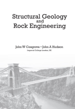
Structural geology and rock engineering / Структурная геология и инженерная геология

As intimated by the book’s title, the purpose of the book is to
(a) Outline the principles of both structural geology and rock engineering (the latter via engineering rock mechanics) and (b) to explain with illustrative examples why the synthesis of the two  subjects is mutually beneficial.
2 Structural Geology and Rock Engineering The McGraw-Hill Dictionary of Scientific and Technical Terms defines structural geology as, “The branch of geology concerned with the form, arrangement and internal structure of the rocks” and rock mechanics as, “Application of the principles of mechanics and geology to quantify the response of rock when it is acted upon by environmental forces, particularly when human-induced factors alter the original ambient forces” <...>

Автор(ы):Corfu F., Geoffrey A.
Издание:The Geological Society of America, 2011 г., 89 стр., ISBN: 978-0-8137-0019-9
Язык(и)Английский
Structural Geology and Tectonic Evolution of the Sognefjord Transect, Caledonian Orogen, Southern Norway—A Field Trip Guide / Структурная геология и тектоническая эволюция разреза Согнефьорд, Каледонский ороген, Южная Норвегия — Путеводитель

The fi eld trip described in this guide starts in the “Norwegian Alps,” the high mountain massif called Jotunheimen, and runs out along Sognefjorden, the world’s longest fjord, to the islands along the west coast of Norway. Geologically, the Sognefjord transect provides a complete cross section through the Caledonian orogenic belt, of Paleozoic age, which in Norway stretches along the west coast from Stavanger to North Cape, a distance of ~2000 km.

Выпуск 1
Редактор(ы):Mukherjee S.
Издание:Springer, 2021 г., 727 стр., ISBN: 978-3-030-0142-3
Язык(и)Английский
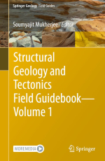
Structural geology and tectonics. Field Guidebook. Volume 1 / Структурная геология и тектоника. Практическое руководство. Часть 1

Techniques of geologicmapping and geologicmap creation have changed significantly from traditional paper-based methods. Geologic mapping and data collection in the field is now primarily facilitated by mobile devices and dedicated geologic mapping software. Geologic map production has become a fully integrated process, importing digital data from the field and making use of cartographic software, such as ArcGIS and Adobe Illustrator, to create interactive geologic map products.

Выпуск 2
Редактор(ы):Mukherjee S.
Издание:Springer, 2023 г., 425 стр., ISBN: 978-3-031-19575-4
Язык(и)Английский
Structural geology and tectonics. Field Guidebook. Volume 2 / Структурная геология и тектоника. Практическое руководство. Часть 2

This guide presents seven itineraries to investigate the geology of the Central Andes, which can be done in seven days of field work along main roads in northern Argentina and Chile. A total of 32 field stops are organized in a complete cross-section that cuts over 600 km of the mountain range, from the Subandean Zone and Eastern Cordillera, between latitudes 24°–23° 20' (Purmamarca–Quebrada de Humahuaca), to the Coastal Cordillera, between latitudes 22° 10'–20° 17' (Tocopilla– Iquique), passing through the domains of North Puna, Western Cordillera, Modern Volcanic Arc, Cordillera de la Sal and Cordillera Domeyko.

Автор(ы):Mukhopadhayay D.K.
Издание:American Association of Petroleum Geologists, 2006 г., 173 стр., ISBN: 81-901729-6-7
Язык(и)Английский
Structural geology for petroleum geoscientists / Структурная геология для специалистов в области нефтяной геологии

Structural geology is obviously one of the more important subjects for geoscientists working in petroleum industry. Folds and faults in deformed rocks make traps for hydrocarbon accumulation. Also, large-scale deformations, the so-called tectonics, control the architecture of petroliferous sedimentary basins. It is the primary job of a structural geologist to interpret geological map and field data, and infer geometry of large scale folds and faults. However, geoscientists with varied specializations and working with different kinds of data may also be called upon to make structural interpretations.

Редактор(ы):Coward M.P., Daltaban T.S., Johnson H.
Издание:The Geological Society of London, 1998 г., 264 стр., ISBN: 1-897799-94-2
Язык(и)Английский
Structural geology in reservoir characterization / Структурная геология при определении характеристик коллектора

COSGROVE, J. W. The role of structural geology in reservoir characterization
ARCHER, J. S. Reservoir characterization and modelling: a framework for field development
FREEMAN, B., YIELDING, G., NEEDHAM, D. T. & BADLEY, M. E. Fault seal prediction: the gouge ratio method
CRAWFORD, B. R. Experimental fault sealing: shear band permeability dependency on cataclastic fault gouge characteristics
GABRIELSEN, R. H., AARLAND, R.-K. & ALSAKER, E. Identification and spatial distribution of fractures in porous, siliciclastic sediments

1009.81