Добрый день, Коллеги. Важное сообщение, просьба принять участие. Музей Ферсмана ищет помощь для реставрационных работ в помещении. Подробности по ссылке

Поиск по книгам
Автор(ы):Bohling G.
Издание:2005 г., 20 стр.
Язык(и)Английский
Kriging

Optimal interpolation based on regression against observed z values of surrounding data points, weighted according to spatial covariance values. <...>

Автор(ы):Beck L.R., Dungan J.L., Rossi R.E.
Издание:1994 г., 9 стр.
Язык(и)Английский
Kriging in the shadows: Geostatistical interpolation for remote sensing / Кригинг в тени: геостатистическая интерполяция для дистанционного зондирования

It is often useful to estimate obscured or missing remotely sensed data. Traditional interpolation methods, such as nearest-neighbor or bilinear resampling, do not take full advantage of the spatial information in the image. An alternative method, a geostatistical technique known as indicator krigingo is described and demonstrated using a Landsat Thematic Mapper image in southern Chiapas, Mexico. The image was first classified into  pasture and nonpasture land cover. For each pixel that was obscured by cloud or cloud shadow, the probability that it was pasture was assigned by the algorithm. An exponential omnidirectional variogram model was used to characterize the spatial continuity of the image for use in the kriging algorithm. Assuming a cutoff probability level of 50%, the error was shown to be 17% with no obvious spatial bias but with some tendency to categorize nonpasture as pasture (overestimation). While this is a promising result, the method's practical application in other missing data problems for remotely sensed images will depend on the amount and spatial pattern of the unobscured pixels and missing pixels and the success of the spatial continuity model used. <...>

Издание 4
Автор(ы):Huijbregts Ch.J., Journel A.G.
Издание:Academic Press, 1989 г., 609 стр., ISBN: 0-12-3091050-1
Язык(и)Английский
Mining geostatistics / Геостатистика при изучении месторождений

The distribution of ore grades within a deposit is of mixed character, being partly structured and partly random. On one hand, the mineralizing process has an overall structure and follows certain laws, either geological or metallogenic; in particular, zones of rich and poor grades always exist, and this is possible only if the variability of grades possesses a certain degree of continuity. Depending upon the type of ore deposit, this degree of continuity will be more or less marked, but it will always exist; mining engineers can indeed be thankful for this fact because, otherwise, no local estimation and, consequently, no selection would be possible. However, even though mineralization is never so chaotic as to preclude all forms of forecasting, it is never regular enough to allow the use of a deterministic forecasting technique . This is why a scientific (at least, simply realistic) estimation must necessarily take into account both features - structure and randomness inherent in any deposit. Since geologists stress the first of these two aspects, and statisticians stress the second, I proposed, over 15 years ago, the name geostatistics to designate the field which synthetizes these two features and opens the way to the solution of problems of evaluation of mining deposits <...>

Автор(ы):Caers J.
Издание:Society of petroleum engineers, 2005 г., 88 стр., ISBN: 978-1-55563-106-2
Язык(и)Английский
Petroleum geostatistics / Нефтяная геостатистика

This book is different from most books written about geostatistics. The focus here is not on providing an analytical and deductive understanding. It does not attempt to explain the inner workings of its algorithms or exactly how a variogram is calculated and modeled, nor does it provide an exhaustive list of geostatistical algorithms for seismic-data integration.

Автор(ы):Clark I.
Издание:2001 г., 119 стр.
Язык(и)Английский
Practical geostatistics / Практическая геостатистика

This book is aimed at postgraduates, undergraduates and workers in industry who require an introduction to geostatistics. It is based on seven years of courses to undergraduates, M.Sc. students and short courses to industry, and reflects the problems which have been encountered in presenting this material to mining engineers and geologists over a wide age range, and with an equally wide range of numerical ability. The book would provide the foundation of a course of about 20 to 30 hours, or of a five-day short course.

Автор(ы):Clark I.
Издание:Elsevier, 1987 г., 129 стр., ISBN: 0-85334-843-X
Язык(и)Английский
Practical geostatistics / Практическая геостатистика
Редактор(ы):Carrera J., Gomez-Hernandez J.J., Sanchez-Vila X.
Издание:Kluwer Academic Publishers, 2002 г., 556 стр., ISBN: 1-4020-2007-4
Язык(и)Английский
Quantitative geology and geostatistics. geoENV IV – Geostatistics for environmental applications / Количественная геология и геостатистика. geoENV IV – Геостатистика для применения в окружающей среде

The fourth edition of the European Conference on Geostatistics for Environmental Applications (geoENV IV) took place in Barcelona, November 27-29, 2002. As a proof that there is an increasing interest in environmental issues in the geostatistical community, the conference attracted over 100 participants, mostly Europeans (up to 10 European countries were represented), but also from other countries in the world. Only 46 contributions, selected out of around 100 submitted papers, were invited to be presented orally during the conference. Additionally 30 authors were invited to present their work in poster format during a special session.

Том 1
Редактор(ы):Deutsch C.V., Leuangthong O.
Издание:Springer, 2004 г., 1168 стр., ISBN: 978-1-4020-3515-9
Язык(и)Английский
Quantitative geology and geostatistics. Geostatistics BANFF 2004. Volume 1 / Количественная геология и геостатистика. Геостатистика BANFF 2004. Том 1

Geostatistical simulation makes strong assumptions of stationarity in the mean and the variance over the domain of interest. Unfortunately, geological nature usually does not reflect this assumption and we are forced to subdivide our model area into stationary regions that have some common geological controls and similar statistical properties. This paper addresses the significant complexity introduced by boundaries. Boundaries are often soft, that is, samples near boundaries influence multiple rock types.

Редактор(ы):Froidevaux R., Gomez-Hernandex J., Soares A.
Издание:Springer, 1999 г., 566 стр., ISBN: 978-90-481-5249-0
Язык(и)Английский
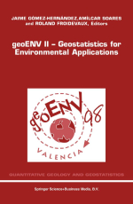
Quantitative geology and geostatistics. Volume 10. geoENV II – Geostatistics for environmental applications / Количественная геология и геостатистика. Том 10. geoENV II – Геостатистика для применения в окружающей среде

The Second European Conference on Geostatistics for Environmental Applications took place in Valencia, November 18-20, 1998. Two years have past from the first meeting in Lisbon and the geostatistical community has kept active in the environmental field. In these days of congress inflation, we feel that continuity can only be achieved by ensuring quality in the papers. For this reason, all papers in the book have been reviewed by, at least, two referees, and care has been taken to ensure that the reviewer comments have been incorporated in the final version of the manuscript. We are thankful to the members of the scientific committee for their timely review of the scripts. All in all, there are three keynote papers from experts in soil science, climatology and ecology and 43 contributed papers providing a good indication of the status of geostatistics as applied in the environmental field all over the world. We feel now confident that the geoENV conference series, seeded around a coffee table almost six years ago, will march firmly into the next century. <...>

2350.09