Добрый день, Коллеги. Важное сообщение, просьба принять участие. Музей Ферсмана ищет помощь для реставрационных работ в помещении. Подробности по ссылке

Поиск по книгам
Издание:Wiley, 2018 г., 490 стр., ISBN: 978-1-118-45585-2
Язык(и)Английский
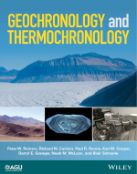
Geochronology and thermochronology / Геохронология и термостратиграфия

Geochronology, including thermochronology, is an essential component of practically all modern Earth and planetary science and provides fundamental information for many other areas, including archeology, marine sciences, and ecology. Geochronology establishes the timing of critical events ranging from the age of the Earth to stratigraphic boundaries, and it provides unique constraints on the pace and dynamics of processes ranging from condensation of the solar nebula to planetary differentiation to surface exposure to biologic evolution. Given that Earth and planetary scientists commonly seek to understand relationships between events or phenomena for which physical evidence is incomplete or ambiguous, establishing temporal relationships through geochronology often provides a substantial basis for causality arguments.

Although the concept of geochronology has existed for millennia, and the particular name has been around since 1893, most scientists would probably agree that the modern practice or discipline is based on application of radioisotopic (or cosmogenic) systems in natural materials, which has existed for only a little more than a century (or less). Even into the 20th century, the geologic timescale floated freely in time. Geologists had established sequences of evolutionary and orogenic events in the rock record, but numerical estimates ranged widely, more so further back in geologic history. Without precise dates, only poorly constrained arguments could be made about the relative durations and the time separating major events in the geologic record. Likewise, prior to radioisotopic methods, the best available estimates for the age of the Earth (and solar system) disagreed by several orders of magnitude. The rather sudden recognition of nuclear structure and radioactive decay around the beginning of the 20th century, changed Earth and planetary science fundamentally. The very first radioisotopic dates measured increased the previously deduced minimum age of the Earth by about an order of magnitude, and subsequent work, less than 100 years ago, increased it by another factor of ten. <...>

Редактор(ы):Rafferty J.P.
Издание:Britannica, 2011 г., 246 стр., ISBN: 978-1-61530-195-9
Язык(и)Английский
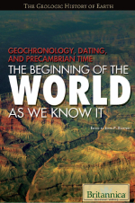
Geochronology, dating and precambrian time. The beginning of the world as we know / Геохронология, датировка и докембрийское время. Начало мира, каким мы его знаем

Planet Earth was formed roughly 4.6 billion years ago. For human beings—used to measuring time in terms of days, weeks, and months—such an enormous span of time can be a difficult concept to grasp. Geologists, scientists who study the Earth and the processes that continue to shape it, have broken up this vast expanse of “deep time” into major divisions based on what they have learned from the study of ancient rocks and fossils. The first of these divisions—from approximately 4.6 billion until 542 million years ago—is known as the Precambrian, meaning everything that happened before the Cambrian period. (Today some people prefer to call this period the Cryptozoic, which means “hidden life.”) Almost all of planet Earth’s history is Precambrian. Until recently, however, it has remained the most unknown, the strangest, and most perplexing period in all geologic

history—what some have referred to as the “Dark Ages” of Earth’s existence. <...>

Автор(ы):Herring T.A.
Издание:Cambridge, 2015 г., 414 стр.
Язык(и)Английский
Geodesy / Геодезия

Modern geodesy as discussed in this volume started with the development of distance measurement using propagating electromagnetic signals and the launch of Earth-orbiting satellites. With these developments, space-based geodesy allowed global  measurements of positions, changes in the rotation of the Earth, and the Earth’s gravity field. These three areas, positioning, Earth rotation, and gravity field, are considered the three pillars of geodesy. The accuracy of current measurement systems allows time variations to be observed in all three areas. Also, the complexity of problems is such that each of the pillars interacts with each other and with many other branches of Earth science. This interaction is most apparent in the role that water plays in modern geodetic measurements.

ТематикаГеодезия
МеткиГеодезия (418)
Издание:1983 г., 102 стр.
Язык(и)Английский
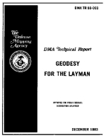
Geodesy for the layman / Геодезия для непрофессионала

The basic principles of geodesy are presented in an elementary form. The formation of geodetic datums is introduced and the necessity of connecting or joining datums is discussed. Methods used to connect independent geodetic systems to a single world reference system are discussed, including the role of gravity data. The 1983 edition of this publication contains an expanded discussion of satellite and related technological applications to geodesy and an updated description of the World Geodetic System. <...>

ТематикаГеодезия
МеткиГеодезия (418)
Издание:2016 г., 206 стр.
Язык(и)Английский, Русский
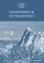
Geodynamics & tectonophysics. Issue 2 / Геодинамика и тектонофизика. Выпуск 2

Бониниты во времени и пространстве: петрогенезис и геодинамические обстановки образования

Длиннопериодные изменения в соотношении процессов тектоно-плитного и мантийно-плюмового происхождения в докембрии

Раннепалеозойский базитовый магматизм на северо-востоке Сибирского кратона

Неотектоника Охотского моря

Строение и история абиссальных холмов северо-западной плиты Пацифики по данным непрерывного сейсмического профилирования и сейсмостратиграфии

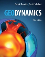
Издание 3
Автор(ы):Schubert G., Turcotte D.L.
Издание:Cambridge, 2002 г., 656 стр., ISBN: 978-1-107-00653-9
Язык(и)Английский
Geodynamics / Геодинамика

The plate tectonic model provides a framework for understanding many geodynamic processes. Earthquakes, volcanism, and mountain building are examples. The plate velocities, 10– 100 mm yr−1, imply a fluid-like behavior of the solid Earth. Hot mantle rock can flow (behave as a fluid) on geological time scales due to solid-state creep and thermal convection. The hot mantle rock is cooled by heat loss to the Earth’s surface resulting in a cold thermal “boundary layer.” This boundary layer is rigid and is referred to as the lithosphere. The surface lithosphere is broken into a series of plates that are in relative motion with respect to each other. This motion results in “plate tectonics.”

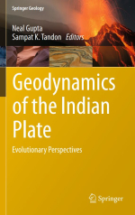
Редактор(ы):Gupta N., Tandon S.K.
Издание:Springer, 2020 г., 573 стр., ISBN: 978-3-030-15988-7
Язык(и)Английский
Geodynamics of the Indian plate. Evolutionary perspectives / Геодинамика Индийской плиты. Эволюционные перспективы

Introduction to Geodynamics of the Indian Plate: Evolutionary Perspectives Sampat K. Tandon and Neal Gupta
Evolving Early Earth: Insights from Peninsular India M. Jayananda, S. Dey, and K. R. Aadhiseshan
Tracking India Within Precambrian Supercontinent Cycles Sarbani Patranabis-Deb, Dilip Saha, and M. Santosh
Proterozoic Sedimentary Basins of India Partha Pratim Chakraborty, S. K. Tandon, Sagnik Basu Roy, Subhojit Saha, and Pritam P. Paul
Oxygenation of Early Atmosphere and Potential Stratigraphic Records from India Joydip Mukhopadhyay

Автор(ы):Struwe K.
Издание:Springer, 2007 г., 499 стр., ISBN: 978-3-540-71236-7
Язык(и)Английский
Geodynamics of the lithosphere. An introduction / Геодинамика литосферы. Введение

This book is a reflection of my enthusiasm for the quantitative treatment of geological problems. However, I am originally a field geologist and over the years I had to rely on the help of many who are more numerically literate than myself to teach me the wonders of quantitative geodynamics. Many of those are acknowledged in the first edition of this book. Of those who helped me with this 2nd edition, my special thanks go to S Hergarten and J Robl.

Автор(ы):Struwe K.
Издание:Springer-Verlag, 2007 г., 503 стр.
Язык(и)Английский
Geodynamics of the lithosphere. Quantitative description of geological problems / Геодинамика литосферы. Количественное описание геологических проблем

The large scale structure of the earth is caused by geodynamic processes which are explained using energetic, kinematic and dynamic descriptions. While “geodynamic processes” are understood to include a large variety of processes and the term is used quite loosely, the methods of their description involve well defined fields. Energetic descriptions are involved with distribution of energy in our planet, typically expressed in terms of heat and temperature. Kinematic descriptions describe movements using velocities, strains and strain rates. Dynamic descriptions indicate how stresses and forces behave.

Издание:Institute of Physical Publishing, 1996 г., 396 стр., ISBN: 0-7503-0052-3
Язык(и)Английский
Geoelectromagnetic waves / Геоэлектромагнитные волны

This book is devoted to the theory of geoelectromagnetic oscillations and waves, i.e. waves of natural origin arising in the Earth’s crust, in the ocean, in the atmosphere, in the ionosphere, in the magnetosphere and in the interplanetary medium in front of the magnetosphere.
We have sought to give a simple and clear presentation of the physical picture of the waves. When selecting the material special attention was paid to the theoretical inferences that can be easily compared with the observational data. Complicated and unwieldy calculations were omitted where possible. At the same time, where formulae have been presented without derivation, we have tried to explain their physical meaning.

946.19