Добрый день, Коллеги. Важное сообщение, просьба принять участие. Музей Ферсмана ищет помощь для реставрационных работ в помещении. Подробности по ссылке

Поиск по книгам
Автор(ы):Rey J.
Издание:Laboratoire de Geologie de L'Universite Paul Sabatier, Toulouse, 1972 г., 573 стр.
Язык(и)Французский
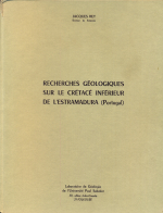
Recherches géologiques sur le Crétacé inférieur de L'Estramadura (Portugal) / Геологические исследования нижнего мела Эстрамадура (Португалия)

Le Crétacé inférieur de l’Estramadura, au Portugal, m’apparaissait, lorsque j’en entrepris l'étude, comme un thème de recherches à la fois séduisant et redoutable. Séduisant, car tout examen systématique avait été abandonné depuis plus de soixante ans, en dépit de la présence de classiques ensembles stratigraphiques, de la richesse des faunes et de la variété des faciès. Redoutable, car il m’amenait à suivre les traces de cet illustre géologue que fut Choffat. Il était bien évident que je ne pouvais mener cette tâche à son terme que grâce à de nombreux et bienveillants appuis. J’en ai largement bénéficié, sinon même abusé. Il m’est donc particulièrement agréable de remercier aujourd’hui tous ceux qui, durant les longues années de travail, m’ont aidé, conseillé et encouragé. <...>

Автор(ы):Casteras M.
Издание:Laboratoire de Geologie de L'Universite Paul Sabatier, Toulouse, 1972 г., 575 стр.
Язык(и)Португальский
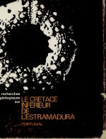
Recherches geologiques sur le cretace inferieur de LEstramadura (Portugal)

Le Crétacé inférieur de LEstramadura, au Portugal, m'apparaissait, lors-que j'en entrepris Vêtude, comme un thème de recherches à la fois séduisant et redoutable. Séduisant, car tout examen systématique avait été abandonné depuis plus de soixante ans, en dépit de la présence de classiques ensembles stratigraphiques, de la richesse des faunes et de la variété des fácies. Redoutable, car il m'amenait à suivre les traces de cet illustre géologue que fut Choffat. II était bien évident que je ne pouvais mener cette tache à son terme que grâce à de nombreux et bienveillants appuis. I'en ai large-ment beneficie, sinon même abuse. II m'est donc particulièrement agréable de remercier aujourd'hui tous ceux qui, durant les longues années de travail, m'ont aidé, conseillé et encouragé

Издание:NIOSH, 2007 г., 93 стр.
Язык(и)Английский
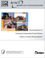
Recommendations for Evaluating & Implementing Proximity Warning Systems on Surface Mining Equipment / Рекомендации по оценке и внедрению систем предупреждения о приближении на оборудовании для открытых горных работ

Accidents involving surface mining equipment that collide with another vehicle, run over a pedestrian worker, or back over an embankment or other object are a major concern for mine workers and managers, regulators, insurance companies, and safety researchers. These accidents occur in spite of rules that require audible back-up alarms on mobile equipment (Code of Federal Regulations, 1999; Laroche, 2006).

Редактор(ы):Edgerton W.W.
Издание:Society for Mining Metallurgy and Exploration Inc., 2008 г., 155 стр., ISBN: 978-0-87335-292-5
Язык(и)Английский
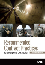
Recommended contract practices for underground construction / Рекомендуемая практика заключения контрактов на подземное строительство

In the 1970s, members of the U.S. National Committee on Tunneling Technology (USNCTT) recognized a need to review and improve contracting practices for underground construction. The committee conducted an intensive study and several workshop reviews, ultimately publishing a set of recommended practices in 1974.

Автор(ы):Noppe M.A.
Издание:2004 г., 7 стр.
Язык(и)Английский
Reconciliation: importance of good sampling and data QAQC / Сопоставление: важность надлежащей выборки и контроля качества данных

Mining reconciliation is the comparison of estimated tonnage, grade and metal with actual measurements. The aims are to measure the performance of the operation, support the calculation of the mineral asset, validate the Mineral Resource and Ore Reserve estimates, and provide key performance indicators for short and long-term control (Morley, 2003). Ongoing, regular and efficient reconciliation should also highlight improvement opportunities and allow for proactive short-term forecasting by providing reliable calibrations to critical estimates. The concept is that of “measure, control and improve”.  <...>

Редактор(ы):Groisman P.Y., Gutman G.
Издание:Springer, 2013 г., 364 стр., ISBN: 978-94-007-4568-1
Язык(и)Английский
Regional environmental changes in Siberia and their global consequences / Региональные экологические изменения в Сибири и их глобальные последствия

The vast region of Siberia is expected to experience potentially rapid land-cover changes, which are among the earliest indicators of the Earth’s response to climate warming. Moreover, climate change affects both the boreal ecosystems and socioeconomic infrastructure.

ТематикаЭкология
Автор(ы):Davidson J., Mpodozis C.
Издание:1991 г., 13 стр.
Язык(и)Английский
Regional geologic setting of epithermal gold deposits, Chile / Региональные геологические условия эпитермальных золоторудных месторождений, Чили

Epithermal gold deposits in Chile are Cretaceous to Cenozoic in age. The ores and the volcanic rocks with which they are associated were generated at a noncollisional, ocean-continent convergent plate margin. They are related to long, slightly sinuous north-northeasttrending magmatic belts roughly parallel to the Pacific coast. Most of the deposits are associated with eroded volcanic centers and subvolcanic porphyries. North-south variations in the nature, extent, and timing of magmatism control the succession of mineralization events. In the Late Cretaceous, vein districts (e.g., E1 Bronce) and hydrothermal alteration zones were formed in central Chile.

Том 1, Издание 2
Редактор(ы):Adam J., Bally A.W., Chiarella D., Roberts D.G., Scarselli N.
Издание:Elsevier, 2020 г., 877 стр., ISBN: 978-0-444-64134-2
Язык(и)Английский
Regional geology and tectonics. Principles of geologic analysis. Volume 1 / Региональная геология и тектоника. Часть 1. Принципы геологического анализа

The most important question every geoscientist should continually ask is ‘why’? Why do I see what I see? Too often it is accepted, for example, that a sedimentary basin ‘is there’, and geoscientists continue to work on surfaces and units within its boundaries, without ever questioning ‘why do I have this hole in the ground’? Why is it here? What governed its geometry and stratigraphic architecture? What controlled the sediment entry points? What dictates the thermal structure? In resource evaluation and field development, the focus is commonly further narrowed, with management only requesting a map on a ‘Green Horizon’ picked on seismic data in a workstation environment covering only a small segment of the total basin area; insights from the broader regional and mega-regional geological understanding are lost. <...>

Редактор(ы):Bally A.W., Roberts D.G.
Издание:Elsevier, 2012 г., 1221 стр., ISBN: 978-0-444-56357-6
Язык(и)Английский
Regional geology and tectonics: Phanerozoic passive margins, cratonic basins and global tectonic maps / Региональная геология и тектоника: Фанерозойские пассивные окраины, кратонные бассейны и глобальные тектонические карты

Both the petroleum industry and academia continue to undergo a transition whereby active knowledge transfer by experienced earth scientists represented by faculty teachers and researchers, Chief geoscientists, etc. is rapidly changing to passive knowledge (or data transfer) through a variety of electronic media and systems. Over the recent past, the broad experience base in both industry and academia has been phased out through retirement, redundancy and focus on specific research areas. In the case of industry, a new generation of younger specialists, sometimes called Nintendo geoscientists, are trained to solve specific practical problems based on highly focussed data acquisition and interpretation using work stations. In academia, an increasingly holistic focus on earth systems science is eroding the broader geological base that has hitherto underpinned scholarly research. <...>

784.21