Добрый день, Коллеги. Важное сообщение, просьба принять участие. Музей Ферсмана ищет помощь для реставрационных работ в помещении. Подробности по ссылке

Поиск по книгам
Издание:2007 г., 16 стр.
Язык(и)Английский
Combining data from multiple years or areas to improve variogram estimation / Объединение данных за несколько лет или областей для улучшения оценки вариограммы

A requirement for geostatistical prediction is estimation of the variogram from the data. Often low sample size is a major impediment to elucidating a variogram even for a highly autocorrelated spatial process. This paper presents a methodology for improving variogram estimation when samples exist from multiple years or regions sharing a similar process for generating spatial autocorrelation.

Издание:2003 г., 11 стр.
Язык(и)Английский
Environmental data mining and modeling based on machine learning algorithms and geostatistics / Интеллектуальный анализ и моделирование экологических данных на основе алгоритмов машинного обучения и геостатистики

The paper presents some contemporary approaches to spatial environmental data analysis. The main topics are concentrated on the decision-oriented problems of environmental spatial data mining and modeling: valorization and representativity of data with the help of exploratory data analysis, spatial predictions, probabilistic and risk mapping, development and application of conditional stochastic simulation models. The innovative part of the paper presents integrated/hybrid model—machine learning (ML) residuals sequential simulations—MLRSS.

Автор(ы):Snowden D.V.
Издание:1989 г., 4 стр.
Язык(и)Английский
Estimating recoverable reserves – developments in applied geostatistics / Оценка извлекаемых запасов – достижения в области прикладной геостатистики

So much work has been done in recent years using geostatistics to solve practical problems that we no longer have to apologise for nor justify the method. The method is as good as the practitioner, which goes, after all, for any technical application. There have been enough case studies now to show that almost any orebody, simple or complex in structure, which has a definable spatial continuity, will be amenable to geostatistical evaluation given that it is suitably sampled.

Автор(ы):Journel A.G.
Издание:American Geophysical Union, Washington, 1989 г., 56 стр., ISBN: 0-87590-708-3
Язык(и)Английский
Fundamentals of geostatistics in five lessons / Основы геостатистики в пяти уроках

From its inception as a separate discipline, geostatis tics sought recognition from practitioners, not from math ematicians or physicists. and rightfully so. Indeed, the theory was essentially established by the 1950's by Kol mogorov and Wiener and exposed by Matern (1960), Whit tle (1963), and Matheron (1965), among others. But there is a long, hard way between a concept expressed by matrix notations in a Hilbert space and its implementation and routine application. It is my opinion that the main con tribution of geostatistics has been and still is implementa. tion, an essential follow-up step much too often forsaken by theoreticians. <...>

Редактор(ы):Forster A., Merriam D.F.
Издание:Plenum press, New York, 1996 г., 337 стр., ISBN: 978-1-4613-4613-8017-7
Язык(и)Английский
Geologic modeling and mapping / Геологическое моделирование и картирование

Subsurface fluid flow is critically dependent on the 3D distribution of petrophysical properties in rocks. In sequences of sedimentary rocks these properties are strongly influenced by lithology and facies distribution that stem from the geologic processes that generated them.

Автор(ы):Olea R.A., Pawlowsky-Glahn V.
Издание:Oxford university press, Oxford, 2004 г., 203 стр., ISBN: 0-19-517166-7
Язык(и)Английский
Geostatistical analysis of compositional data / Геостатистический анализ композиционных данных

Geological data, notably geochemical data, often take the form of a regionalized composition. The concept of regionalized composition combines the concepts of composition and coregionalization. A composition, also known in the literature as a closed array (Chayes 1962), is a random vector whose components add up to a constant. A coregionalization is a set of two or more regionalized variables defined over the same spatial domain, which is modeled as a realization of a vector random function. Here the term regionalized composition is used both for the vector random function used to model a composition and for the realization that we can observe <...>

Редактор(ы):Giraldo R., Mateu J.
Издание:Wiley, 2022 г., 450 стр., ISBN: 9781119387848
Язык(и)Английский
Geostatistical functional data analysis / Геостатистический функциональный анализ данных

Spatial statistics has developed rapidly during the last 30 years. We have seen an interesting progress both in theoretical developments and in practical studies. Some early applications were in mining, forestry, and hydrology. It seems to be honest to remark that the increasing availability of computer power and skillful computer software has stimulated the ability to solve increasingly complex problems.

Издание 4
Автор(ы):Давид М. (David M.)
Издание:Elsevier, 1982 г., 374 стр., ISBN: 0-444-41609-9
Язык(и)Английский
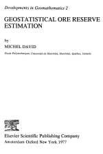
Geostatistical ore reserve estimation / Геостатистические методы при оценке запасов руд

This text intends to be a technical one. This means that techniques to solve identified problems will be presented. As the theory which serves as a basis for these techniques is very new, and relatively unfamiliar to the mineral industry, several chapters or sections will be devoted to it. These two ideas of a technique and a theory have been my guideline in preparing this course on the geostatistical estimation of mineral resources. The main target was to stay, as much as possible, close to the practical problems. This is the reason for the many examples which are intermeshed with the text; however, in many cases, staying t o o close t o a problem obscures the broader frame into which a question has to be asked before finding a correct answer. This is the reason for some theoretical digressions, which may seem to some as an attempt to try and make things look complicated. Certainly, in a particular mine, many problems can be solved without a total understanding of the complete theory. On the other hand, when one considers all the problems occurring in different mines, one cannot hope to solve them without having a good grasp, a synthetic view of the theory of regionalized variables as developed by G. Matheron in France, the most advanced developments of which have just been published in the Proceedings of a N.A.T.O. Advanced Study Institute (Guarascio, Huijbregts, David, 1976) <...>

Редактор(ы):Armstrong M., Dowd P.A.
Издание:Springer, 1994 г., 257 стр., ISBN: 978-90-481-4372-6
Язык(и)Английский
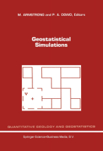
Geostatistical simulations / Геостатистические симуляции

Stochastic simulation has been suggested as a viable method for characterizing the uncertainty associated with the prediction of a nonlinear function of a spatially-varying parameter. Geostatistical simulation algorithms generate realizations of a random field with specified statistical and geostatistical properties. A nonlinear function (called a transfer function) is evaluated over each realization to obtain an uncertainty distribution of a system response that reflects the spatial variability and uncertainty in the parameter. Crucial management decisions, such as potential regulatory compliance of proposed nuclear waste facilities and optimal allocation of resources in environment al remediation, are based on the resulting system response uncertainty distribution. <...>

Издание:McGraw-Hill Book Company, New York, 1980 г., 173 стр.
Язык(и)Английский
Geostatistics / Геостатистика

Miners and geologists have always known that the value of minerals in a given volume of ore depends heavily on the position of the ore in the orebody and on the value of the ground surrounding it. Thus, traditional methods of ore reserve estimation have attempted to combine data, on the position of the sample with an intuitive notion of "area of influence" to produce usable results. Polygonal and triangular weighting, rectangular zones of influence, and inverse distance methods were all developed so that both characteristics—spatial position and value of surrounding ground-would be included in the estimation. However, there is no objective way to measure the reliability of these estimating techniques.

5298.69