Добрый день, Коллеги. Важное сообщение, просьба принять участие. Музей Ферсмана ищет помощь для реставрационных работ в помещении. Подробности по ссылке

Поиск по книгам
Редактор(ы):Merriam D.F.
Издание:Plenum press, 1970 г., 182 стр., ISBN: 978-1-4615-7103-2
Язык(и)Английский
Geostatistics. A colloquium / Геостатистика. Коллоквиум

Although geologists have used statistical analysis in their research for many years, only recently has geostatistics, as a creative tool in the geosciences, received the attention it deserves. Even now many geologists are unaware of the tremendous power statistical methods offer. Today earth scientists can use summary statistics for large data bases, frequency distributions, sampling designs and problems, and applications of stochastic models and use them in dynamic ways for research and developm·ent.

Издание 2
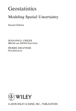
Автор(ы):Chiles J.-P., Delfiner P.
Издание:Wiley, 2012 г., 730 стр., ISBN: 978-0-470-18315-1
Язык(и)Английский
Geostatistics. Modeling spatial uncertainty / Геостатистика. Моделирование пространственной неопределенности

Geostatistics aims at providing quantitative descriptions of natural variables distributed in space or in time and space. Examples of such variables are 

Ore grades in a mineral deposit 

Depth and thickness of a geological layer 

Porosity and permeability in a porous medium 

Density of trees of a certain species in a forest 

Soil properties in a region 

Rainfall over a catchment area 

Pressure, temperature, and wind velocity in the atmosphere
Concentrations of pollutants in a contaminated site

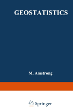
Редактор(ы):Armstrong M.
Издание:Springer, 1988 г., 1058 стр., ISBN: 978-94-015-6846-3
Язык(и)Английский
Geostatistics. Volume 2 / Геостатистика. Часть 2

The main developments during four decades of geostatistical applications on the Witwatersrand-type gold deposits are reviewed and critically compared with a view to highlighting the progress made to date. The basic techniques - from the preliminary borehole valuation of mining properties to the block estimating of ore reserves and foreseeable recoveries are analysed and the prospects for methodological improvements are discussed.

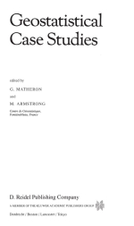
Редактор(ы):Armstrong M., Matheron G.
Издание:D.Reidel publishing company, 1987 г., 246 стр., ISBN: 978-94-010-8018-7
Язык(и)Английский
Gestatistical Case Studies / Геостатистические тематические исследования

The objective of this paper is to show how well known the structure is for a particular uranium deposit. After presenting the average vertical variogram for all the holes, some of the individual variograms will be studied and we will show the influence of a few very rich holes on the overall variogram. This turns out to be poorly defined. The first order variogram, which also has been considered, is curiously similar to the usual variogram, whereas the structure of the translated logarithm proves to be better known. <...>

Издание 2
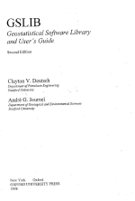
Автор(ы):Deutsch C.V., Journel A.G.
Издание:Oxford university press, 1998 г., 369 стр., ISBN: 0-19-510015-8
Язык(и)Английский
GSLIB geostatistical software library and user's guide / Библиотека программного обеспечения GSLIB и практическое руководство по геостатистике

GSLIB is the name of a directory containing the geostatistical software developed at Stanford. Generations of graduate students have contributed to

this constantly changing collection of programs, ideas, and utilities. Some of the :nost widely used public-domain geostatistical software [58, 62, 721 and many more in-house programs were initiated from GSLIB. It was decided to open the GSLIB directory to a wide audience, providing the source code to seed new developments, custom-made application tools, and, it is hoped, new theoretical advances <...>

Автор(ы):Jacqui Coombes
Издание:1997 г., 16 стр.
Язык(и)Английский
Handy hints for variography / Полезные советы по вариографии

The intention of this paper is to provide the user with a few essential and handy hints for variogram analysis. So often one is faced with the task of analysing the spatial continuity of a data set or with the task of generating a resource model using geostatistical techniques. However, practical guidelines for completing these tasks are few and far between and, even though one may attend a geostatistics course, time lapses between exposure to geostatistical techniques and actual application of the techniques to real situations is generally large enough for the handy hints of variography to be lost in the never-never land of memories. <...>

Автор(ы):Rivoirard J.
Издание:ENSMP, 1990 г., 97 стр.
Язык(и)Английский
Introduction to disjunctive kriging and nonlinear geostatistics / Введение в дизъюнктивный кригинг и нелинейную геостатистику

The discipline which is now known as geostatistics began to develope over thirty years ago for mining evaluation and since has extended to other fields of activity. Around 1960 in particular, G. Matheron built linear geostatistics. Some of its tools (variogram, kriging) are widely used nowadays. Linear geostatistics makes it possible for instance to evaluate the metal content of a mining block or panel by estimating the mean of the grades of the points in it from samples. The reader of this book is supposed to be familiar with linear geostatistics. <...>

Автор(ы):Bardossy A.
Язык(и)Английский
Introduction to Geostatistics / Введение в геостатистику

Most of the natural phenomena we study are variable both in space and time. Considering a topographic surface or a groundwater contamination one can observe high variability within small distances. The variability is a result of natural processes, thus deterministic. As most of these processes are sensitive and the conditions under which the they took place are not fully known, it is not possible to describe them based on physical and chemical laws completely. <...>

Автор(ы):Kitanidis P.K.
Издание:Cambridge University Press, 1999 г., 270 стр., ISBN: 0-521-58312-8
Язык(и)Английский
Introduction to geostatistics. Applications in hydrogeology / Введение в геостатистику. Применение в гидрогеологии

This book grew out of class notes for a course that served two purposes:
1.    To familiarize graduate students in hydrogeology and environmental engineering with some practical methods for solving interpolation and related estimation problems. The course emphasized geostatistical methods.
2.    To illustrate how one may use data to develop empirical models, that is, to provide an introduction to applied statistical modeling.

Издание:НПП «КРИВБАССАКАДЕМИНВЕСТ», Кривой Рог, 37 стр.
Язык(и)Русский
K-MINE - программный комплекс для маркшейдеров, геологов и горных инженеров

K-MINE – это специализированная геоинформационная система для решения задач геодезии, картографии, геологии, проектирования.

Существуют специализированные решения K-MINE для предприятий горногопроизводства, сельского хозяйства, транспорта и др. Основой для работы системы служат цифровыетрехмерные модели объектов различной сложности (карты местности, модели месторождений, генеральныхпланов, полей сельскохозяйственного назначения, карьеров, шахт и др.). Наличие специализированногоматематического аппарата позволяет объединять геоданные с таблично-графической информацией, чтоприводит к возможности создания многосвязных аналитических отчетов, проектной документации, построениякомплексных проектных решений для производства и хозяйственной деятельности.

Разработчиком системы является компания «КРИВБАССАКАДЕМИНВЕСТ» (г. Кривой Рог, Украина). Первая версия системы вышла в свет в 1998 г. недропользование <...>


7065.79