Добрый день, Коллеги. Важное сообщение, просьба принять участие. Музей Ферсмана ищет помощь для реставрационных работ в помещении. Подробности по ссылке
This book is an introduction to critical cartography and GIS. As such, it is neither a textbook nor a software manual. My purpose is to discuss various aspects of mapping theory and practice, from critical social theory to some of the most interesting new mapping practices such as map hacking and the geospatial web. It is an appreciation of a more critical cartography and GIS.
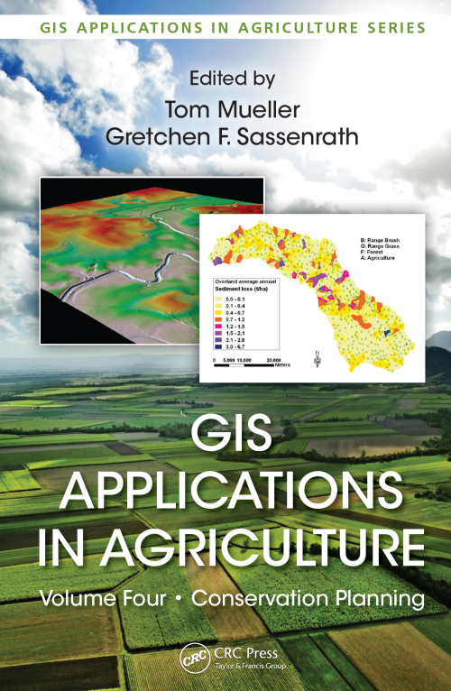
GIS Applications in Agriculture, Volume Four: Conservation Planning, edited by Tom Mueller and Gretchen F. Sassenrath, is the fourth volume in the book series GIS Applications in Agriculture, which is designed to enhance the application and use of geographic information systems (GISs) in agriculture by providing detailed GIS applications that are useful to scientists, educators, students, consultants, and farmers. The first volume, GIS Applications in Agriculture, edited by Francis J. Pierce and David Clay, was published by CRC Press in 2007. The second volume, GIS Applications in Agriculture: Nutrient Management for Improved Energy Efficiency, edited by David Clay and John Shanahan, and the third volume, GIS Applications in Agriculture: Invasive Species, edited by Sharon Clay, were published by CRC Press in 2011. While the newest book in this series, the idea of a book on conservation planning using GIS was identified in 2007 when the book series began. Intuitively, conservation planning through GIS applications should appeal to all conservationists who clearly understand that a key to achieving soil and water conservation is rooted in an understanding of the spatial and temporal variation in both soil and water resources and natural and human-induced forces that affect the quality and quantity of those resources. <...>
GIS Tutorial 1: Basic Workbook is the direct result of the authors' experiences teaching GIS to high school students in a summer program at Carnegie Mellon University, undergraduate and graduate students in several departments and disciplines at Carnegie Mellon University, as well as working professionals. GIS Tutorial 1 is a hands-on workbook with step-by-step exercises that take the reader from the basics of using ArcGlS Desktop interfaces through performing advanced spatial analyses. <...>
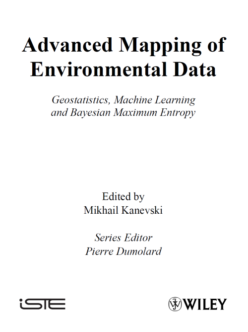
In this introductory chapter we describe general problems of spatial environmental data analysis, modeling, validation and visualization. Many of these problems are considered in detail in the following chapters using geostatistical models, machine learning algorithms (MLA) of neural networks and Support Vector Machines, and the Bayesian Maximum Entropy (BME) approach. The term “mapping” in the book is considered not only as an interpolation in two- or threedimensional geographical space, but in a more general sense of estimating the desired dependencies from empirical data.
Geostatistics aims at providing quantitative descriptions of natural variables distributed in space or in time and space. Examples of such variables are
Ore grades in a mineral deposit
Depth and thickness of a geological layer
Porosity and permeability in a porous medium
Density of trees of a certain species in a forest
Soil properties in a region
Rainfall over a catchment area
Pressure, temperature, and wind velocity in the atmosphere Concentrations of pollutants in a contaminated site
Geostatistical simulation makes strong assumptions of stationarity in the mean and the variance over the domain of interest. Unfortunately, geological nature usually does not reflect this assumption and we are forced to subdivide our model area into stationary regions that have some common geological controls and similar statistical properties. This paper addresses the significant complexity introduced by boundaries. Boundaries are often soft, that is, samples near boundaries influence multiple rock types.
The wealth of mineral resources that lies beneath the Earth’s surface drives techno‑logical advancements and underpins our economic prosperity. This comprehensive book presents the methods and processes of mineral resource estimation at each step along the mining value chain and provides a necessary framework for understanding mineral development and exploitation. The complexities associated with mineral resource estimation are addressed by explaining the importance of reliable methodologies and the consideration of uncertainty in decision‑making.
Geological data, notably geochemical data, often take the form of a regionalized composition. The concept of regionalized composition combines the concepts of composition and coregionalization. A composition, also known in the literature as a closed array (Chayes 1962), is a random vector whose components add up to a constant. A coregionalization is a set of two or more regionalized variables defined over the same spatial domain, which is modeled as a realization of a vector random function. Here the term regionalized composition is used both for the vector random function used to model a composition and for the realization that we can observe <...>
Рассмотрены вопросы создания и применения геоинформационных систем (ГИС) для решения задач управления, бизнеса, мониторинга и др. Описаны особенности организации данных и их моделирования в этих системах. Даны характеристики основных инструментальных систем ГИС, предназначенных для организации прикладных геоинформационных систем. Приведены варианты решения практических задач в управлении, экологии, контроле, учете и т.д. Для студентов вузов, учащихся колледжей, лицеев и других средних учебных заведений, а также для всех, интересующихся этой тематикой.