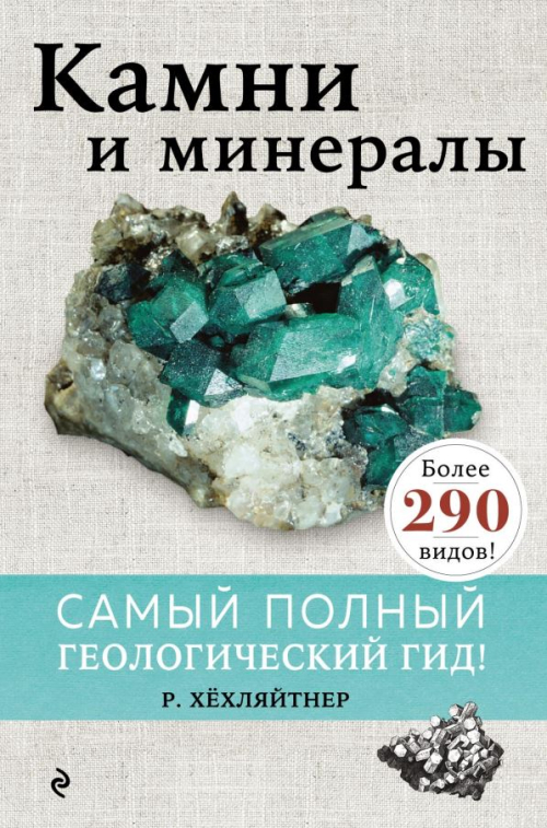
Добрый день, Коллеги. Важное сообщение, просьба принять участие. Музей Ферсмана ищет помощь для реставрационных работ в помещении. Подробности по ссылке
This guidebook is dedicated to ultramafic-mafic intrusions, volcanic rocks and the world-class PGE-Cu-Ni sulfide deposits of the Noril’sk Province, Polar Siberia. The characteristics of geology, mineralogy and geochemistry of volcanic rocks and ore-bearing ultramafic-mafic intrusions are briefly outlined. The proposed excursion stops include inspection of the different volcanic and intrusive rocks, associated PGE-Cu-Ni sulfide ores from drill cores and bedrock outcrops. In addition, an open pit Medvezhy Ruchei and two mines (Oktyabrsky and Taimyrsky) collectively provide an overview of the Noril’sk-type intrusions and associated disseminated and massive PGE-Cu-Ni sulfide ores.
Trilobites are hard-shelled, segmented creatures that existed over 300 million years ago in the Earth’s ancient seas. They went extinct before dinosaurs even existed, and are the signature creatures of the Paleozoic Era, the first era to generate a diversity of complex life forms, including nearly all of the phyla of today. Although dinosaurs are the most well-known fossil life forms, trilobites are also a favorite among those familiar with paleontology (the study of the development of life on Earth) <...>
Modern Fluvial-Deltaic Deposits in Daihai Lake Basin, Northern China Shunli Li, Chengpeng Tan, Xin Shan, Xinghe Yu, and Xuefa Shi
Core Investigation of the International Continental Scientific Drilling Program from the Cretaceous Songliao Basin (SK-1/SK-2/ SK-3), NE China Yuan Gao, Youfeng Gao, and Daniel E.
Ibarra Cambrian Tempestites in the Xiaweidian Area, Western Beijing City Bo Liu, Kaibo Shi, Hangyu Liu, Chun Wu, and Qing He
Lower Cretaceous Lacustrine Sedimentary Sequences of a Small Intracontinental Rift Basin in Luanping, China Ping Luo, Chuanmin Zhou, Xingyang Zhang, Zhijie Zhang, Xuanjie Zhang, and Xiufen Zhai Songliao
The North American Cordillera is home to a greater diversity of volcanic provinces than any comparably sized region in the world. The interplay between changing plate-margin interactions, tectonic complexity, intra-crustal magma differentiation, and mantle melting have resulted in a wealth of volcanic landscapes. Field trips in this series visit many of these landscapes, including (1) active subduction-related arc volcanoes in the Cascade Range;
This five day field trip is a general overview of the geology and tectonic history of central Colorado and of the geology of seven famous mining districts. Some of these mining districts had their most productive years in the latter decades of the 19th century, whereas others reached their peak production more recently. At present mining activity in some of them has ceased. In others it is at low levels compared to earlier years. The regional geology and the road log are compiled from numerous sources. The principal ones are field trip guides by Tweto (1978), Reed and others (1988), Lipman (in press) and unpublished field guides of the Colorado Scientific Society and the Society of Economic Geologists. Figure 1 shows the principal geographic features along the route of the trip. <...>
На 1100 фото, фотопанорамах, разрезах и картах показано современное геологическое строение Крыма. С позиций актуалистической геодинамики, приведены новые интерпретации уникальных геологических объектов. На фоторисунках обосновано выделение региональных меланжей, сложных шарьяжных складок, надвигов и оползневых комплексов. Приведены короткие пояснения строения, список литературы и словарь терминов. Атлас может использоваться как основа для создания общепринятой модели строения Крыма, а также как путеводитель при геологических, географических и природоведческих экскурсиях
Geomorphology literally means the study of the Earth’s landforms. It is defi ned by the International Association of Geomorphologists (IAG; www.geomorph.org) as the interdisciplinary and systematic study of landforms and their landscapes, as well as the Earth surface processes that create them. Geomorphologists investigate landforms and landscapes addressing multiple aspects, such as their genesis, morphometry , chronology and past and future evolution. They also investigate Earth surface processes not only to understand their morphogenetic role, but also to gain a scientifi c basis for assessing and managing a great deal of environmental problems associated with them, notably geohazards (e.g. landslides, fl oods, subsidence, earthquakes).
Nachdem »Die Ammoniten des süddeutschen Lias« - seit 1992 bereits in zweiter Auflage - und ebenso »Die Ammoniten des süddeutschen Doggers« starke Beachtung bei Fachleuten und Amateuren weit über die Grenzen des Unrersu-ehungsgebietes hinaus gefunden harren, wurde die Frage nach Erscheinen eines dritten Bandes zunehmend häufiger gestellt. So war es mir ein Bedürfnis, das Gesamtwerk durch die monographische Erfassung der süddeutschen Malm-Ammoni-ten umso 2Ügiger zu vervollständigen.
The fi eld trip described in this guide starts in the “Norwegian Alps,” the high mountain massif called Jotunheimen, and runs out along Sognefjorden, the world’s longest fjord, to the islands along the west coast of Norway. Geologically, the Sognefjord transect provides a complete cross section through the Caledonian orogenic belt, of Paleozoic age, which in Norway stretches along the west coast from Stavanger to North Cape, a distance of ~2000 km.
The geology, tectonics and stratigraphy of the Monchegorsk region (Kola Peninsula, Russia) is briefly described in the guidebook. The geological structure, ore localization and mineralogy of Cu-Ni-PGE and Cr occurrences in the major layered intrusions (Monchepluton, Imandra lopolith, Monchetundra intrusion) are presented in more detail.