Добрый день, Коллеги. Важное сообщение, просьба принять участие. Музей Ферсмана ищет помощь для реставрационных работ в помещении. Подробности по ссылке

Издание:Издательство РГПУ им А.И.Герцена, Санкт-Петербург, 2022 г., 111 стр., УДК: 91, ISBN: 978-5-8064-3188-3
Язык(и)Русский
Атлас Ленинградской области

Атлас Ленинградской области является научно-справочным географическим и картографическим произведением, синтезирующим современные знания о природе, населении и хозяйстве региона.

Атлас содержит 140 карт. Основные масштабы тематических карт: 1 : 1 500 000, 1 : 2 000 000, 1 : 3 000 000, 1 : 5 000 000. Масштабы карт административных районов области: 1 : 165 000, 1 : 300 000, 1 : 320 000, 1 : 350 000, 1 : 400 000, 1 : 1 500 000, 1 : 550 000.

Редактор(ы):Snoke A.W., Todd V.R., Tullis J.
Издание:Princeton University Press, 1998 г., 933 стр., ISBN: 0-691-01220-2
Язык(и)Английский
Fault-related rocks. A photographic atlas / Горные породы, связанные с тектоническими нарушениями (тектонические брекчии). Атлас фотографий

The initial concept of a photographic atlas on fault rocks was developed  during informal discussions at the Geological Society of America Penrose  Conference "Significance and Petrogenesis of Mylonitic Rocks" held at San  Diego, California, in spring 1981, and coconvened by the editors of this  book. Many participants felt that a new consensus about mylonites and ductile shear zones had been achieved at the conference, based largely upon the  contributions of geoscientists who brought perspectives from the laboratory  as well as from the field. In part motivated by the publication (1982) of the  Atlas of Deformational and Metamorphic Rock Fabrics (and its predecessor,  the Atlas of Rock Cleavage) both edited by G. J. Borradaile, Μ. B. Bayly, and  C. McA. Powell, we felt that a collection of photographs of features characteristic of faults and shear zones, ranging in scale from mesoscopic to microscopic to even submicroscopic, together with carefully documented locations  and regional (or experimental) information, would provide a valuable reference as well as a teaching device <...>

Издание:Elsevier, 2022 г., 417 стр., ISBN: 978-0-12-81797-8-9
Язык(и)Английский
Atlas of deformed and metamorphosed rocks from proterozoic orogens / Атлас деформированных и метаморфизованных горных пород протерозойских орогенов

Orogens in space and time are the potential sources of information in understanding the mechanism of episodic global material circulation on a whole-mantle-scale. They represent the hallmarks of the interaction among lithospheric plates. The word “orogen” is derived from Greece (oros for “mountain,” genesis for origin). The term “orogen” or “orogenic belt” has been traditionally described as a mountain belt composed of different types of rocks or rock strata forming a complex of variable size, typically tens to hundreds of kilometres wide and several thousand kilometre long, later fragmented during younger geological time due to various processes (e.g., Miashiro, 1961). In modern terminology, an orogen can be defined as a major linear deformed zone, sandwiched between cratons with prolonged deformational history, repeatedly reactivated and associated with different events of magmatic pulses and metamorphic episodes in space and time (Dewey and Bird, 1970). An orogen or orogenic belt develops when a continental plate crumples and is pushed upwards to form one or multiple mountain ranges. This involves a series of geological processes called “orogenesis.” <...>

Автор(ы):Sawyer E.W.
Издание:National Research Council of Canada, 2008 г., 384 стр., ISBN: 978-0-660-19787-6
Язык(и)Английский
Atlas of migmatites / Атлас мигматитов

Migmatites are spectacular, complex-looking rocks that can inspire, fascinate, or confuse geologists. All migmatites viewed in an outcrop represent the sum of a series of processes that acted in parallel, or sequentially, and the influence of various local factors (see the photographs in section A). In order to begin to understand the complexity and seemingly endless variety in migmatites, and to provide the reader context for the subject of this book, some of the key factors and processes that make individual migmatites the way they are should be outlined at the outset <...>

Редактор(ы):Goudswaard W., Jenyon M.K.
Издание:European association of exploretion geophysicsts, 1988 г., 292 стр.
Язык(и)Английский
Seismic atlas of structural and stratigraphic features / Сейсмический атлас структурных и стратиграфических особенностей

This Atlas is designed to be a useful work of reference in an easily-handled format amenable to future expansion both by the E.A.E.G. and the users themselves. It is intended for geoscientists in both the industrial and academic spheres who are at an early career stage, and who would find it of value to see how the interpretation of a wide variety of types of structure is approached on actual examples. The notes accompanying the examples have been kept as concise as is consistent with clarity, and some guidance for further study has been given in the form of a list of key words, and brief references with each group of examples; these in turn will open up the literature.

Armenia Geologic maps Atlas / Атлас геологических карт Армении
Карта составлена:2005 г.
Язык(и)Армянский
Масштаб:1:1000000
Назначение карты:Атлас карт
Скачать
Карта (12.95M)
На странице представлен материал:Атлас карт: Armenia Geologic maps Atlas / Атлас геологических карт Армении, масштаб: 1:1000000 , составлена: 2005 г.
Автор(ы):Augustithis S.-S.P.
Издание:W DE G, 1995 г., 671 стр., ISBN: 3-11-0136939-2
Язык(и)Английский
Atlas of the textural patterns of ore minerals and metallogenic processes / Атлас текстурных особенностей рудных минералов и металлогенических процессов

More than thirty years ago, microprobe analysis introduced the possibility of analyzing quantitatively in situ small surfaces of polished sections, rendering obsolete many of the optical measurements and other data that had been presented in many standard ore-mineralogy textbooks, and thus a new approach to the subject was called for. In addition, it should also be pointed out that whereas many excellent books are available on the mineralogy of ore minerals (see page 218) and a thorough treatment of mineral species is presented in their special sections, it is believed that as microprobe analytical facilities develop and are widely applied, the identification and compositional variation of ore minerals will become more and more a matter of microprobe analysis and x-ray studies. <...>

Издание:Cambridge University Press, 2019 г., 301 стр., ISBN: 978-1107036291
Язык(и)Английский
The Atlas of Mars. Mapping its geography and geology / Атлас Марса. Картирование географии и геологии

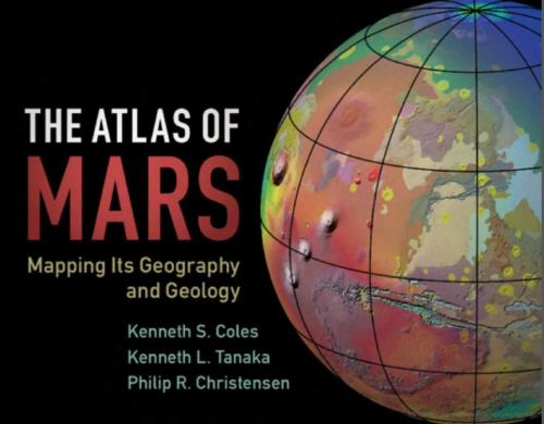
Planetary scientist and educator Ken Coles has teamed up with Ken Tanaka from the United States Geological Survey’s Astrogeology team and Phil Christensen, Principal Investigator of the Mars Odyssey orbiter’s THEMIS science team, to produce this all-purpose reference atlas, The Atlas of Mars. Each of the 30 standard charts includes: a full-page color topographic map at 1:10,000,000 scale, a THEMIS daytime infrared map at the same scale with features labeled, a simplified geologic map of the corresponding area, and a section describing prominent features of interest. The Atlas is rounded out with extensive material on Mars’ global characteristics, regional geography and geology, a Glossary of Terms, and an indexed Gazetteer of up-to-date Martian feature names and nomenclature. This is an essential guide for a broad readership of academics, students, amateur astronomers, and space enthusiasts, replacing the NASA atlas from the 1970s. <...>

Ленты новостей
987.7