Добрый день, Коллеги. Важное сообщение, просьба принять участие. Музей Ферсмана ищет помощь для реставрационных работ в помещении. Подробности по ссылке
Промышленное предприятие представляет собой комплекс технологически взаимосвязанных сооружений, обеспечивающих производство и выпуск определенной продукции. Входящие в состав промышленного предприятия сооружения производственного назначения называют промышленными. К ним относятся специализированные здания и сооружения для обеспечения определенного технологического или производственного процесса, а также связанные с ними энергетические, тепловые и другие установки, механизированные склады, подземные и наземные коммуникации и т.д.
Геодезия и маркшейдерское Дело являются близкими науками, решающими вопросы, во многом схожие между собой; средства, при помощи которых выполняются задачи, по существу, одни и те же— маркшейдерско-геодезические приборы и инструменты. Исторически маркшейдерия явилась продолжением (развитием) геодезии применительно к горному и геологоразведочному делу. Маркшейдерское дело как и геодезия имеют важное значение при проведении поисковых и геологоразведочных работ, при строительстве и эксплуатации горных предприятий, где маркшейдерско-геодезическое обслуживание выполняется для различных видов работ и технологических процессов, требующих зачастую применения сложных методов измерений и инструментов и предъявляющих высокую профессиональную подготовленность у исполнителей работ. Геодезия и маркшейдерское дело тесно связаны с математикой, физикой, астрономией, картографией, радиоэлектроникой, радиотехникой, географией, геоморфологией. Геодезия изучает форму и размеры Земли или отдельных ее частей и методы измерения на земной поверхности, производимые как для отображения е^ на картах и планах, так и для выполнения различных инженерных задач. Маркшейдерское дело является разделом горной науки, включающим измерения на Поверхности и в горных выработках, выполняемых при разведке и эксплуатации месторождений строительстве горных предприятий с целью построения планов н чертежей изучаемых объектов, а также для решения горно-геометрических задач. В геодезии различают две ее части: высшую геодезию я. геодезию. В высшей геодезии изучают методы измерений для высокоточного определения положения в плане и по высоте отдельных точек на земной поверхности, используемых в дальнейшем для уточнения фигуры и размеров Земли, а также для создания опорных геодезических сетей, без которых невозможна правильная постановка и проведение топографических съемок инженерных работ.
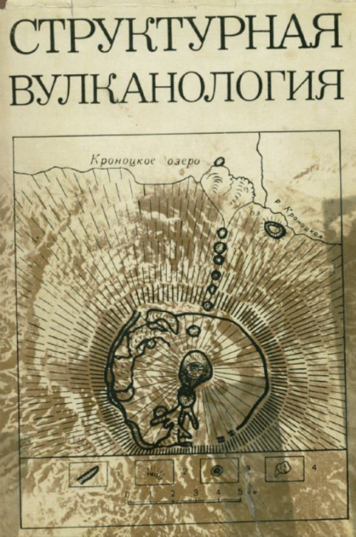
Структурная вулканология возникла как раздел вулканологии в процессе дифференциации наук о Земле — геологии, геофизики, геохимии. Она развивается под влиянием типичного для современных наук синтеза. Изучая проблемы взаимосвязи вулканизма и тектоники, она участвует в создании общей теории развития Земли. Будучи явлением космического порядка, вулканизм стал играть структурообразующую роль на планетарной стадии дифференциации и дегазации оболочек Земли. Вулканическая деятельность рассматривается как часть единого тектоно-магматического процесса, формирующего земную поверхность в результате поднятия и излияния магмы одновременно с перемещениями глыб земной коры.
В предлагаемой монографии, составленной коллективом авторов, подводятся основные итоги исследованиям геохимических барьеров в различных системах зоны гипергенеза — горных породах, корах выветривания, континентальных отложениях, почвах, ландшафтах. Книга подготовлена по материалам конференции “Геохимические барьеры в зоне гипергенеза” (октябрь 1999 г.), посвященной памяти основателя учения о геохимических барьерах А И. Перельмана (1916-1998).
Подготовлена специалистами СССР и НРБ. Изложены методика исследований естественной регенерации бытовых стоков в аридной зоне, гидрогеохимические аспекты процессов загрязнения, полевые и лабораторные методы определения фильтрационных и миграционных параметров. Анализируется влияние постепенной заиленности инфильтрационного сооружения на восполнение запасов подземных вод. Приведена методика оптимизации работы водозабора и управления режимом этих вод. Даны рекомендации по планированию и проведению опытно-миграционных исследований. Для специалистов, работающих в области динамики и геохимии подземных вод, водоснабжения, охраны окружающей среды.
Книга, в которой рассматриваются отношения гравиметрии и геодезии, посвящена 90-летию со дня рождения Всеволода Владимировича Бровара - крупного российского ученого в области геодезической гравиметрии и геодезии, и 100-летию со дня рождения Михаила Сергеевича Молоденского - российского геодезиста и геофизика, основоположника современной теории фигуры Земли, освободивший геодезию от гипотез о внутреннем строении Земли и превративший ее в точную науку. Цель работы состоит в показе плодотворного взаимного влияния гравиметрии и геодезии, эволюции во времени целей и задач геодезии и гравиметрии, подведении основных итогов теоретических, экспериментальных и производственных работ в области геодезической гравиметрии или физической геодезии на рубеже второго и третьего тысячелетия, перехода от частного к системному решению задач, а также в определении перспектив развития гравиметрии в интересах геодезии. В книге обобщены достижения гравиметрии и геодезии на длительном этапе. В приложении прослежена эволюция содержания задач геодезии и гравиметрии, даны портреты около двухсот ученых (теоретиков, экспериментаторов и организаторов) и описания в хронологическом порядке их вклада в теорию, аппаратуру и производство измерений. Показана необходимость перехода к системному подходу решения задач геодезии и гравиметрии, к пересмотру стратегии развития геодезии и гравиметрии как наук, так и топографо-геодезического и гравиметрического производства; рассмотрены перспективы совместного развития геодезии и гравиметрии и их новые области применения.
Ordovician volcanic, volcaniclastic and intrusive rocks of calc-alkaline affinity in the Eastern Subprovince of the Lachlan Orogen were formed in the intraoceanic Macquarie Volcanic Arc. The Macquarie Arc was developed in response to west-dipping subduction along part of the boundary between eastern Gondwana and the proto-Pacific Plate and was situated on the Gondwana Plate, some 1000 km east of Precambrian continental crust. The intervening area was occupied by a back arc basin that developed on oceanic crust as the proto-PacificPlate rolled back eastwards after the Middle Cambrian Delamerian Orogeny. Subsequent extension, strike-slip translation and thin-skinned tectonics have structurally dissected the single arc into four north to NNE trending structural belts of Ordovician calc-alkaline rocks that are separated largely by younger rift basins and in part by coeval craton-derived turbidites.
Evolutionary science is for the most part based on observation and indirect inference. It is not experimental science, even though experiments can certainly play a role in our understanding of processes. We can never hope to have the resources to build our own planet and observe how it evolves; we cannot even hope (at least in the foreseeable future) to observe an ensemble of Earth-like planets elsewhere in the universe and at diverse stages of their evolution (though there is certainly much discussion about detection of such planets; e.g., Seager (2003)). There are two central ideas that govern our thinking about Earth and its history. One is ‘provenance’: the nature and origin of the material that went into making Earth. This is our cosmic heritage, one that we presumably share with neighboring terrestrial planets, and (to some uncertain extent) we share with the meteorites and the abundances of elements in the Sun. The other is ‘process’: Earth is an engine and its current structure is a consequence of those ongoing processes, expressed in the form it takes now. The most obvious and important of these processes is plate tectonics and the inextricably entwined process of mantle convection. However, this central evolutionary process cannot be separated from the nature of the atmosphere and ocean, the geochemical evolution of various parts of Earth expressed in the rock record, and life. Figure 1 shows conceptually the ideas of Earth evolution, expressed as a curve in some multidimensional space that is here simplified by focusing on two variables (‘this’ and ‘that’), the identities of which are not important. They could be physical variables such as temperature, or chemical variables (composition of a particular reservoir) or isotopic tracers. The figure intends to convey the idea that we have an initial condition, an evolutionary path, and a present state. The initial condition is dictated not only by provenance but also by the physics of the formation process. By analogy, we would say that the apples from an apple tree owemuch of their nature not only to the genetics of apples (the process of their formation) but also, to some extent, the soil and climate in which the tree grew.We are informed of this initial condition by astronomy, which tells us about how planets form in other solar systems, by geochemistry (a memory within Earth of thematerials and conditions of Earth formation), and by physical modeling: simulations and analysis of what may have occurred. Notably, we do not get information on the initial condition from geology since there are no rocks or landforms that date back to the earliest history of Earth. Geology, aided by geochemistry and geobiology, plays a central role informing us about Earth history. Though some geophysicists study evolution, nearly all geophysical techniques are directed toward understanding a snapshot of present Earth, or a very short period prior to present Earth, and it is only through modeling (e.g., of geological data) that the physical aspects of evolution are illuminated.
For as long as man has speculated about the interior of the Earth, it has been presumed that there exists a central core. Centuries before the rise of modern science, philosophers, and theologians had concluded that the Earth has a hot region at its center, with properties distinct from all other parts of the planet. For nearly as long a time it has been known that the Earth is also magnetic, but the cause of the Earth’s agnetism remained just as mysterious as the nature of the deep interior. Scientific inquiry about the core grew from early investigations of the properties of the geomagnetic field, which began during the era of global exploration. Although the ancient Chinese deserve the credit for discovering Earth’s magnetism, Gilbert (1600) was the first to demonstrate that the compass needle is controlled by a force originating within the Earth (Figure 1). He showed that the pattern of magnetic field lines on a uniformly magnetized sphere approximate the known directions of the compass needle over the Earth’s surface. Three hundred and fifty years later, Sidney Chapman characterized Gilbert’s demonstration as ‘‘the only successful experiment in the history of geomagnetism!’’ Later it was observed that Earth’s magnetic field changes slowly with time. In his famous explanation for this secular variation, Halley (1683, 1692) proposed that the geomagnetic field has its origin near the Earth’s center, in a region separated from the solid crust by a cavernous, fluidfilled shell. Halley (Figure 2) envisioned that both the crust and the central region or core rotate in the prograde sense, but the core spins slightly slower, causing the magnetic field to drift systematically westward as seen at the surface. Thus, two important and long-lasting concepts were born: the basic three-layer model of Earth’s interior (solid crust and mantle, liquid outer and solid inner core), and the association between the westward geomagnetic drift and westward motion of the fluid outer core with respect to other parts of the Earth system. Halley’s model implicitly assumed that the magnetic field originated in a solid inner core (Evans, 1988), akin to Gilbert’s uniformly magnetized sphere. Subsequently, it was shown that Halley’s model is at variance with the ferromagnetic properties of Earth materials, which lose their permanent magnetization at the Curie temperature at depths of a few tens of kilometers beneath the surface (see Chapter 5.06). However, by then the physical connection between magnetic fields and electric currents had been established, providing an alternative explanation for the geomagnetic field that relied on free electric currents rather than permanent magnetization.
Much of what we refer to as geology, or more accurately geological activity on Earth, is due to the simple act of our planet cooling to space. What allows this activity to persist over the lifetime of the solar system is that the major and most massive portion of the planet, namely the mantle, is so large, moves so slowly, and cools so gradually that it sets the pace of cooling for the whole Earth.