Добрый день, Коллеги. Важное сообщение, просьба принять участие. Музей Ферсмана ищет помощь для реставрационных работ в помещении. Подробности по ссылке
An understanding of the structural elements in the sub-surface is of great importance when establishing new constructions in bedrock, or surveying areas prone to rockslides. In this thesis the focus has been on combining methods within geology, structural geology, geophysics and engineering geology to reach an interdisciplinary understanding and predict sub-surface structures.
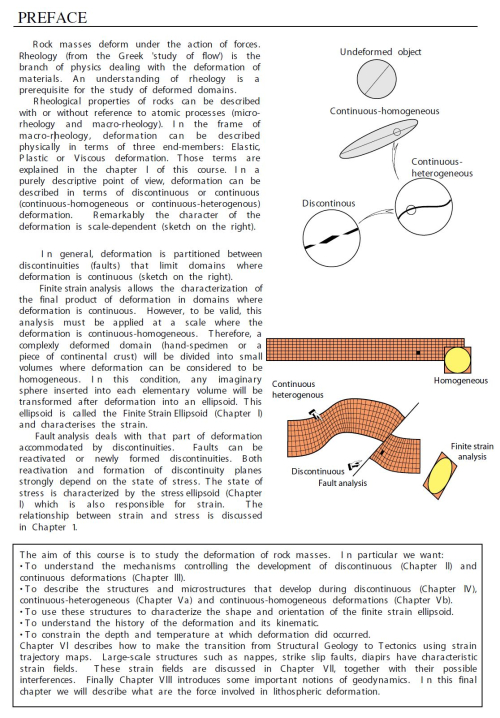
R ock masses deform under the action of forces. Rheology (from the Greek 'study of flow') is the branch of physics dealing with the deformation of materials. An understanding of rheology is a prerequisite for the study of deformed domains. Rheological properties of rocks can be described with or without reference to atomic processes (microrheology and macro-rheology).
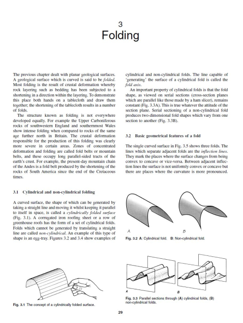
The previous chapter dealt with planar geological surfaces. A geological surface which is curved is said to be folded. Most folding is the result of crustal deformation whereby rock layering such as bedding has been subjected to a shortening in a direction within the layering. To demonstrate this place both hands on a tablecloth and draw them together; the shortening of the tablecloth results in a number of folds.
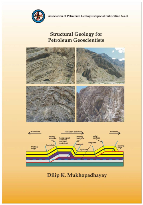
Structural geology is obviously one of the more important subjects for geoscientists working in petroleum industry. Folds and faults in deformed rocks make traps for hydrocarbon accumulation. Also, large-scale deformations, the so-called tectonics, control the architecture of petroliferous sedimentary basins. It is the primary job of a structural geologist to interpret geological map and field data, and infer geometry of large scale folds and faults. However, geoscientists with varied specializations and working with different kinds of data may also be called upon to make structural interpretations.
Folds in ductile shear zones are common structures that have a variety of origins. These can be pre-existing folds that become modified or folds developed during the shearing event. Among the syn-shearing folds, a second subdivision is based on the relative age of the folded surface, which can be pre-existing or newly formed during the shearing event. In each of the three categories final fold geometry and orientation show complex relationships with the kinematic frame. The final fold geometry depends on the vorticity within the shear zone, the rheology and the initial orientation of the folded surface relative to the kinematic framework. It follows that folds are complex structures, difficult to use as kinematic indicators. However, in shear zones where undeformed wall rocks with pre-shear structures are accessible and where kinematics can be well established, folds can provide a valuable natural means to understand the initiation and evolution of structures under non-coaxial regimes. We point to the need of discriminating among different plausible categories, based on the nature of the folded surface and on the inherent structural features of each category. <...>
Number 1 The Casanova Complex of the Northern Apennines: a melange formed on a distal passive continental margin A structural analysis of the Moine Thrust Zone between Loch Eriboll and Foinaven, NW Scotland The origin of tensile fracture lineaments Subcritical crack propagation in rocks: theory, experimental results and applications Calculations of volume change in ductile band structures The problem of shearing along axial plane foliations
I have been teaching Structural Geology and Tectonics for the past four decades and during this period, I always felt a need for a glossary or definitional dictionary devoted to this branch. I therefory, made an attempt in this direction. The editor for while doing the groundwork of the book made use of Glossary of Geology edited by R. Bates & J. Jackson (Am. Geo!. Inst., 1980); Glossary of Geology in Hindi edited by myself (CSTT Govt. of India 1996); Introduction to the structure of the earth by E. Spencer; Tectonic Geology by myself (2006); Geology: an Introduction by myself (2004).