Добрый день, Коллеги. Важное сообщение, просьба принять участие. Музей Ферсмана ищет помощь для реставрационных работ в помещении. Подробности по ссылке
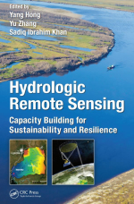
Hydrologic remote sensing. Capacity building for sustainability and resilience / Дистанционное гидрологическое зондирование. Наращивание потенциала в области устойчивого развития и жизнестойкости
Inadequate in situ observations have been historical barriers in the development of hydrologic science. Additionally, with the changing climate and ever accelerating human activities, it is anticipated that water-related disasters such as flood, landslide, and drought will be more severe and frequent, thus threatening more regions around the world. Flooding, which is considered as one of the most hazardous disasters in both rural and urban areas, accounts for around one-third of all global geophysical hazards and causes significant human suffering, loss of life, and property damage. The International Flood Network indicates that from 1995 to 2004, natural disasters caused 471,000 fatalities worldwide and economic losses totaling approximately $49 billion, out of which approximately 94,000 (20%) of the fatalities and $16 billion (33%) of the economic damages were attributed to floods alone. Comparing with fast-paced flood, drought is a slow-onset natural hazard that can nonetheless have wide and prolonged negative environmental and socioeconomic impacts.
As water security is one of the most critical international issues, the current challenges and opportunities in hydrologic science lie in (1) the capability of the hydrologic model in representing the physical hydrologic process, that is, the model structure; (2) model parameter optimization; and (3) accuracy, reliability, and adequacy of forcing data (e.g., in situ and remote sensing observation). Satellite remote sensing techniques bear the promising potential to overcome the limited spatial coverage of in situ observations, thus enabling better understanding of hydrologic cycles on regional and global scales. Compared to site-based measurements, remote sensing observations can better represent the spatial variability of the hydrologic components such as precipitation, soil moisture, evapotranspiration, and total water storage on a large scale (e.g., over the globe). Satellite remote sensing techniques are of particular importance for emerging regions that have inadequate or even no in situ observations. To date, remote sensing techniques have become a cost-effective approach to observe hydrologic variables on large scales and to further improve flood and drought prediction, especially for those emerging regions. <...>


