Добрый день, Коллеги. Важное сообщение, просьба принять участие. Музей Ферсмана ищет помощь для реставрационных работ в помещении. Подробности по ссылке
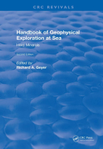
Handbook of geophysical exploration at sea / Руководство по геофизическим исследованиям на море
The percentage composition of the subject matter of this revised edition is approximately the same as that for the first, but the number of chapters has increased significantly. This necessitated the publication of a companion volume. In addition to dealing with various geophysical exploration methods, it adds and emphasizes the use of radiometric methods to explore for hard minerals found in sediments on and beneath the ocean floor. The chapters describing the various methods have been added because of their extensive usefulness in finding hard minerals of economic value, as well as in the search for hydrocarbons. The former also qualify for inclusion in this volume because these too are basically remote sensing methods; and can therefore be included in the generally accepted definition of the basic subject of Geophysics.
There is a great diversity of pertinent scientific areas comprising the broad subject of "Geophysical Exploration at Sea", but these can be classified into three major categories, namely: (a) potential field methods, as represented for example by gravity, magnetic, electrical, and telluric current methods; (b) those based on elastic wave theory, as it applies to the generation, transmission, reception and display of acoustic and seismic waves, as they propagate in the sea and into unconsolidated and consolidated bottom sediments; and (c) radiometric methods. <...>
The Minerals Management Service's Offshore Hard Minerals Program on the United States Outer Continental Shelf: Status of Projects and Activitie
Capabilities of Some Systems Used to Survey the Deep-sea Floor
Geophysical Study of the East African Margin
Airborne Gravimetry
Basement Configuration Identified in the Marine Geoid, and Petroleum Exploration of the Seychelles Platform
High-Resolution Geophysical Mapping of the Mississippi-Alabama Outer Continental Shelf
Very-High-Resolution, Seismic-Reflection Profiling and Other Acoustic Techniques with Examples from Virginia
Seismic Stratigraphy and Salt Tectonics of the East Breaks Region, Gulf of Mexico
Application of Seismic Profile Methods to Sand Source Studies for Beach Nourishmen
Radiometric Sea Floor Exploration Methods
Exploration for Submarine Mineral Deposits by Use of Gamma-Ray Radiometric Methods
Overview of Nuclear Techniques for Marine Mineral Surveys and Environmental Assessment
Resistivity at Sea
Significance of Pore Pressure in Marine Sediments: Measurements and Derived Properties
Summary of Marine Sedimentary Shear Modulus and Acoustic Speed Profile Results Using a Gravity Wave Inversion Technique
An Experimental Study for Applying the Spectral Analysis of Surface Waves Method to Offshore Areas
Analysis of Preconsolidation Pressure Methods for Fine-Grained Sediments in Nares Abyssal Plain, Mississippi Delta, and Other Selected Areas


