Добрый день, Коллеги. Важное сообщение, просьба принять участие. Музей Ферсмана ищет помощь для реставрационных работ в помещении. Подробности по ссылке
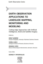
Earth observation applications to landslide mapping, monitoring and modeling / Применение наблюдения Земли для картографирования, мониторинга и моделирования оползней
Landslides are a common natural process widespread worldwide and can cause significant damage or even loss of life (Fleming & Taylor, 1980; Kjekstad & Highland, 2009; Petley, 2012; Schuster & Fleming, 1986). Researchers study various geohazards, including landslides, using a variety of approaches at different scales, from individual sites to regional, national, continental, and global analyses. The last decade has been important for landslide research because studies that imply drone mapping have significantly increased. The drone is also referred to in the literature as Unmanned Aerial Vehicle (UAV), Unmanned Aircraft Systems (UAS), Remotely Piloted Aircraft Systems (RPAS), or Remotely Piloted Vehicle (RPV). Unlike satellite images that cover large areas with different resolutions (low to high), the images collected through drones are made to a much smaller extent but with high and ultra-high resolution.
A UAV or drone is an autonomous flight machine piloted from the ground by a person with a remote controller. The flight can be conducted manually using joysticks and buttons or automated through a specialized flight planning program. In the beginning, they were built exclusively for military purposes. Still, with the advancement of technology, UAVs (drones) have begun to be used more and more in Earth Sciences, including the study of landslides. In the United States, for example, the US Federal Aviation Administration approved a UAV deployment for civil purposes in 2005 after the Katrina Hurricane strikes (Federal Aviation Administration, 2005; University of South Florida, 2005). However, autonomous (pilot-free) flight vehicles have a long history. The first devices, which were very different from those at present, were developed one hundred years ago (Callahan, 2014; Colomina & Molina, 2014; Granshaw, 2018). <...>


