Добрый день, Коллеги. Важное сообщение, просьба принять участие. Музей Ферсмана ищет помощь для реставрационных работ в помещении. Подробности по ссылке
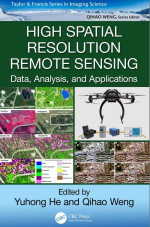
High spatial resolution remote sensing. Data, analysis, and applications / Дистанционное зондирование с высоким пространственным разрешением. Данные, анализ и приложения
High spatial resolution data provide a novel data source for addressing environmental questions with an unprecedented level of detail. These remote sensing data are a result of significant advances in image acquisition platforms and sensors, including satellite, manned aircraft, and unmanned aerial vehicle (UAV) platforms. Furthermore, the recent development of commercially operated satellite platforms with high spatial resolution sensors allows for the collection of a large amount of images at regular time intervals, with relatively large footprints (i.e., image swathes). For example, the WorldView series, with the WorldView-1 satellite launched on September 18, 2007, and WorldView-4 launched on November 11, 2016, are capable of resolving objects at 31 cm in the panchromatic band and at 1.24 m in 4 (or 8)-band multispectral over a 13.1-km-wide swath. For a specific study site, these image data can be easily searched and acquired at a reasonable cost through service companies, such as DigitalGlobe. In addition, the recent proliferation of UAVs has made it possible to collect images at spatial and temporal scales that would be impossible using traditional platforms. Many recent works have focused on collecting imagery using UAV-equipped multispectral, hyperspectral, and thermal sensors as well as laser scanners at centimeter resolutions. High (meters) and ultra-high (centimeters) spatial resolution images open a door for fine-scale analysis of objects at the Earth’s surface. A number of scientific journal articles have highlighted the usefulness of high spatial resolution remote sensing, including the use of remote sensing in studying the physical environmental system, the human system, and the interactions between them. Examples in physical environmental studies include fine-scale forest inventory (Mora et al., 2013), wetland plant community identification (Zweig et al., 2015), grassland mapping (Lu and He, 2017), and water resources (Debell et al., 2016). In terms of the human system, high spatial resolution remote sensing has been used to study urban impervious surfaces (Yang and He, 2017), public health (Hartfield et al., 2011), and epidemics (Lacaux et al., 2007). As for human-environment interactions, high-resolution remote sensing has been used for land degradation (Wiesmair et al., 2016), precision farming (ZarcoTejada et al., 2013), water and air pollution (Yao et al., 2015), and natural hazards (e.g., earthquakes, typhoons, floods, landslides) (Joyce et al., 2009). <...>


