Добрый день, Коллеги. Важное сообщение, просьба принять участие. Музей Ферсмана ищет помощь для реставрационных работ в помещении. Подробности по ссылке

Поиск по книгам
Издание 6
Автор(ы):Brown A.R.
Издание:American Association of Petroleum Geologists, Tulsa, 2004 г., 540 стр., ISBN: 0-89181-364-0
Язык(и)Английский
Interpretation of Three-Dimensional Seismic Data / Интерпретация трехмерных сейсмических данных

This quotation is familiar to all geoscientists, but it is just as pertinent today as it has ever been. Today’s advanced geophysical workstations are truly magnificent tools, but we should remember that they are only tools. The skill remains the geological interpretation of geophysical data. I sometimes apologize to myself and others that this still needs to be said — but it surely does! I am indeed disappointed by the general standard of seismic interpretation in the world today.

Издание 5
Автор(ы):Brown A.R.
Издание:American Association of Petroleum Geologists, Tulsa, 1999 г., 527 стр., ISBN: 0-89181-352-7
Язык(и)Английский
Interpretation of Three-Dimensional Seismic Data / Интерпретация трехмерных сейсмических данных

The oil and gas business has witnessed over the past decade a quantum leap in effectiveness of geophysics in E&P operations. Indeed the industry may never before have witnessed a technological advance as profound as or with the overwhelming business impact of 3-D seismic. Under refinement and development for almost three decades, the 1990s saw the coalescing of technical cross currents that have shaken the economic foundations of the oil and gas industry, and have fueled a world economic growth spurt. Today oil prices have been reported as being at the lowest level in 50 years, due in a major part to inordinately high supplies; that is, higher volumes found by 3-D seismic. <...>

Издание 7
Автор(ы):Brown A.R.
Издание:American Association of Petroleum Geologists, 2011 г., 662 стр., ISBN: 978-0-89181-374-3
Язык(и)Английский
Interpretation of Three-Dimensional Seismic Data / Интерпретация трехмерных сейсмических данных

Now that this book has been in use, through various editions, for more than 22 years, I must reflect on the many contributions that have ensured its success. Most particularly I must thank Bill Abriel, Rebecca Latimer, David Roberts, Greg Partyka, Malcolm Lansley, Les Denham, and Dave Agarwal for writing sections for me. Many people, too numerous to name, have kindly released data examples and discussed their interpretations with me. AAPG and SEG have cooperated in the book’s publication since the Fifth Edition. Anne Thomas has edited all editions. The high quality of the product depends significantly on her editorial expertise.

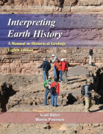
Издание 8
Автор(ы):Petersen M., Ritter S.
Издание:Wav, 2015 г., 305 стр., ISBN: 978-1-4786-1145-5
Язык(и)Английский
Interpreting Earth history. A manual in historical geology / Интерпретация Земной истории. Руководство по исторической геологии

Interpreting Earth History was written to provide deeper learning activities for historical geology students at the college and university level. Material is organized in much the same sequence as chapters in most popular historical geology textbooks and it is expected that students will use the explanatory text to augment, not replace, textbook content. The purpose of the manual is to provide students the opportunity to engage with geological data from a variety of sources (maps, fossils, rocks, etc.) and at a variety of scales to discern and explain geological patterns.

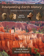
Издание 9
Автор(ы):Petersen M.S., Ritter S.M.
Издание:Waveland Press, 2023 г., 313 стр., ISBN: 978-1-4786-4897-0
Язык(и)Русский
Interpreting Earth history. A manual in historical geology / Интерпретация Земной истории. Руководство по исторической геологии

The discovery of “deep time” is one of geology’s greatest contributions to human understanding. The conceptual foundations laid by eighteenth- and nineteenth-century geologists working in relatively small geographic areas paved the way for development of the modern high-resolution geological timescale (figure 1.1), which spans 4.6 billion years of Earth history and applies to geological features anywhere on Earth.

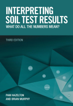
Издание 3
Автор(ы):Hazelton P., Murphy B.
Издание:CSIRO, 2016 г., 200 стр., ISBN: 978-1486303960
Язык(и)Английский
Interpreting soil test results. What do all the numbers mean? / Интерпретация результатов анализа почвы. Что означают все эти цифры?

Soils are a valuable resource and a critical component in many of the environmental and economic issues facing society today. Understanding soil properties and soil behaviour and interpreting soil data are especially relevant for many environmental and land management issues facing the community. These issues include urban development, control of salinity, clearing of native vegetation, prevention of land degradation, control of water and wind erosion, irrigation development, the management of effluent disposal, contamination and the management of acid sulfate soils.

Автор(ы):Ray D.K.
Издание:Москва, 1979 г., 38 стр.
Язык(и)Английский
Interregional seminar on the development potential o precambrian mineral deposits / Межрегиональный семинар, посвященный потенциалу освоения докембрийских месторождений полезных ископаемых

The Precambrians of India are the principal sources of iron and manganese, base metal, gold and alloy metal ore deposits and a host of non-metallic substances of industrial use. A spectacular limeament divides the Indian peninsular shield into two contrasted segments. The southern segment is girdled by an Archean granulite belt. Inwards, gneissess and two distinct Greenstone-banded iron sequences span the Lower Proterozoic time and perhaps the Middle Proterozoic too. Upper Proterozoic platform cover rests unconformably on them in separate basins. In the northern segment the greenstone belts are not so distinct, and the Middle Proterozoic has a better development. Upper Proterozoic platform cover is more widespread. <...>

Автор(ы):Eisma D.
Издание:CRC Press, 1997 г., 541 стр., ISBN: 0-8493-8049-9
Язык(и)Английский
Intertidal deposits. River mouths, tidal flats and coastal lagoons / Приливно-отливные отложения. Устья рек, приливные отмели и прибрежные лагуны

This book is the outcome of experience, first with the Wadden Sea and later with other intertidal areas in the world visited by the author and co-authors, partly to do research, partly because of more personal interest and fascination. Intertidal areas can be important for many reasons besides scientific or economic ones, as the many activities testify that aim to keep intertidal areas in a (more or less) natural state.

724.45