Добрый день, Коллеги. Важное сообщение, просьба принять участие. Музей Ферсмана ищет помощь для реставрационных работ в помещении. Подробности по ссылке

Поиск по книгам
Автор(ы):Dana E.S., Ford W.E.
Издание:John Wiley & Sons INC, New York - London, 1944 г., 480 стр.
Язык(и)Английский
Manual of mineralogy

A mineral may be defined as any naturally occurring chemical element or compound formed as a product of inorganic processes. This eliminates all artificial products of the laboratory as well as all natural products formed by organic agencies. The above definition is brief; and, though it embraces most of the substances considered as minerals in this book, it should be considerably expanded to be all-inclusive.

Minerals are the materials of which most of the rocks of the earth's crust consist and are, therefore, among the common objects of daily observation. The great majority of rocks are not made up of single minerals, but are more or less heterogeneous aggregates of several different species. A few rocks, like limestone and quartzite, consist of but one mineral in a more or less pure state. In addition to occurring as essential and integral parts of rocks, minerals are found distributed through them in a scattered way, or in veins and cavities. <...>

Издание 21
Автор(ы):Hurlbut C.S., Klein C.
Издание:John Wiley & Sons INC, 1993 г., 699 стр., ISBN: 0-471-57452-X
Язык(и)Английский
Manual of mineralogy

Mineralogy is an integral part of the undergraduate education of geologists and it may also be part of a curriculum in materials science. One or several courses in mineralogy are generally required in a geology or earth science undergraduate program. These courses are meant as prerequisites to upper-level courses in petrology, geochemistry, economic geology, or mineralogy itself.

Автор(ы):Johannsen A.
Издание:McGraw-Hill Book Company, New York, 1914 г., 649 стр.
Язык(и)Английский
Manual of petrographic methods

In this, the first attempt to give in English a comprehensive review of petrographic methods, it cannot be otherwise than that there should be many omissions—it is to be hoped not many errors. If any is found the author will be extremely glad to have his attention called to it, as he will also be for criticisms, or suggestions for additional material that should be included.

Том 3
Автор(ы):Eng C., Epps R.J., Head K.H.
Издание:Whittles publishing, 2014 г., 423 стр., ISBN: 978-184995-054-1
Язык(и)Английский
Manual of soil laboratory testing. Volume 3: Effective stress tests / Руководство по лабораторным методам исследования почв. Том 3. Эффективные стресс-тесты

This book is the third in a series of three, intended primarily to provide a working manual for laboratory technicians and others engaged in the testing of soils for building and engineering purposes. It is not meant in any way to be used as a substitute for the Standards referred to therein, but to augment their requirements by the provision of step by step procedures. This third edition has been revised to take account of the current requirements of BS 1377: 1990,

Издание 4
Автор(ы):Bloetscher F.
Издание:American Water Works Association, 2014 г., 295 стр., ISBN: 978-1-58321-964-5
Язык(и)Английский
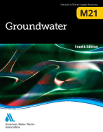
Manual of water supply practices. Groundwater / Руководство по практике водоснабжения. Грунтовые воды

This AWWA revision to Manual M21 is the culmination of nearly three years of effort by members of the Groundwater Resources Committee. This edition has been written to provide the reader with a general understanding of the principles involved with ground
water, its movement and character, and the subsequent impact these characteristics have on the design, construction, and maintenance of groundwater well systems for water utilities.

Редактор(ы):Luppens J.A., Stanton R.W., Wilson S.E.
Издание:ASTM, 1992 г., 67 стр., ISBN: 0-8031-1464-8
Язык(и)Английский
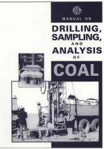
Manual on drilling, sampling, and analysis of coal / Руководство по бурению, отбору проб и анализу угля

THREE A S TM STANDARDS are available for sampling coal: ASTM Practice for Collection of Channel Samples of Coal in the Mine (D 4596), ASTM Test Methods for Collection of a Gross Sample of Coal (D 2234), and ASTM Practice for Collection of Coal Samples from Core (D 5192). The first two standards are applicable only to existing mining operations, test pits, or transportation of coal.

Автор(ы):Bose N., Mukherjee S.
Издание:Elsevier, 2017 г., 141 стр., ISBN: 978-0-142-809681-9
Язык(и)Английский
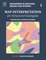
Map interpretation for structural geologists / Интерпретация карт для структурных геологов

In geological maps, the undulation of the topography is represented by height contours. These contours represent lines along which all the points have the same altitude. Height contours are represented usually by broken lines and the numbers attached to them indicate the altitude of the corresponding contour.

Автор(ы):Snyder J.P.
Издание:United States Government Printing Office, Washington, 1987 г., 393 стр.
Язык(и)Английский
Map projections - a working manual / Картографические проекции - руководство по эксплуатации

After decades of using only one map projection, the Polyconic, for its mapping program, the U.S. Geological Survey (USGS) now uses several of the more common projections for its published maps. For larger scale maps, including topographic quadrangles and the State Base Map Series, conformal projections such as the Transverse Mercator and the Lambert Conformal Conic are used. Equal-area and equidistant projections appear in the National Atlas.

Издание:1998 г., 14 стр.
Язык(и)Английский
Mapping altered rocks using Landsat TM and lithogeochemical data: Sulphurets-Brucejack Lake District, British Columbia, Canada / Картографирование измененных горных пород с использованием спутника Landsat TM и литогеохимических данных: Сернистые отложения

Landsat Thematic Mapper [TM) data have been used to detect the presence of altered rocks associated with ore mineral deposition. In arid environments, the spectral signatures of diagnostic minerals are often not masked by water, vegetation, or suxficial materials. There are many studies in which TM data have been used to locate hydrothermally altered rocks in near desert regions, but few successful examples can be found that relate to glaciated, vegetated terrain at high latitudes. In this paper, TM data, in concert with lithogeochemical data and field observations, are used to detect and map altered rocks in the Sulphurets-Brucejack Lake district of northwestern British Columbia.

744.95