Добрый день, Коллеги. Важное сообщение, просьба принять участие. Музей Ферсмана ищет помощь для реставрационных работ в помещении. Подробности по ссылке

Поиск по книгам
Автор(ы):Wilson G.
Издание:George Allen & Unwin Ltd, London, 1982 г., 134 стр., ISBN: 978-94-011-6840-3
Язык(и)Английский
Introduction to small-scale geological structures / Введение в мелкомасштабные геологические структуры

The small-scale structures referred to in this publication are those structures of tectonic origin that can be observed with the naked eye in the field. Their scale varies broadly between that of the hand-specimen to that of the exposure, or even mountainside. Such structures are the visible effects of rock deformation caused by local stresses and movements which have been induced in the rocks by external tectonic forces of possibly unknown origin. Recognition of these minor structures, and appreciation of their origin and significance assist the field geologist to elucidate the larger-scale geological structures of his area.

Автор(ы):Bobo B., Jones C.
Издание:Wiley Blackwell, 2013 г., 609 стр., ISBN: 978-0-470-65943-4
Язык(и)Английский
Introduction to soil mechanics / Введение в механику грунтов

Soils consist of solid particles, enclosing voids or pores. The voids may be filled with air or water or both. These three soil states (or phases) can be visualized by the enlargement of three small samples of soil.

Автор(ы):Allmendinger R.W.
Издание:1999 г., 289 стр.
Язык(и)Английский
Introduction to structural geology / Введение в стурктурную геологию

Structural Geology is the study of deformed rocks. To do so, we define the geometries of rock bodies in three dimensions. Then, we measure or infer the translations, rotations, and strains experienced by rocks both during, and particularly since, their formation based on indicators of what they looked like prior to their deformation. Finally, we try to infer the stresses that produced the deformation based on our knowledge of material properties. Structure is closely related to various fields of engineering mechanics, structural engineering, and material science. <...>

Издание:University of Leeds, Leeds, 45 стр.
Язык(и)Английский
Introduction to structural geology. Workbook 3. Geological maps / Введение в стурктурную геологию. Рабочая тетрадь 3. Геологическая карта

Geological maps represent the solid geology at the Earth’s surface unconcealed by vegetation, soil or buildings (figure 1a). Different rock types and formations are illustrated by different colours and/or symbols. Other features such as faults, mineral veins, coal seams, marker horizons and landslips are shown. Bedding and structural features such as cleavage and foliations are indicated by strike and dip or plunge and azimuth symbols (figure 1b).

Автор(ы):Orme A., Sack D.
Издание:Elsevier, 2013 г., 409 стр.
Язык(и)Английский
Introduction to the foundations of geomorphology / Введение в основы геоморфологии

Geomorphology, the study of landforms and their formative processes, is a multidisciplinary field most strongly associated with the geographical and geological sciences. It encompasses numerous subfields of specialization that are not necessarily mutually exclusive. Like all disciplines, what geomorphology is like today derives in part from the practitioners, ideas, controversies, and events involved in its development. This paper presents a brief perspective and overview of the history of geomorphology as an introduction to the subsequent chapters in the volume, each of which focuses on a specific period of the discipline's history or on concepts that have figured prominently in its past development or current status. A brief summary of the following 18 papers in this volume provides insight into the range of ideas and methods that are engaged in the theory and practice of geomorphology. The volume as a whole provides historical and thematic context for the subsequent volumes in the Treatise on Geomorphology.

Редактор(ы):Loon T.
Издание:Elsevier, 2004 г., 575 стр.
Язык(и)Английский
Introduction to the physics of cohesive sediment in the marine environment / Введение в физику связных отложений в морской среде

A comprehensive study of cohesive sediment requires a multi-disciplinary approach. The behaviour of cohesive sediment is determined by physical, biological and chemical aspects. Furthermore, there is a wide range of societal issues related to cohesive sediments, such as siltation in navigational channels, water quality problems, sustainable management of estuaries and wetlands, stability of continental slopes, etc <...>

Издание 2
Автор(ы):Chapman D., Metje N., Stark A.
Издание:CRC Press, 2018 г., 456 стр., ISBN: 978-1-4987-6624-1
Язык(и)Английский
Introduction to tunnel construction / Введение в строительство туннелей

Tunnels are unlike any other civil engineering structures. In buildings or bridges, the building materials have defined properties and they can be tested to ensure they meet these, whereas this is not the case in tunnelling. Table 1.1 illustrates some of the issues associated with tunnel design when compared to above ground construction projects. Although a tunnel structure often needs support systems made up of concrete and steel, it is the ground that is the major part of the structure, and this can have both a supporting and a loading role.

Автор(ы):Evenick J.C.
Издание:PennWell Corporation, 2008 г., 255 стр., ISBN: 978-1-59370-138-3
Язык(и)Английский
Introduction to well logs & subsurface maps / Введение в документацию скважин и карты погребенного рельефа

After a well is drilled, a string of geophysical instruments (called a sonde) is placed into the borehole to record the geophysical properties of the subsurface strata. The data are digitally recorded in a nearby logging facility (commonly a logging vehicle for land-based rigs) and transferred to a paper log and/or saved as a digital .las data file. It is very common to get both a digital and paper copy of the well.

Издание 4
Автор(ы):Jensen J.R.
Издание:Pearson, 2015 г., 658 стр., ISBN: 978-0-13-405816-0
Язык(и)Английский
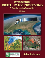
Introductory digital image processing. A remote sensing perspective / Вводная информация о цифровой обработке изображений. Перспективы дистанционного зондирования

T he 4th edition of Introductory Digital Image Processing: A Remote Sensing Perspective provides up-to-date information on analytical methods used to analyze digital remote sensing data. T he book is ideal for introductory through graduate level university instruction in departments that routinely analyze airborne and/or satellite remote sensor data to solve geospatial problems, including: geography, geology, marine science, forestry, anthropology, biology, soil science, agronomy, urban planning, and others.

Автор(ы):Scales J.A., Smith M.L.
Издание:Samizdat Press, 1996 г., 209 стр.
Язык(и)Английский
Introductory geophysical inverse theory: Part I / Введение в теорию решения обратной задачи в геофизике. Часть 1

This course is an introduction to some of the balkanized family of techniques and philosophies that reside under the umbrella of inverse theory. In this section we present the central threads that bind all of these singular items together in a harmonious whole. That's impossible of course, but what we will do is provide a point of view that, while it will break from time-to-time, is good enough to be going on with. The goal of this chapter is to introduce a real inverse problem and explore some of the issues that arise in a non-technical way. Later, we explore the resulting complications in greater depth <...>

749.23