Добрый день, Коллеги. Важное сообщение, просьба принять участие. Музей Ферсмана ищет помощь для реставрационных работ в помещении. Подробности по ссылке

Поиск по книгам
Автор(ы):Aoki K.
Издание:CRC Press, 2023 г., 300 стр., ISBN: 978-0367420772
Язык(и)Английский
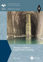
Storage of LPG in large rock caverns. ISRM Book series / Хранение сжиженного газа в больших скальных пещерах. Серия книг ISRM

Under Japan’s energy policy, the Japan Organization for Metals and Energy Security (JOGMEC) operates the national stockpiling project of crude oil and liquefied petroleum gas (LPG). In addition to three existing above-ground LPG tank facilities, in 2002, construction began on two of the world’s largest facilities, Kurashiki (capacity 400,000 t) and Namikata (450,000 t). These rock cavern storage systems were completed in 2012 allowing the longterm stockpiling operation to continue.

For the first time in Japan, these two high pressure gas storages adopted the hydrodynamic containment system, in which the groundwater pressure holds the gas in unsealed rock tunnels. They are of the world’s largest class.<...>

Автор(ы):Mazzoli S.
Издание:Springer-Verlag, 1995 г., 13 стр.
Язык(и)Английский
Strain analysis in Jurassic argillites of the Monte Sirino area (Lagonegro Zone, southern Apennines, Italy) and implications for deformation paths in pelitic rocks / Анализ деформаций в юрских аргиллитах района Монте-Сирино (зона Лагонегро, южные Апеннины

Analysis of strain in Jurassic argillites forming part of the folded and thrusted sedimentary succession of the Lagonegro basin (southern Italian Apennines) has been carried out using ellipsoid-shaped 'reduction' spots as strain markers. Most of the determined finite strain ellipsoids are of oblate type and show a peculiar distribution of the maximum extension direction (X), with maxima either subparallel or subperpendicular to the local fold axes.

Автор(ы):Ionesi B.
Издание:Editura Academiei Republicii Populare Romine, Bucuresti, 1968 г., 382 стр.
Язык(и)Румынский
Stratigrafia depozitelor miocene de platforma dintre valea siretului si valea moldovei  / Стратиграфия миоценовых отложений на платформе между долиной Сирет и долиной Молдовы

Studiul geologici Platformei Moldovene§ti §i in special a depozitelor neogene a constituit o preocupare permanentà a cercetàtorilor ie§eni, aceasta marcìnd o veche tradire. Incepìnd cu anul 1862, cìnd a apàrut lucrarca lui G r. Cobàlcescu Calcami de la Bàpidea, §i pina in pre-zcnt s-au adus contribuii importante asupra orizontàrii, delimitàrii §i ràspìndirii sedimcntelor neogene, asupra tectonicii §i con^inutului fau-nistic. In ce prive§te fauna acestor sedimente, s-au efectuat studii amànun-ite in special asupra molu§telor §i foraminiferelor, pe baza càrora s-au sta-bilit, de altfel, delimitàrile stratigrafice dintre subdiviziunile neogenului. <...>


Автор(ы):Vlaicvu-Tatarim N.
Издание:Editura Academiei Republicii Populare Romine, Бухарест, 1963 г., 220 стр.
Язык(и)Румынский
Stratigrafia eocenului din regiunea de la sud-vest de Cluj

Deşi şcoala geologică romînească are o tradiţie puternică ce se sprijină pe lucrări centenare cum este Calcarul ele la Răpidea a lui Gr. C o b ă 1-cescu sau aproape tot aşa de bătrîne ca acelea ale celuilalt întemeietor al acestei tradiţii, Gr. Ştefănescu, se simţea nevoia activării muncii geologice mai ales în universitate. Aceasta s-a înfăptuit cu mult succes prin instituirea aspirantura în diferite discipline, între care şi stratigrafia sau geologia istorică, din care face parte şi lucrarea de faţă.

în evoluţia preocupărilor geologice din ţara noastră s-a resimţit pînă la instaurarea regimului de democraţie populară influenţa capitalismului, care în domeniul cercetărilor geologice s-a manifestat prin acordarea unui interes deosebit acelor formaţiuni geologice care ofereau, fără multă trudă, mari avantaje economice prin bogăţiile pe care le cuprindeau. De aceea, s-a dat o mare atenţie depozitelor terţiare noi, pliocene, din Subcarpaţi, care conţineau în ele bogate zăcăminte de petrol.

Редактор(ы):Ruhle W.
Издание:Wydawnictwa geologiczne, Варшава, 1970 г., 322 стр.
Язык(и)Польский
Stratigrafia mezozoiku obrezenia gor Swietokrzyskich / Стратиграфия мезозоя в обрамлении Свентокшинских гор

Góry Świętokrzyskie powstałe w paleozoicznych epokach tektonicznych były wielokrotnie zalewane częściowo lub całkowicie przez morza permu, triasu, jury i kredy. Osady morskie i lądowe przykrywały je i były denudowane wicie razy. Erozja działała najintensywniej w centrum gór. Osady pozostały w miąższych i ciągłych seriach jedynie na peryferii górotworu. Dziś skały mezozoiczne otaczają z północy, zachodu i południa centralną, najwyżej wyniesioną część Gór Świętokrzyskich stanowiącą obszar wychodni skał paleozoicznych. Pokrywa mezozoiczna położona wokół wychodni paleozoiku jest nazywana otoczką mezozoiczną Gór Świętokrzyskich. Nie jest ona zaburzona tak silnie przez ruchy górotwórcze jak skały z przed okresii góro-twórczości waryscyjskiej. Jednak ruchy epoki tektonicznej alpejskiej dotknęły ją dość silnie, szczególnie od strony południowo-zachodniej i na jej peryferiach północno-wschodnich. Były to ruchy starokimeryjskie, młodokimeryjskie, subhercyńskie i laramijskie. Najsilniejsze były te ostatnie. Spowodowały one ostateczne wydźwignięcie się całego antyklinorium środkowopolskiego, do którego należą Górj- Świętokrzyskie wraz z otoczką mezozoiczną.

Tworzenie się osadów ery mezozoicznej na terenie gór i w ich otoczeniu warunkowane było przez trzy zasadnicze rysy. Pierwsze to położenie Gór Świętokrzyskich wTaz z ich otoczeniem w obrębie parageosynkliny duńsko-polskiej (W. Pożaryski, 1959) obrzeżającej od południowego zachodu platformę wschodnioeuropejską. W części pozakar-packiej parageosynklina była żywa głównie w permie i mezozoiku, kiedy wykazywała ogólną tendencję przegłębienia, które dochodziło maksymalnie w tym czasie w sumie do około 10 000 m. Drugi rys to przejawienie stałej tendencji wydźwigania obszaru centralnego Gór Świętokrzyskich podczas trwania sedymentacji mezozoicznej. Trzecie to związanie w starszym mezozoiku (trias i lias) obszaru Gór Świętokrzyskich z tarczą ukraińską, a rozerwanie tej łączności w młodszym mezozoiku, od doggeru począwszy przez zalanie obszaru synklinorium brzeżnego położonego na wschód od Gór Świętokrzyskich .

W rezultacie takiego układu budowy i czynników działających centralna część Gór Świętokrzyskich obecnie jest pozbawiona osadów mezozoicznych, a kiedyś musiała być nimi przykryta. Maksymalne miąższości tych osadów nie znajdowały się jednak w osi parageosynkliny na jej odcinku świętokrzyskim, a na pograniczu antyklinorium środkowopolskiego i synklinoriów obrzeżających go od NE i SW. Wobec częściowego na całej długości antyklinorium, a w Górach Świętokrzyskich całkowitego zdenudowania mezozoiku, trudno jest określić gdzie przebiegała, czy też przebiegały osie basenów sedymentacyjnych we wszystkich momentach permu, triasu,  jury   i  kredy.

Выпуск 136
Издание:Journal Marine Geology, 1997 г., 13 стр.
Язык(и)Английский
Stratigraphic numerical modelling of a carbonate platform on the Romanche transverse ridge, equatorial Atlantic

The Romanche transverse ridge (equatorial Atlantic) is located in the northern flank of the fracture zone, opposite the eastern ridge-transform intersection (RTI). It constitutes a major positive topographic anomaly that reaches a height of over 4 km above the level predicted by the thermal subsidence curve. A series of E-W aligned peaks, located on the crest of the transverse ridge, were at sea level during early and middle Miocene times; they are presently capped by a ~300 m thick, shallow-water carbonate platform that grew on a subsiding oceanic crust basement surface flattened by erosion at sea level. These structures are now about 1 km below sea level. High resolution seismic reflection surveys and multibeam morphobathymetry as well as study of samples recovered from the carbonate platform allowed a reconstruction of the paleoenvironment and of the vertical movements of the peaks starting from the lower Miocene. Ages derived from microfossils suggest that the base of the carbonate platform dates from 17-25 m.y. ago and the sinking of the platform started between 18 and 13 m.y. ago. These data were included in a numerical simulation model that takes into account thermal and tectonic subsidence, growth potential of the carbonates, subaerial and submarine erosion rates and Mio-Pliocene absolute sea level fluctuations. The results outline the subsidence history of the Romanche transverse ridge and suggest post-Miocene subsidence faster than that predicted by the thermal cooling model.


Издание 2
Автор(ы):Slatt R.M.
Издание:Elsevier, 2013 г., 669 стр., ISBN: 978-0-444-56365-1
Язык(и)Английский
Stratigraphic reservoir characterization for petroleum geologists, geophysicists and engineers / Стратиграфическая характеристика коллектора для геологов-нефтяников, геофизиков и инженеров

In the latest book published in this series, Geophysics for Petroleum Engineers, written by Professor F. Aminzadeh and Dr. S.N. Dasgupta, I had the pleasure of providing a brief preface that emphasized the strong need to maintain and improve lines of communication among and between modern reservoir, drilling, and production engineers and geophysicists, geologists, and petrophysicists. That volume, produced by experts in the geosciences and engineering within industry and academia, was designed and written with alleviating the traditional communication gap between the disciplines and asset team members firmly in mind <...>

Издание 2
Редактор(ы):Jenkins D.G., Murray J.W.
Издание:British micropalaeontological society series, 1989 г., 589 стр., ISBN: 0-7458-0153-6
Stratigraphical atlas of fossil foraminifera / Стратиграфический атлас ископаемых фораминифер

The British Micropalaeontological Society may be said to have come of age when it pblished A Sirarigraphicai Index of Brifish Orrraroda in 1978. This was the first of a snes of special publications aimed at bringag together knowledge for a particular faund group in order to make it more useful to -cialists and non-specialists alike. The preunt volume has been written with the same jectives in mind.

Автор(ы):Teil I.
Редактор(ы):Jeannet A.
Издание:Hallwag AG, Bern, 1951 г., 354 стр.
Язык(и)Немецкий
Stratigraphie und palaeontologie des oolithischen Eisenerzlagers von Hernach und seiner Umgebung

Der zuerst (1851) erwähnte Horizont ist derjenige der Macrocephalus-Schichten in der Umgebung von Wölflinswil . Er wurde dort ins Oxfordien gestellt, dessen Basis durch einen  rugensteinförmigen Thoneisen-stein» gebildet wird, eine Schicht, die sich wohl am ehesten mit dem englischen Kelloway Rock vergleichen lässt. <...>

783.8