Добрый день, Коллеги. Важное сообщение, просьба принять участие. Музей Ферсмана ищет помощь для реставрационных работ в помещении. Подробности по ссылке

Поиск по книгам
Издание:Packt Publishing, 2017 г., 817 стр., ISBN: 978-1-78829-972-5
Язык(и)Английский
QGIS: Becoming a GIS. Power user. Master data management, visualization, and spatial analysis techniques in QGIS and become a GIS power user / QGIS: Как стать ГИС-специалистом. Опытный пользователь

QGIS is a crossing point of the free and open source geospatial world. While there are a great many tools in QGIS, it is not one massive application that does everything, and it was never really designed to be that from the beginning. It is rather a visual interface to much of the open source geospatial world. You can load data from proprietary and open formats into spatial databases of various flavors and then analyze the data with well-known analytical backends before creating a printed or web-based map to display and interact with your results. What’s QGIS’s role in all this? It’s the place where you check your data along the way, build and queue the analysis, visualize the results, and develop cartographic end products. This learning path will teach you all that and more, in a hands-on learn-by-doing manner. Become an expert in QGIS with this useful companion. <...>

Автор(ы):Demetriades A., Karamanos H.
Издание:16 стр.
Язык(и)Английский
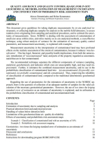
Quality assurance and quality control (QA/QC) for in-situ geochemical methods, estimation of measurement uncertainty and construction of probability risk assessment maps / Обеспечение и контроль качества (ОК/QC) геохимических методов in-situ

This document gives guidelines for taking duplicate measurements by in-situ analytical instruments, or collecting duplicate samples for analysis in the mobile field laboratory, to assess random errors originating from sampling and analytical procedures, and to estimate the uncertainty of measurements. Since, NORISC is dealing with the assessment of contamination of small-size areas within cities, and relies mainly on in-situ analytical methods, a cost-effective technique, using robust analysis of variance for the estimation of necessary quality control parameters, and measurement uncertainty, is explained with examples <...>

Автор(ы):Engle M.A., Geboy N.J.
Издание:USGS Information Services, 2011 г., 32 стр.
Язык(и)Английский
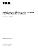
Quality Assurance and Quality Control of Geochemical Data: A Primer for the Research Scientist / Обеспечение качества и контроль качества геохимических данных: учебник для ученого-исследователя

Geochemistry is a constantly expanding science. More and more, scientists are employing geochemical tools to help answer questions about the Earth and earth system processes. Scientists may assume that the responsibility of examining and assessing the quality of the geochemical data they generate is not theirs but rather that of the analytical laboratories to which their samples have been submitted. This assumption may be partially based on knowledge about internal and external quality assurance and quality control (QA/QC) programs in which analytical laboratories typically participate. Or there may be a perceived lack of time or resources to adequately examine data quality. Regardless of the reason, the lack of QA/QC protocols can lead to the generation and publication of erroneous data. Because the interpretations drawn from the data are primary products to U.S. Geological Survey (USGS) stakeholders, the consequences of publishing erroneous results can be significant. The principal investigator of a scientific study ultimately is responsible for the quality and interpretation of the project’s findings, and thus must also play a role in the understanding, implementation, and presentation of QA/QC information about the data. <...>

Издание:Smee and Associates Consulting Ltd., 44 стр.
Язык(и)Английский
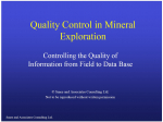
Quality Control in Mineral Exploration. Controlling the Quality of Information from Field to Data Base / Контроль качества при разведке полезных ископаемых. Контроль качества информации от поля до базы данных

Quality Control in Mineral Exploration

There many goals associated with a QA/QC program for the mineral industry:

• Prevent the entry of large errors into the geological Database.

• Demonstrate that sampling and analytical variances are small relative to geological variance.

• Provide assurance that the accuracy of the data can be confirmed.

• Save management time by automating sample names and performing automatic checks on sample names.

• Allow problems to be realized rapidly to minimize their effects.

• Keep an archive for a complete audit trail.

• Comply meticulously with government regulations and standards with a minimal amount of employee time and effort.

Автор(ы):Абзалов М.З.
Издание:Exploration and Mining Geology, 2008 г., 14 стр.
Язык(и)Английский
Quality control of assay data: A review of procedures for measuring and monitoring precision and accuracy / Контроль качества данных анализа: обзор процедур измерения и мониторинга точности и безошибочности

Control of analytical data quality is usually referred to in the mining industry as Quality Assurance and Quality Control (QAQC), and involves the monitoring of sample quality and quantification of analytical accuracy and precision. QAQC procedures normally involve using sample duplicates and specially prepared standards whose grade is known. Numerous case studies indicate that reliable control of sample precision is achieved by using approximately 5% to 10% of field duplicates and 3% to 5% of pulp duplicates. These duplicate samples should be prepared and analyzed in the primary laboratory.

Редактор(ы):Carrera J., Gomez-Hernandez J.J., Sanchez-Vila X.
Издание:Kluwer Academic Publishers, 2002 г., 556 стр., ISBN: 1-4020-2007-4
Язык(и)Английский
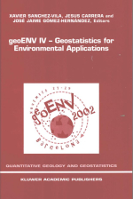
Quantitative geology and geostatistics. geoENV IV – Geostatistics for environmental applications / Количественная геология и геостатистика. geoENV IV – Геостатистика для применения в окружающей среде

The fourth edition of the European Conference on Geostatistics for Environmental Applications (geoENV IV) took place in Barcelona, November 27-29, 2002. As a proof that there is an increasing interest in environmental issues in the geostatistical community, the conference attracted over 100 participants, mostly Europeans (up to 10 European countries were represented), but also from other countries in the world. Only 46 contributions, selected out of around 100 submitted papers, were invited to be presented orally during the conference. Additionally 30 authors were invited to present their work in poster format during a special session.

Редактор(ы):Froidevaux R., Gomez-Hernandex J., Soares A.
Издание:Springer, 1999 г., 566 стр., ISBN: 978-90-481-5249-0
Язык(и)Английский
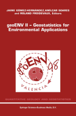
Quantitative geology and geostatistics. Volume 10. geoENV II – Geostatistics for environmental applications / Количественная геология и геостатистика. Том 10. geoENV II – Геостатистика для применения в окружающей среде

The Second European Conference on Geostatistics for Environmental Applications took place in Valencia, November 18-20, 1998. Two years have past from the first meeting in Lisbon and the geostatistical community has kept active in the environmental field. In these days of congress inflation, we feel that continuity can only be achieved by ensuring quality in the papers. For this reason, all papers in the book have been reviewed by, at least, two referees, and care has been taken to ensure that the reviewer comments have been incorporated in the final version of the manuscript. We are thankful to the members of the scientific committee for their timely review of the scripts. All in all, there are three keynote papers from experts in soil science, climatology and ecology and 43 contributed papers providing a good indication of the status of geostatistics as applied in the environmental field all over the world. We feel now confident that the geoENV conference series, seeded around a coffee table almost six years ago, will march firmly into the next century. <...>

Редактор(ы):Atkinson P.M., Lloyd C.D.
Издание:Springer, 2010 г., 435 стр., ISBN: 978-90-481-2321-6
Язык(и)Английский
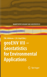
Quantitative geology and geostatistics. Volume 16. geoENV VII – Geostatistics for environmental applications / Количественная геология и геостатистика. Том 16. geoENV VII – Геостатистика для применения в окружающей среде

Proceedings of the seventh European conference on geostatistics for environmental applications / Материалы Седьмой Европейской конференции по геостатистике для применения в окружающей среде


Characterising spatial and temporal variation in environmental properties, generatingmaps from sparse samples, and quantifying uncertainties in the maps, are key concerns across the environmental sciences. The body of tools known as geostatistics offers a powerful means of addressing these and related questions. This volume presents recent research in methodological developments in geostatistics and in a variety of specific environmental application areas including soil science, climatology, pollution, health, wildlife mapping, fisheries and remote sensing, amongst others.

717.94