Добрый день, Коллеги. Важное сообщение, просьба принять участие. Музей Ферсмана ищет помощь для реставрационных работ в помещении. Подробности по ссылке

Поиск по книгам
Издание:GeoArabia, 2001 г., 369 стр., ISBN: 9901-03-08-9
Язык(и)Английский
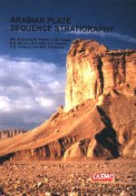
Arabian plate sequence stratigraphy / Секвенс-стратиграфия Аравийской плиты

The Middle East hosts the greatest concentration of oil and gas on Earth, with the vast majority located on the Arabian Plate. Most of it is contained in super-giant fields, making the Arabian Plate the world’s premier hydrocarbon province. In 1980, the Middle East accounted lor some 55% oi remaining world oil reserves, while today it accounts lor about 65%. As seen in the figure, world oil demand is forecast by the OPEC World Economic Model to increase rapidly, in part driven by global population growth. The world's population now stands at some 6 billion, having doubled in the last 40 years. These rising trends in reserve base, oil and gas supply and global population are expected to continue during this century. <...>

Издание:ESRI, 2008 г., 248 стр.
Язык(и)Английский
ArcGIS Desktop I: Getting Started with GIS / ArcGIS Desktop I: Знакомимся с ГИС

In this exercise, you will install the data that will be used throughout this course. The data is stored on a CD and will be copied to your hard drive by an automated install program. After installing the data, you will have the opportunity to create an ESRI Global Account, which will allow you to access all pages on the ESRI Support Center, a valuable online technical resource <...>

Автор(ы):Keller M.
Издание:Geology Society of America, 2011 г., 130 стр.
Язык(и)Английский
Argentine Precordillera: Sedimentary and plate tectonic history of a Laurentian crustal fragment in South America / Аргентинские Предкордильеры: Осадочная геология и история тектоники плит Лаврентийского фрагмента коры в Южной Америке

The Argentine Precordillera (“Precordillera”) is part of a larger terrane which is exotic to the western margin of Gondwana. This larger terrane is characterized by a Grenvillian-type basement and the presence of Laurentian carbonate-platform rocks of Cambrian–Ordovician age. The original position of the terrane is interpreted to be the Ouachita embayment of southeastern Laurentia.

Автор(ы):Goudie A.S.
Издание:Cambridge University Press, 2013 г., 467 стр., ISBN: 978-1-107-00554-9
Язык(и)Английский
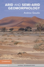
Arid and semi-arid geomorphology / Аридная и полуаридная геоморфология

Based on four decades of research by Professor Andrew S. Goudie, this volume provides a state-of-the-art synthesis of our understanding of desert geomorphology. It presents a truly international perspective, with examples from all over the world. Extensively referenced and illustrated, it covers such topics as the importance of past climatic changes, the variability of different desert environments, rock breakdown, wind erosion and dust storm generation, sand dunes, fluvial and slope forms and processes, the role of the applied geomorphologist in desert development and conservation and the Earth as an analogue for other planetary bodies. This book is destined to become the classic volume on arid and semi-arid geomorphology for advanced students and researchers in physical geography, geomorphology, Earth science, sedimentology, environmental science and archaeology <...>

Издание:2020 г., 102 стр.
Язык(и)Английский
Arid environment. Perspectives, challenges and management / Аридные условия окружающей среды. Перспективы, проблемы и управление

Arid environments cover more than one-third of the world’s land area and represent the most common habitat on Earth after the oceans. Aridity poses a threat to the environment, as well as the economy, security, development, food security, and social life around the world. The causes of increased aridity are complex and are thought to be both natural and man-made. Factors such as climate change, population growth, soil erosion, inappropriate irrigation, wrong farming, soil, water, and groundwater contamination, urbanization, deforestation, improper water management, desertification of arid and semiarid zones appear as causes of drought.

This book covers a wide range of scientific research studies, from water management to groundwater management, from land rehabilitation to soil reclamation, which will help prevent and minimize man-made aridity. In addition, many studies related to aridities such as environmental education, environmental awareness, sustainable development, and management policies and plans are also welcome. <...>

Том 3
Автор(ы):Baker H., Okamoto H.
Издание:ASM International, 1992 г., 499 стр., ISBN: 978-0-87170-381-1
Язык(и)Английский
ASM Handbook. Volume 3. Alloy phase diagrams / Справочник по АСМ. Том 3. Фазовые диаграммы сплавов

This book is an introductory source aimed at practicing engineers and material scientists, that text explains how to use phase diagrams. The more than 1,000 binary and 300 ternary diagrams included cover most commercial alloy systems. The Appendix includes the melting and boiling points of the elements, their allotropic transformation, and magnetic transition temperatures and their crystal structures.

Автор(ы):Reyment A.R., Savazi E.
Издание:Elsevier, 1999 г., 285 стр., ISBN: 0-444-82568-1
Язык(и)Английский
Aspects of multivariate statistical analysis in geology / Аспекты многомерного статистического анализа в геологии

Multivariate statistical methods have become commonplace in the Earth Sciences. What was once an exclusive area of activity is now within the reach of Everyman, owing to the ubiquitousness of mini-computers and the ready availability of software for doing the computing. In the days when one was required to do one's own programming, it was necessary to acquire considerable proficiency in linear algebra and one or more programming languages. Today, the vast majority of the people who use multivariate methods to analyse geological data have little or no idea of the matrix operations underlying a particular method, nor, for that matter, what the program is actually supposed to be doing. This situation can be both good and bad. It can do no harm if everything goes according to schedule, the program being used is competently constructed, which, alas, is far from being the general case, and there are no strong deviations from standard statistical theory in the data under examination. It is bad if the data do not fit the theoretical requirements of a particular method and even worse if the method of computation used is inappropriate. It is an inescapable and sad fact of life that much geological and biological material deviates in some manner or other from the theoretical requirements of a multivariate statistical procedure. The immediate relevance of this observation is that there are many sources of error in doing an analysis of geological data by means of standard statistical software.

Редактор(ы):Aitchison J.C., Ali J.R., Fletcher C.J.N., Malpas J.
Издание:The Geological Society of London, 2004 г., 374 стр., ISBN: 1-86239-156-4
Язык(и)Английский
Aspects of the tectonic evolution of China / Аспекты тектонической эволюции Китая

The subject of this Special Publication is one of the most interesting in global geoscience: the evolution of the tectonic collage that forms China. Many of the processes that shape the Earth's lithosphere are best exemplified by the geology of this part of Asia, but, since geology has no national boundaries, the geological evolution of China cannot be appropriately discussed without reference to key features in adjacent areas. The geology of China provides outstanding opportunities to elucidate global processes, but there are some features that are unique to the region. Many have been the focus of recent attention and have attracted international research teams because of their world-wide significance. <...>

Том 17, Выпуск 3
Издание:Stratigraphy and Geological Correlation, 2009 г., 16 стр.
Язык(и)Английский
Assembly and Breakup of Rodinia (Some Results of IGCP Project 440)

The principal results of project 440 “Assembly and Breakup of Rodinia” of the International Geological Correlation Programme (IGCP) are reviewed in this work. A map of that supercontinent compiled using geological and paleomagnetic data describes global paleogeography 900 Ma ago. The assembly of Rodinia, which comprised most of Precambrian continental blocks, lasted ca. 400 m.y. (from 1300 to 900 Ma). Its breakup presumably triggered by mantle superplume took place between 830 and 650 Ma. The correlation between tectonic events in different continental blocks is considered. Some problems concerning the Rodinia reconstruction and history, e.g., the slow growth of juvenile crust and effects of mantle-plume events during the amalgamation period and of glaciations at the breakup time, are discussed. The latter caused changes in the biosphere and climate, whereas postglacial periods stimulated progress in biota evolution

Издание 2
Автор(ы):Congalton R.G., Green K.
Издание:CRC Press, 2009 г., 209 стр., ISBN: 978-1-4200-5512-2
Язык(и)Английский
Assessing the accuracy of remotely sensed data. Principles and practices / Оценка точности данных дистанционного зондирования. Принципы и практика

The field of assessing the accuracy of maps derived from remotely sensed data has continued to develop and mature since the first edition of this book was published in 1999. The original eight chapters have been expanded to eleven. Of most significance is a new chapter that covers positional accuracy.

2560.81