Добрый день, Коллеги. Важное сообщение, просьба принять участие. Музей Ферсмана ищет помощь для реставрационных работ в помещении. Подробности по ссылке

Поиск по книгам
Автор(ы):Pallant C., Pallant H.
Издание:Bloomsbury, 2014 г., 323 стр., ISBN: 978-1-47290-993-0
Язык(и)Английский
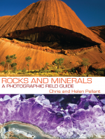
Rocks and minerals. A photographic field guide / Породы и минералы. Полевой фото-путеводитель

Rocks and minerals are the basis for the structure of the Earth’s crust. Minerals are composed of atoms of single elements or a number of different elements. They can have perfect crystalline form and amazingly rich colours; some are prized as gemstones; many are the source of economically useful metals and other raw materials. New minerals are still being discovered, especially in industrial slag and even on shipwrecks. Rocks are made of minerals. Many, especially crystalline igneous rocks and marble, are frequently used decoratively, and certain rocks such as limestone, coal and ironstone have great economic uses. However, the Earth has been scarred by the extraction and use of these raw materials; watercourses and soils have been polluted and the atmosphere changed.

Автор(ы):Eduardo A.P.Vieira, Souza L.H.
Издание:PGS Publishing, Linden Park, 2002 г., 12 стр.
Язык(и)Английский
Salobo 3 Alpha deposit: geology and mineralisation

The Salobo 3 Alpha Deposit is found in the southeast of the Amazon Craton, north of the Serra dos Carajas, in the State of Para, Brazil. The deposit is contained in supracrustal rocks of Igarape Salobo Group of Archean age, represented by iron-rich schists, metagreywackes, amphibolites and quartzites. This sequence overlies the basement gneisses of the Xingu Complex composed of partially migmatized gneisses. The original stratigraphic relationships are masked by intense ductile-brittle shear zones responsible for the generation of allochthonous rocks. The deposit extends over an area of approximately 4000 metres along strike (NW), is 100 to 600 metres wide and has been recognised to depths of 750 metres below the surface. The estimated mineral resources are of the order of 789 Mt with 0,96% Cu and 0,52 g/t Au. Copper mineralization occurs as chalcocite and bomite, with subordinate quantities of chalcopyrite, together with variable proportions of molybdenite, cobaltite, covellite, gold and silver, lodged in schists with variable proportions of magnetite, amphibole, olivine, garnet, biotite, quartz and piagioclase. Brittle-ductile shear zone deformation has resulted in lenticular shaped ore shoots that characteristically show close associations between copper mineralization and magnetite contents. The host rocks were progressively metamorphosed to pyroxene hornfels facies, at equilibrium temperatures of 750°C, resulting from sinistral transcurrent transpressive shearing accompanied by oblique thrusting. A first hydrothermal event developed at temperatures between 650 to 550°C causing partial substitution of chalcopyrite by bornite and chalcocite, accompanied by intense K-metasomatism. This was followed by sinistral transcurrent transtensive shear zone formation, causing green schist facies metasomatism, characterized by intense chloritization and partial substitution of bornite by chalcocite. Several hypotheses have been proposed for the genesis of the deposit. Based on similarities in the ore mineralogy and the hydrothermal alteration pattern, this deposit could be ascribed to the large class of iron oxide copper-gold deposits.

Автор(ы):Swanson R.G.
Издание:American Association of Petroleum Geologists, Tulsa, 1981 г., 95 стр.
Язык(и)Русский
Sample examination manual / Руководство по описанию образцов керна

Accurate sample description is basic geologic work - the   foundation upon which the entire structure of subsurface investigation rests. This manual has been compiled to furnish convenient reference data on standard   stratigraphic procedures.  Techniques of examining, describing, and logging well   cuttings, cores, and outcrop samples are set forth.

Although the primary responsibility of the sample logger was once that of providing correlation points for structural mapping, it has become increasingly important for him to provide stratigraphic data.  The source, transporting medium, environment of deposition, and post-depositional history of the sediments all can be determined by sample examination.  Two elements are involved:  logging to represent what is present in the samples, and interpretation of the geologic history from the material which is logged.

A description may become so detailed and voluminous as to obscure important characteristics; the stratigrapher must learn to be selective and report only significant details .  Sample studies should be made carefully and attentively.  The accuracy of a study is dependent upon the quality of the samples and the skill of the observer.  Thorough and careful initial examination and description of samples will save time and avert the necessity for re-examination.


Автор(ы):Абзалов М.З.
Издание:2011 г., 34 стр.
Язык(и)Английский
Sampling Errors and Control of Assay Data Quality in Exploration and Mining Geology / Ошибки отбора проб и контроль качества данных анализа в геологоразведке и рудной геологии

The fundamental cause of the errors of samples of rocks and minerals collected by geologists for evaluation of mining projects is heterogeneity of the sampled materials (Gy, 1982; Francois-Bongarcon, 1993; Pitard, 1993). Constitution heterogeneity and distribution heterogeneity (Pitard, 1993) both are important and cause geological sampling errors. The more heterogeneous the sampled material the more difficult it is to obtain a representative sample and infer characteristics of the geological object from samples. The current chapter overviews sampling theory explaining sampling error types and their likely causes, and also describes the practical approaches used in the mining industry for estimating sampling errors and monitoring them at an acceptably low level. It is based on numerous case studies by the author (Abzalov & Both, 1997; Abzalov, 1999, 2007, 2008; Abzalov & Humphreys, 2002; Abzalov & Mazzoni, 2004; Abzalov & Pickers, 2005; Abzalov et al., 2007; Abzalov & Bower, 2009) and also reviews of the recently published QAQC procedures used in the mining industry (Taylor, 1987; Vallee et al., 1992; Leaver et al., 1997; Long, 1998; Sketchley, 1998).

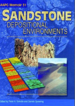
Редактор(ы):Scholle P.A., Spearing D.
Издание:American Association of Petroleum Geologists, 1982 г., 408 стр., ISBN: 0891813071
Язык(и)Английский
Sandstone depositional environments / Условия образования песчаников

The study of sandstone depositional environments has an extensive existing literature. Much of this literature is oriented toward the specialist in the field rather than the generalist, and contains materials largely devoted to the hydrodynamics of sedimentation or the mechanisms of sediment movement and deposition; a minority contains well-illustrated material which is applicable to recognition of depositional environments. This volume is specifically designed for use by the non-sedimentologist, the petroleum
geologist, or the field geologist who needs to use sandstone depositional environments in facies reconstructions and environmental interpretations. <...>

Редактор(ы):Wang Z.L., Zhou W.
Издание:Springer, 2006 г., 533 стр., ISBN: 978-0-387-33325-0
Язык(и)Английский
Scanning microscopy for nanotechnology techniques and applications / Сканирующая микроскопия для нанотехнологических методов и применений

Advances in nanotechnology over the past decade have made scanning electron microscopy (SEM) an indispensable and powerful tool for analyzing and constructing new nanomaterials. Development of nanomaterials requires advanced techniques and skills to attain higher quality images, understand nanostructures, and improve synthesis strategies.

Редактор(ы):Heidbach O.
Издание:2016 г., 55 стр.
Язык(и)Английский
Scientific Technical Report 16-01 WSM quality ranking scheme, database description and analysis guidelines for stress indicator / Научно-технический отчет 16-01 Схема ранжирования качества WSM, описание БД и рекомендации по анализу показателя стресса

The World Stress Map (WSM) compiles information of the contemporary crustal stress using a wide range of very different stress indicator which can be grouped into four categories:
• Earthquake focal mechanisms
• Well bore breakouts and drilling-induced fractures
• In-situ stress measurements (overcoring, hydraulic fracturing, borehole slotter)
• Young geologic data (from fault-slip analysis and volcanic vent alignments)

Автор(ы):Coulomb J.
Издание:D.Reidel publishing company, 1972 г., 192 стр., ISBN: 978-90-277-0238-8
Язык(и)Английский
Sea floor spreading and continental drift / Спрединг и движение континентов

Studies of the magnetic anomalies paralleling ocean ridges have furnished partisans of continental drift with decisive arguments. To take stock of this important question, my colleague Thellier and I decided in the early summer of 1967 to make it the subject of the annual seminar on Earth physics for the school year 1967-68. Although research was still developing rapidly, the General Assembly of the International Union of Geodesy and Geophysics held in Switzerland in September, particularly some of the meetings in Zurich under the auspices of the International Committee for the Upper Mantle, appeared to confirm that we had made no important omissions. At the conclusion of the seminar, where I had been responsible for most of the lectures, I resolved to write the present volume for the non-specialized scientific reader.

Редактор(ы):Hastings B.S., Kendall C.G.S.C., Posamentier H., Ross C.A., Wagoner J.V., Wilgus C.K.
Издание:Society of Economic Geologists Paleontologists and Mineralogists, 1988 г., 410 стр., ISBN: 9781565760899
Язык(и)Английский
Sea-level changes: An integrated approach / Изменение уровня моря: комплексный подход

In October 1985, SEPM sponsored a four-day conference entitled "Sea-Level Changes—An Integrated Approach." The conference was organized by Everest Geotech, Inc., and hosted by Transco Exploration Company in Houston, Texas. Co-conveners of the conference were Dr. Cheryl Wilgus of Everest Geotech, Inc., Dr. Walter C. Pitman of Lamont-Dougherty Oceanographic Institute, and Dr. Christopher G. St. C. Kendall of the University of South Carolina.

892.17