Добрый день, Коллеги. Важное сообщение, просьба принять участие. Музей Ферсмана ищет помощь для реставрационных работ в помещении. Подробности по ссылке

Поиск по книгам
Издание:VniiGeophysica, Тверь, 1986 г., 67 стр.
Язык(и)Английский, Русский
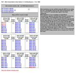
BKZ Intrpretation Chart Album

Mud resistivity can be verified using the BKZ curve using the non –permeable interval with interval thickness / Bit Size > 16 and RT considerably higher than Mud resistivity.
BKZ departure curve is plotted on logarithmic transparency together with Bit Size constant vertical line (X axis AO/BS, Y axis Rapp/Rm). Bit size constant is overlaid with BS line on No-Invasion chart for appropriate device type (lateral or normal) The transparency is moved vertically along the BS line on the chart until the BKZ curve is matched with the chart (specifically the left part of the curve )  Verified RM  is defined as the Y value of the transparency grid crossed by Rapp / Rmud = 1 line (chart cross). Mud resistivity value is read from the transparency grid, RT defined as Y value on the chart grid where the BKZ measurement curve crosses the A line on the chart

Автор(ы):Hustrulid W.
Издание:A.A.Balkema, 1999 г., 359 стр.
Язык(и)Английский
Blasting principles for open pit mining. Part 1. General design concepts / Принципы ведения взрывных работ открытым способом. Часть 1. Общие концепции проектирования

Proper rock fragmentation is the key first element of the ore winning process. It is a two step activity in the sense that the holes for distributing the explosives within the rock mass must first be drilled (Step 1) as specified by the fragmentation plan. This is then followed by the controlled rubblization (Step 2) of the interlytng rock.

Автор(ы):Stadtler A.
Издание:Ruhr-universitat Bochum, Ruhr, 1998 г., 127 стр.
Язык(и)Немецкий
Bochumer geologische und geotchnische. Heft 49 (1998). Der bentheimer sandstein (Valangin, NW-Deutschland). Eine palokologische und sequenzstratigraphische analyse

This thesis represents one part of the European project “Geological characterisation of shallow marine sands for reservoir modelling and high resolution stratigraphic analysis”, which was established to study shallow marine sands with respect to reservoir properties. The research was focused on the micropalaeontological characterisation of mudstone and source rock successions and the nature, origin and reservoir characteristics of the Bentheim Sandstone in the Lower Saxony Basin.

Редактор(ы):Harvey P., Lovell M., Williamson G.
Издание:The Geological Society of London, 1999 г., 295 стр., ISBN: 1-86239-043-6
Язык(и)Английский
Borehole Imaging: applications and case histories / Изображение скважин: приложения и исторические примеры

Borehole images now form a major part of the interpretation strategy for subsurface geological interpretation in a wide variety of scenarios. This volume attempts to document some case histories together with image acquisition and analysis techniques. It by no means covers the full breadth of the subject but is intended to provide a valuable source of information within one volume. We hope the broad spectrum of this text will encourage geologists to look outside their immediate areas of interest with the potential to learn from complementary work in other areas. <...>

Редактор(ы):Anovitz L.M., Grew E.S.
Издание:Mineralogical Society of America, Washington, 2002 г., 883 стр., ISBN: 0-939950-41-3
Язык(и)Английский
Boron. Mineralogy, petrology and geochemistry / Бор. Минералогия, петрология и геохимия

Boron is a widespread constituent of crustal rocks, being found in sedimentary, volcanic, plutonic and metamorphic environments. The Earth's upper continental crust  (average of 15 ppm B, 27th in abundance) is highly enriched in boron relative to the primitive mantle, which is inferred to have had 0.6 ppm B prior to creation of the crust (Taylor and McLennan, 1985; 1995;

Автор(ы):Rickwood P.C.
Издание:Elsevier, 1989 г., 17 стр.
Язык(и)Английский
Boundary lines within petrologic diagrams which use oxides of major and minor elements / Граничные линии на петрологических схемах, в которых используются оксиды как основные и второстепенные элементы

Use of some petrologic diagrams applied to analyses of volcanic rocks is unnecessarily difficult due to lack of data for construction of discriminant lines between rock series. Coordinates are provided for sufficient points to enable accurate plotting of the boundary lines within seven diagrams, viz.: ( 1 ) TAS - total alkalies (Na20+K20) vs. SIO2; (2) K20 vs. SiO2; (3) AFM; (4) Jensen; (5) KTP - K20-TiO~-P205; (6)FMS- (FeO*/MgO) vs. SIO2; and (7) TAKTIP- K20/(Na20+K20) vs. TiOz/P2Os. Different versions of these boundaries are collated to indicate their variable position, and it is demonstrated that inter-laboratory analytical precision suffices to account for almost all of their spread on the TAS and K20 vs. SiO2 diagrams.

Редактор(ы):Almeras Y.
Издание:Imprimerie Rhodanienne, Lyon, 1964 г., 154 стр.
Язык(и)Французский
Brachiopodes du lias et du dogger

Lorsque l'on se propose d'étudier les Brachiopodes du Lias et du Dogger , on est surpris par le grand nombre d'espèces créées aussi bien que par le nombre d'ouvrages décrivant des Brachiopodes . Devant un sujet aussi vaste , devant des efforts aussi dispersés , il m'a paru opportun de faire le point : dénombrer les espèces nouvelles d'après les recherches bibliographiques , mettre sur fiches méca-nalytiques leurs diagnoses originales , établir les listes synonymiques critiques est le premier travail à effectuer et il a pour résultat l'obtention de la durée moyenne  de  vie  pour chaque  espèce   (répartition stratigraphique) <...>

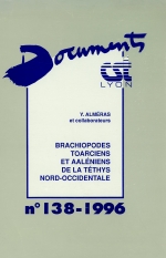
Автор(ы):Almeras Y.
Издание:Centre des Sciences de la Terre, Lyon, 1996 г., 196 стр., ISBN: 5-85454-088-3
Язык(и)Французский
Brachiopodes toarciens et aaleniens de la tethys nord-occidentale

The recent accessibility of the collection of Dumortier, the complementary collects in the Bas-Beaujolais and in the Southern Provence, allow us to present the paleontological revision of the Toarcian and Lower Aalenian brachiopods of the Rhone basin (Bas-Beaujolais, Mont d'Or Lyonnais, La Verpilliere - Saint Quentin-Fallavier and Southern Provence). Then, the systematics of Dumortier is reactualized. The different species are again located in a more precised strati graphical framework. So, it is possible to deduce the biostratigraphy of Toarcian and Lower Aalenian brachiopods and then, to verify the value of the zonal succession established before (Almeras & ah, 1991)

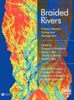
Редактор(ы):Best J.L., Bristow C.S., Petts G.E., Smith G.H.S.
Издание:Blackwell, 2006 г., 387 стр., ISBN: 978-1-4051-5121-4
Язык(и)Английский
Braided rivers: Process, deposits, ecology and management / Многорусловые реки: процесс, месторождения, экология и управление

In 1992, the first conference on Braided Rivers was held at the Geological Society of London (Best & Bristow, 1993). It sought to bring together a wide range of practitioners, primarily sedimentologists, geomorphologists and engineers, to review the state-of-the-art in research, and discuss common problems and future research directions.

1469.49