Добрый день, Коллеги. Важное сообщение, просьба принять участие. Музей Ферсмана ищет помощь для реставрационных работ в помещении. Подробности по ссылке
В сборнике представлены результаты работ, проводимых в области информатизации в вузах и научно-исследовательских институтах Государственного Комитета Российской Федерации по высшему образованию.
Сборник состоит из трех разделов, включающих научно-методические статьи и обзоры по различным аспектам применения новых информационных технологий в высшей школе.
Объемная геологическая модель является отображением изучаемого блока земной коры в виде совокупности трехмерных геометрических тел, наделенных широчайшим спектром свойств, включая геологические, петрофизические, геохимические и т.д., при этом решение задачи построения достоверной (адекватной и эффективной) геолого-геофизической модели всегда представляет основную цель геологоразведочного производства.
A ConvGRU Deep Learning Algorithm to Forecast Global Ionospheric TEC Maps Sivakrishna Kondaveeti, P. Mahitha, G. Shivani, and T. Vaishnavi Estimation of Daily Air Relative Humidity Using a Novel Outlier-Robust Extreme Learning Machine Model: A Case Study of Two Algerian Locations Khaled Merabet and Salim Heddam Significance of Machine Learning in Understanding Earth’s Magnetosphere and Solar Activity Manjuleshwar Panda, Yogesh Chandra, and Deepak Pandey Harnessing Artificial Intelligence for the Detection and Analysis of Microplastics and Associated Chemicals in the Atmosphere
В монографии представлено описание новых методов анализа данных систем геофизического мониторинга. Область исследований относится к проблематике теории обработки прямых экспериментальных данных и связана с мониторингом и прогнозом состояния околоземного пространства. Особое внимание в книге уделено методам анализа данных в периоды солнечных событий, магнитных и ионосферных бурь.
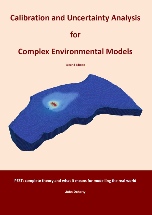
PEST stands for “parameter estimation”. When it was originally written in 1994, this is all that PEST did. However over the 20 years that have elapsed since then, the capabilities of the PEST suite of software have expanded enormously. The emphasis has shifted from inversion to inversion-constrained model parameter and predictive uncertainty analysis.
В учебном пособии излагаются основы применения компьютерной техники и программного обеспечения для решения широкого круга геологических задач. Рассмотрены методологические приёмы математической обработки геологической информации с помощью наиболее распространённых программных средств. Учебное пособие предназначено для студентов специальностей направления 130300 «Прикладная геология»
There are two aspects of interestingness of rules that have been studied in data mining literature, objective and subjective measures (Liu, 1997; Adomavicius & Tuzhilin, 1997; Silberschatz & Tuzhilin, 1995, 1996). Objective measures are data-driven and domain-independent. Generally, they evaluate the rules based on their quality and similarity between them. Subjective measures, including unexpectedness, novelty and actionability, are user-driven and domain-dependent. A rule is actionable if user can do an action to his/her advantage based on this rule (Liu, 1997).
Environmental remote sensing is the measurement, from a distance, of the spectral features of the Earth’s surface and atmosphere. These measurements are normally made by instruments carried by satellites or aircraft, and are used to infer the nature and characteristics of the land or sea surface, or of the atmosphere, at the time of observation.
Книга посвящена одному из актуальных направлений в подземной гидродинамике моделированию движения подземных вод и массопереносу в них загрязняющих компонентов. Подробно рассмотрены теоретические основы моделирования на основе численных методов. Особое внимание уделено вопросам физической сущности процессов фильтрации и массопереноса при использовании компьютерных технологий, оценке и проверке достоверности исходной информации и принимаемых предпосылок для разработки математической модели