Добрый день, Коллеги. Важное сообщение, просьба принять участие. Музей Ферсмана ищет помощь для реставрационных работ в помещении. Подробности по ссылке
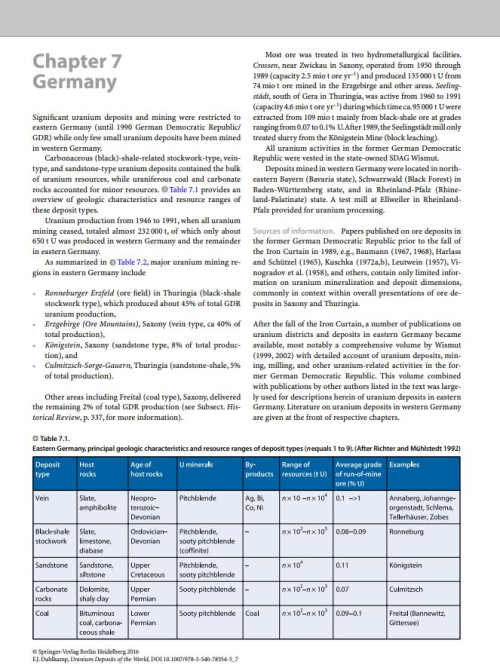
Significant uranium deposits and mining were restricted to eastern Germany (until 1990 German Democratic Republic/GDR) while only few small uranium deposits have been mined in western Germany.
Compared with other mineral commodities, especially metals, whose utility has become evident by centuries of trial and error, the appreciation of uranium has developed from theories based in physics in the 1930s to exploit the unique energy density of uranium’s transformation in nuclear fission. Initially this was in the crucible of a world war, but always beyond military uses was the promise of the “uranium boiler” canvassed in the second British MAUD (Military Application of Uranium Detonation) report in July 1941—the work of “one of the most effective scientific committees that ever existed.” <...>
The uranium minerals that today are at the centre of worldwide attention were unknown until 1780, when Wagsfort found a pitchblende sample in 10hanngeorgenstadt. This discovery passed unnoticed, however, since Wags fort thought that it contained a black species of a zinc mineral-hence the n':lme 'pitchblende' (= pitch-like blende). Seven years later, Klaproth, while examining the mineral, noted that it contained an oxide of an unknown metal, which he called 'uranium' in honour of the planet Uranus, recently discovered by Herschel. Klaproth also believed that he had separated the metal, but, in fact, the attempt failed, and uranium, given its strong affinity with oxygen, was not separated until several years later. In 1833 Arfwedson attempted the separation and, in so doing, reduced the pitchblende. His attempt was not successful and only U02 was obtained. It was Peligot, in 1840, who was finally successful. He managed the reduction of the metal working with metallic potassium. It should be remembered that twelve years earlier Berzelius had isolated thorium.
The emphasis of this volume is on the characterization of uranium deposits. Chapter 1 includes an introductory note in the form of a brief summary of world uranium resources and their definitions with respect to confidence classes and cost categories. This was considered justified insofar as an understanding of an ore deposit cannot be achieved from purely geological parameters. Economic considerations have to be included. Demand for the commodity and, in the western world, related price/cost factors dictate and define whether a localized metal concentration is a deposit that can be profitably exploited presently or in the future, or whether it is a mineral occurrence of only scientific value.
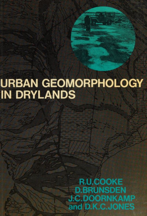
In the winter of 1969 a series of storms in the ‘drylands’ of southern California caused serious soil erosion, numerous landslides, and widespread flooding. Over a hundred people were killed, thousands of homes and other buildings were ruined, the total estimated damage exceeded $200 million, the lives of several million people in the sprawling Los Angeles metropolis were disrupted, and the resources of the community had to be mobilized to cope with the emergency and rehabilitate the region at a cost of well over $8 million (US Corps of Engineers, 1969). The dominant environmental processes responsible for this crisis - erosion, slope failure, and flooding - are geomorphological problems, problems relating to the nature of the land surface and the forces that act upon it. <...>
Structural geology is an important component in regional-, district- and orebody-scale exploration and development of sedimentary rock-hosted Au deposits. Identification of timing of important structural events in an ore district allows analysis and classification of fluid conduits and construction of genetic models for ore formation. The most practical uses of structural geology deal with measurement and definition of various elements that comprise orebodies, which can then be directly applied to ore-reserve estimation, ground control, grade control, safety issues, and mine planning. District- and regional-scale structural studies are directly applicable to long-term strategic planning, economic analysis, and land ownership <...>
Wawa has long been a center of mineral exploration activity and diamonds have been reported in the area since the 1930s. However, diamond exploration did not begin in the area in earnest until 1991. In 1993, Sandor Surmacz and Marcelle Hauseux of Saminex began a prospecting program in the area which culminated in their discovery of the “Sandor” diamond occurrence in an outcrop on the east side of the Trans-Canada Highway.
Over the last 20 to 30 years there has developed а large body of literature оп the statistical treatment of geochemical data. Some of this literature is in the form of warnings to the geochemical community that their practices are not sufficiently statistically rigorous. Other papers are concerned with improving the statistical techniques current amongst geochemists and they provide methods which are more appropriate to the peculiar properties of some geochemical data. Unfortunately, thete is а tendency to leave the whole subject of the statistical treatment of geochemical data 'to the experts' and consequently а large part of this literature is ignored Ьу most geochemists. This тау in part Ье because the journals in which the papers are located are specific to mathematical geology. Another reason, however, is that mathematical geologists tend to write in order to communicate with other mathematicians rather than with geochemists. Whatever the reason, the net effect is that for а long time geo-statisticians have Ьееп advising geochemists in the practice of their art and yet for the most part their words have seemed irrelevant and have gone unheeded <...>
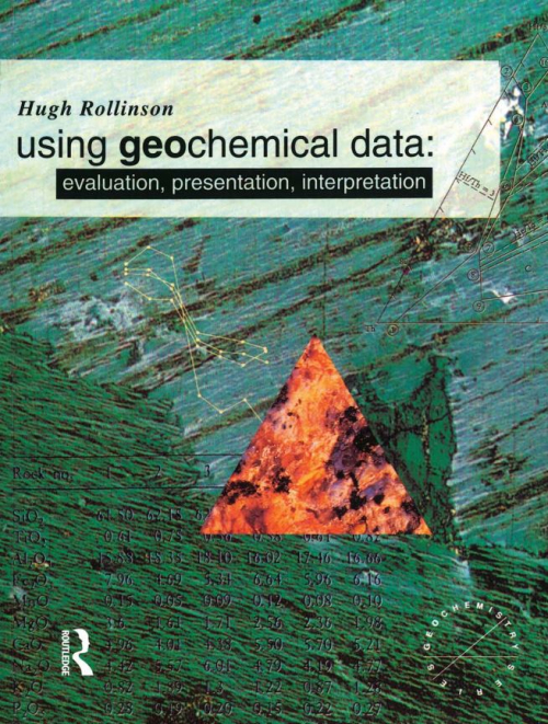
This book is about geochemical data and how they can be used to obtain information about geological processes. Conventionally geochemical data are subdivided into four main categories: the major elements, trace elements, radiogenic isotopes and stable isotopes (see Table 1.1 ). These four types of geochemical data each form the subject of a chapter of this book. Each chapter shows how the particular form of geochemical data can be used and how it provides clues to the origin of the suite of rocks in question. Different methods of data presentation are discussed and their relative merits evaluated. <...>
QGIS is an open-source GIS program for the display and analysis of GIS data. It has developed significantly in the past few years and is now a valuable tool for the mineral exploration industry, and a viable alternative to the commercially available GIS packages. Although not specifically written for geological applications, QGIS can do most of the required GIS tasks required by today’s geoscientists. The terminology is different to the usual earth sciences programs, but many QGIS algorithms do the same thing but with a different name <...>