Добрый день, Коллеги. Важное сообщение, просьба принять участие. Музей Ферсмана ищет помощь для реставрационных работ в помещении. Подробности по ссылке
Розен О. М., Невский Л. К., Журавлев Д. 3., Ротман А. Я., Специус3. В., Макеев А. Ф., Зинчук Н. Н., Манаков А. В., Серенко Б. Я. Палеопротерозойская аккреция на северо-востоке Сибирского кратона: изотопное датирование Анабарской коллизионной системы Кузнецов А. Б., Семихатов М. А., Маслов А. В., Горохов И. М., Прасолов Э. М., Крупенин М. Г., Кислова И. В. Sr- и С -изотопная хемостратиграфия типового разреза верхнего рифея (Южный Урал): новые данные Шевырев А. А. Биохронология триаса: современное состояние и основные проблемы Лобачева С. В., Смирнова Т. Н. Комплексы брахиопод берриаса Крыма Вангенгейм Э. А., Лунгу А. Н., Тесаков А. С. Возраст нижней границы валлезия (континентальный миоцен Европы) Запорожец Н. И., Синельникова В. Н., Ахметъев М. А. Органикостенный фитопланктон палеогена разрезов Западной Камчатки Шлезингер А. Е., Гладенков Ю. Б., Захаров В. А. К оценке новых методических приемов секвенс-стратиграфического анализа Негруца В. 3. Стратиграфия архея на I Российской конференции по проблемам геологии и геодинамики докембрия Памяти Артура Хасенбековича Кагарманова (1934-2005)
This book has been written to bring up to date The Interior of the Earth, published in 1971 following the plate tectonic revolution. Plate tectonic theory has now been widely accepted as a unifying theory for the origin ofthe Earth’s major surface features, and the broad viewpoint taken in 1971 has been vindicated. The last ten years, however, has been a period of continuing rapid advance in earth sciences. The structure of the Earth’s interior has become much better defined. A new understanding ofthe physical processes within the Earth which permit the escape of heat from the deep interior, drive the geomagnetic dynamo and cause the plate motions, is emerging. Consequently, much of the original text has had to be re-written to produce this new book.
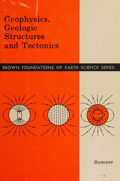
Often times a student is introduced to geophysics as a rather specialized branch of geology, employed only for prospecting or in graduate research. Geophysics courses are usually taken later in a college schedule after adequate preparation in physics and mathematics. Because it is a broad, interdisciplinary area of physical science, one can obtain a background in geophysics by taking selected studies in several different but related fields.
Available knowledge concerning the origin and geologic structure of Mexico is still incomplete. Each day scientific discoveries, advances in mapping, and new techniques of exploration offer more information toward the development of our understanding. Nevertheless, it is still difficult to achieve a complete description of the geologic character of the territory of the nation, as well as to work out functional models to explain the origin of its geologic structure. Along with the development of geologic studies that science has made in Mexico, there have been a few attempts to formulate general works covering the many aspects of geology that the country presents. Nevertheless, one must recognize that the lack of information about certain periods in the geological history of the national territory, and the numerous unexplored areas, have constituted some principal obstacles toward achieving a finished work of this type <...>
Primitive Asteroids and Meteorites was born as a collaboration among members of NASA’s Asteroid Redirect Mission (ARM) Formulation Assessment and Support Team (FAST). As such, we own a great debt of gratitude to Daniel D. Mazanek and David M. Reeves at NASA’s Langley Research Center, to Paul A. Abell at the Johnson Space Center, to Michele Gates at NASA Headquarters, and to countless others who worked in developing this mission. In many ways, ARM allowed for asteroid exploration and mining to move into the tangible realm. ARM brought together a diverse and very passionate group of scientists and engineers who have made the study of meteorites, asteroids, and how to get us there into their lives’ work.
Introduction to the Red Sea: Its Origin, Structure, and Environment Najeeb M.A. Rasul, Ian C.F. Stewart, and Zohair A. Nawab The Red Sea: Birth of an Ocean Enrico Bonatti, Anna Cipriani, and Luca Lupi Geological Evolution of the Red Sea: Historical Background, Review, and Synthesis William Bosworth Seafloor Spreading Initiation: Geophysical and Geochemical Constraints from the Thetis and Nereus Deeps, Central Red Sea Marco Ligi, Enrico Bonatti, and Najeeb M.A. Rasul
В монографии на основании комплексного изучения, включающего литолого-стратиграфический, формационный, петрографический, петрохимичес-кий, термобарометрический и другие методы исследования, а также наблюдений над метаморфизмом и ультра метаморфизмом пород, предлагается новый подход к расчленению суперкрус-тальных и гранита иди ых образований нижнего докембрия западной части Украинского щита. Выделяются побужский, тикичский и звенигородский комплексы, соответственно архейского, эозойского и нижнепротерозойского возраста. Обосновываются принципы формационного анализа метаморфических и ультраметаморфических пород. Предлагается также схема стратиграфического расчленения слоистых пород и схема тектонического районирования западной части Украинского щита. Книга рассчитана на геологов, занимающихся изучением древнейших образований земной коры