Добрый день, Коллеги. Важное сообщение, просьба принять участие. Музей Ферсмана ищет помощь для реставрационных работ в помещении. Подробности по ссылке
The constantly changing landscape of Geographic Information Systems makes it challenging for experts and practitioners to stay informed of the field’s most up-to-date research. That is why Information Science Reference is pleased to offer this three-volume reference collection that will empower students, researchers, and academicians with a strong understanding of critical issues within Geographic Information Systems by providing both broad and detailed perspectives on cutting-edge theories and developments. This reference is designed to act as a single reference source on conceptual, methodological, technical, and managerial issues, as well as provide insight into emerging trends and future opportunities within the discipline.
Initially, I approached this book with a certain trepidation. Forseveral decades, surface geochemistry has been a controversial subject when applied to petroleum exploration. Vertical migration is not a new concept, but the mechanism by which it occurs is still not clear. Quantifying all the different elements from the seal rock to the soil may be an insurmountable task, but we can identify, discuss, and interpret the principal ones.
It has long been recognized that atomic interactions are key in understanding largescale geological phenomena, which is an approach dating at least as far back as the days of Goldschmidt [1]. Conversely, a study of the materials that comprise the planets can tell us much about fundamental physics and chemistry. This line of approach is subsequently exemplified by Pauling's development of the theory of chemical bonding from the structural studies of minerals [2].
This handbook has grown out of the lectures the author has giren at the Faculty of Sciences at Charles University. It takes into consideration the world literature on the subject and the work done by Czech and Slovak economic geologists since the establishment of centralized geological servioe in Czechoslovakia in 1952; these results were published in scientific journals, archive reports, and especially in monographs on the industrial minerals <...>
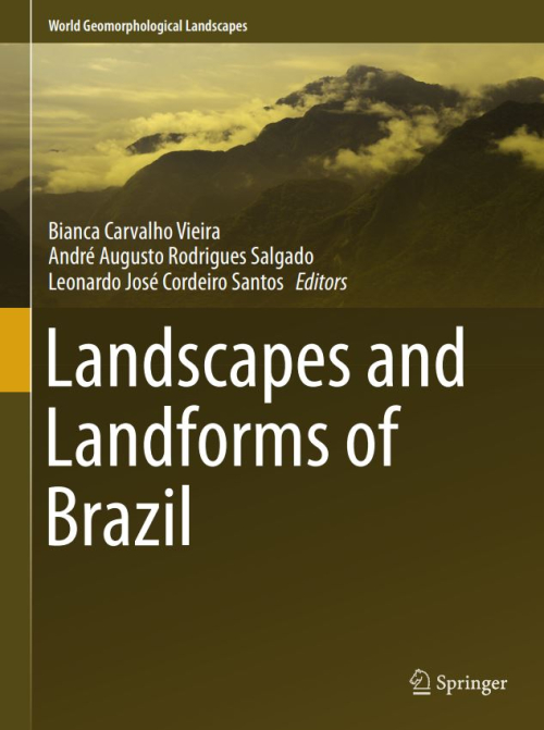
Landforms and landscapes vary enormously across the Earth, from high mountains to endless plains. At a smaller scale, nature often surprises us creating shapes which look improbable. Many physical landscapes are so immensely beautiful that they received the highest possible recognition—they hold the status of World Heritage properties. Apart from often being immensely scenic, landscapes tell stories that not uncommonly can be traced back in time for tens of millions of years and include unique events. In addition, many landscapes owe their appearance and harmony not solely to the natural forces. For centuries, and even millennia, they have been shaped by humans who have modified hillslopes, river courses, and coastlines, and erected structures which often blend with the natural landforms to form inseparable entities. These landscapes are studied by geomorphology—‘the science of scenery’—a part of Earth Sciences that focuses on landforms, their assemblages, surface, and subsurface processes that molded them in the past and that change them today. To show the importance of geomorphology in understanding the landscape, and to present the beauty and diversity of the geomorphological sceneries across the world, we have launched a book series World Geomorphological Landscapes. It aims to be a scientific library of monographs that present and explain physical landscapes, focusing on both representative and uniquely spectacular examples. Each book will contain details on geomorphology of a particular country or a geographically coherent region. This volume presents the geomorphology of Brazil, a big country with a multitude of spectacular landscapes, from the very well known—such as the steep-sided domes of Rio de Janeiro, Iguazu Falls, or majestic rivers of the Amazonian Lowland—to many hidden gems scattered across the Brazilian Shield. For such a vast and varied territory to make a selection of case studies must have been an arduous task, so inevitably they present only a small fraction of what Brazil has to offer in terms of geomorphological sceneries to enjoy. To discover and learn more, go to Brazil! This would be an unforgettable geomorphological experience. The World Geomorphological Landscapes series is produced under the scientific patronage of the International Association of Geomorphologists (IAG)—a society that brings together geomorphologists from all over the world. The IAG was established in 1989 and is an independent scientific association affiliated with the International Geographical Union (IGU) and the International Union of Geological Sciences (IUGS). Among its main aims are to promote geomorphology and to foster dissemination of geomorphological knowledge. I believe that this lavishly illustrated series, which sticks to the scientific rigor, is the most appropriate means to fulfill these aims and to serve the geoscientific community. To this end, my great thanks go to the editors of this volume—Prof. Bianca Carvalho Vieira as the senior editor, and Profs. André Augusto Rodrigues Salgado and Leonardo José Cordeiro Santos as co-editors. <...>
A series of well-publicized disasters and catastrophes during recent years, including a cyclone in Myanmar, earthquakes in China, Haiti, Chile, and New Zealand, and an earthquake and tsunami in Japan, underscore the importance of efforts to reduce risk from natural hazards around the world. Landslides, floods, drought, wildfire, storms, tsunamis, and earthquakes continue to take a heavy toll in lives and infrastructure. In the past decade, disasters have killed over 750,000 people and caused damage costing hundreds of billions of dollars (Centre for Research on the Epidemiology of Disasters, 2011).
Few subjects have caught the attention of the entire world as much as those dealing with natural hazards. The first decade of this new millennium provides a litany of tragic examples of various hazards that turned into disasters affecting millions of individuals around the globe. The human losses (some 225,000 people) associated with the 2004 Indian Ocean earthquake and tsunami, the economic costs (approximately 200 billion USD) of the 2011 Tohoku Japan earthquake, tsunami, and reactor event, and the collective social impacts of human tragedies experienced during Hurricane Katrina in 2005 all provide repetitive reminders that we humans are temporary guests occupying a very active, angry, and ancient planet.
This volume is the third in the new series entitled .Reviews in Mineralogy and Geochemistry [RiMG] (formerly Reviews in Mineralogy [RiM]), published jointly by the Mineralogical Society of America (MSA) and the Geochemical Society. “High-Pressure and High-Temperature Crystal Chemistry” is the brainchild of Bob Hazen, who in 1982 wrote—with his colleage at the Geophysical Lab, Larry Finger—a monograph by the title “Comparative Crystal Chemistry.”
Stratigraphy and sedimentary geology of siliciclastic shelves MlCHELSEN, O. & Danielsen, M. Sequence and systems tract interpretation of the epicontinental Oligocene deposits in the Danish North Sea Konradi, P. B. Foraminiferal biostratigraphy of the post-mid-Miocene in the Danish Central Trough, North Sea Jacobs, P. & De Batist, M. Sequence stratigraphy and architecture on a ramp-type continental shelf: the Belgian Palaeogene Mellere, D. & Steel, R. J. Tidal sedimentation in Inner Hebrides half grabens, Scotland: the Mid-Jurassic Bearreraig Sandstone Formation Spalletti, L. Estuarine and shallow-marine sedimentation in the Upper Cretaceous -Lower Tertiary west-central Patagonian Basin (Argentina)
Soil Mechanics in Engineering Practice, Third Edition, is divided into the following three parts: I. Physical Properties of Soils. 11. Theoretical Soil Mechanics. 111. Problems of Design and Construction. Part I deals with the physical and mechanical properties of homogeneous specimens of undisturbed and remolded soils. It discusses those properties which serve as convenient criteria for distinguishing between different soils and provides instructions for describing soils adequately. It also deals with those soil properties that have a direct bearing on the behavior of soil masses during and after construction operations. Part I also deals with the techniques for securing information about the soil conditions at the chosen site by boring, sounding, sampling, and testing. In spite of the great amount of time and labor involved in such exploratory work, the results commonly leave much room for interpretation.